The Travers River is in the South Island of New Zealand.
The D'Urville River is in the South Island of New Zealand.

The Waimakariri River is one of the largest rivers in Canterbury, on the eastern coast of New Zealand's South Island. It flows for 151 kilometres (94 mi) in a generally southeastward direction from the Southern Alps across the Canterbury Plains to the Pacific Ocean.

The Selwyn River flows through the Selwyn District of Canterbury in the South Island of New Zealand.

The Motueka River is located in the north of the South Island of New Zealand and is a popular tourist destination for watersports and fishing. The Motueka flows 116 kilometres (72 mi) from the mountains 40 km west of the city of Nelson in the southeast of the catchment and flows north to the Tasman Bay.

Arapito is a town in the Karamea area of New Zealand. Arapito is a farming community on the south side of the Karamea River, upriver from the main Karamea township.

Crooked River is a river that flows from headwaters in the Southern Alps to Lake Brunner in the West Coast region of New Zealand's South Island. It is named for the erratic path it takes. Near Lake Brunner, it passes through reasonably flat farmland, but closer to its source, it rushes through gorges and rapids. One tributary is the Poerua River from Lake Poerua.
The Dark River, New Zealand is a river of Fiordland, New Zealand. It rises west of Barrier Peak and flows westward through Fiordland National Park into Lake Grave, which drains into Te Hāpua / Sutherland Sound.
The Deepdale River is a river of New Zealand located in the Tasman Region of the South Island.

The Glentui River is a river in the Canterbury region of New Zealand. It arises on the slopes of Mount Richardson and flows south-east through the locality of Glentui and into Ashley River / Rakahuri, which exits in the Pacific Ocean. The river was earlier called Tui Creek, and the locality named from the station Glentui established by H.C.H. Knowles in 1854.
The Goulter River is a river in the Marlborough region of New Zealand. It rises in the Richmond Range near Lake Chalice. The lake was formed by a landslip about 2000 years ago, which dammed the river. The lake has no outlet, but water seeps through the landslip rubble into the Goulter. The river flows counter-clockwise around Mount Patriarch to join the Wairau River.
The Hangaroa River is a river in the Gisborne Region of New Zealand. Its source is the Huiarau Ranges in the Te Urewera National Park, and flows southeast to merge with the Ruakituri River near Te Reinga. The combined rivers form the Wairoa River, which flows south into Hawke Bay.
The Hapuka River is a river of Westland District, New Zealand. It flows from near The Woolsack north-west to join the Okuru and Turnbull Rivers just before they enter the Tasman Sea. The river is slow-moving and drains swampy land. There are brown trout in the lagoon area.

The Little Wanganui River is a river of the West Coast Region of New Zealand's South Island. It flows generally west from the slopes of Mount Allen, reaching the Karamea Bight close to the small settlement of Little Wanganui. It is home to a large number of trout.
The Motupiko River is a river of the Tasman Region of New Zealand's South Island. A major tributary of the Motueka River, it flows north from its origins southeast of the Hope Saddle, meeting the Motueka at Kohatu Junction, 15 kilometres west of Wakefield. The Motupiko's tributaries include the Rainy River.
The Crow River is a river located in Kahurangi National Park in the West Coast Region of New Zealand. It arises in the Wharepapa / Arthur Range and flows south-west and then north-west into the Karamea River. The river may be named after the South Island kōkako, sometimes called the orange-wattled crow.
The Rainy River is a river of the southern Tasman Region of New Zealand's South Island. It flows north from its sources 2 kilometres (1.2 mi) north of Saint Arnaud, reaching the Motupiko River 6 kilometres (3.7 mi) east of the Hope Saddle. The Motupiko River is a tributary of the Motueka River.
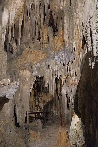
The Ngārua Caves are a series of limestone caves in the Takaka Hill range south of Abel Tasman National Park.
Woodstock is a small settlement in the Tasman District of the northern South Island of New Zealand. It is located on the Motueka Valley Highway, close to the eastern bank of the Motueka River, some 20 kilometres southwest of Motueka, at the junction of the Motueka River and its small tributary, the Dove River.
Brooklyn is a settlement and rural valley in the Tasman District of New Zealand's upper South Island. It is located on the outskirts of Motueka, and is dominated by orchards.
