Drei Buchen

Last updated
Drei Buchen
2012 Pfalzerwald 037 Ritterstein 234 Drei Buchen bei Ramberg.jpg
Ritterstein No. 234: Drei Buchen
Elevation 403 metres.DE-NHN
Traversed byPassstraße
Range Palatine Forest
Coordinates 49°16′15″N8°01′26″E / 49.270745°N 8.023875°E / 49.270745; 8.023875 Coordinates: 49°16′15″N8°01′26″E / 49.270745°N 8.023875°E / 49.270745; 8.023875

Drei Buchen is a hill pass in the central Palatine Forest in the German state of Rhineland-Palatinate. It lies in the estate of the village of Ramberg at a height of 403 metres above sea level (NHN). [1] The L 506 state road runs over the pass from Ramberg to Weyher. At the top of the pass is an inn, the Waldhaus Drei Buchen. The name Drei Buchen means "Three Beeches".

Rhineland-Palatinate State in Germany

Rhineland-Palatinate is a state of Germany.

<i>Normalhöhennull</i> standard reference level, the equivalent of sea level, used in Germany to measure height

Normalhöhennull or NHN is a vertical datum used in Germany.

<i>Landesstraße</i> type of "state roads" mainly in Austria and Germany

Landesstraßen are roads in Germany and Austria that are, as a rule, the responsibility of the respective German or Austrian federal state. The term may therefore be translated as "state road". They are roads that cross the boundary of a rural or urban district. A Landesstraße is thus less important than a Bundesstraße or federal road, but more significant than a Kreisstraße or district road. The classification of a road as a Landesstraße is a legal matter (Widmung). In the free states of Bavaria and Saxony – but not, however, in the Free State of Thuringia – Landesstraßen are known as Staatsstraßen.

Contents

Geography

Ramberg's Waldhaus Drei Buchen 2012 Pfalzerwald 042 Ramberger Waldhaus Drei Buchen.jpg
Ramberg's Waldhaus Drei Buchen

The pass enables a crossing from the Ramberg valley, through which the Dernbach stream flows, to the valley of the Modenbach. [1] Thus Drei Buchen is part of the watershed between the catchment areas of two left-hand tributaries of the River Rhine: the Queich and the Speyerbach. The highest hill in the vicinity of Drei Buchen is the 637-metre-high Roßberg, one kilometre to the southeast, which is the third highest peak in the Palatine Forest mountain range.

Dernbach (Eisbach) river in Germany

The Dernbach is a river in the county of Südliche Weinstraße in the German state of Rhineland-Palatinate. It is 7.46 kilometres long and forms the left-hand, northern headstream of the Eisbach.

Modenbach river in Germany

The Modenbach is a stream, just under 30 kilometres (19 mi) long, and a right-hand tributary of the Speyerbach in the German state of Rhineland-Palatinate.

Drainage divide Elevated terrain that separates neighbouring drainage basins

A drainage divide, water divide, divide, ridgeline,, watershed, water parting or height of land is elevated terrain that separates neighbouring drainage basins. On rugged land, the divide lies along topographical ridges, and may be in the form of a single range of hills or mountains, known as a dividing range. On flat terrain, especially where the ground is marshy, the divide may be harder to discern.

The road over the pass runs from Ramberg, two kilometres to the west, to Weyher, ten kilometres to the east. [1]

At the top of the pass is the Ramberg forest inn or Waldhaus of Drei Buchen, which is managed by the Ramberg branch of the Palatine Forest Club, and a forest car park. [2] The Ramberg Waldhaus should not be confused with the Waldhaus Drei Buchen east of the Bichtenberg in the county of Südwestpfalz, which is 24 kilometres to the southwest. The Ritterstein there, no. 213, also bears the inscription "Drei Buchen".

Palatine Forest Club organization

The Palatine Forest Club is a hiking club in the former Bavarian Palatinate, i.e. the southern part of the German state of Rhineland-Palatinate and the Saarland county of Saarpfalz-Kreis. In 2011 it had 221 local branches with around 27,000 members.

Bichtenberg mountain

The Bichtenberg is a 400-metre-high hill in the western Wasgau, a region on the Franco-German border that includes the southern part of the Palatine Forest and the northern part of the Vosges. Its northwestern flank is in the parish of Lemberg, its southwestern flank in the parish of Dahn. To the north is the Lemberg hamlet of Salzwoog. Three kilometres west lies the Salzwoog Devil's Table.

Südwestpfalz District in Rhineland-Palatinate, Germany

Südwestpfalz is a district in the south of Rhineland-Palatinate, Germany. Neighboring districts are Saarpfalz, the district-free city Zweibrücken, the districts Kaiserslautern and Bad Dürkheim, the district-free city Landau, Südliche Weinstraße, and the French département Bas-Rhin. The district-free city Pirmasens is surrounded by the district.

Sights

At the top of the pass is a Ritterstein , number 234. Several medieval castles in the surrounding area have survived as ruins. The nearest is Meistersel Castle, also called Modeneck Castle (Burg Modeneck) or Modenbacher Schloss, just under one kilometre north. Within two kilometres are the ruins of Neuscharfeneck Castle and the Ramburg.

Ritterstein

A Ritterstein is the German name given to markers made of sandstone erected at sites of historic or natural interest in the Palatine Forest, a range of low mountains in the German state of Rhineland-Palatinate. In some cases, glacial erratics were used, in others, rocks or walls at the site were used on which to carve the information.

Meistersel Castle

Meistersel Castle is a ruined castle near Ramberg on the outskirts of the Palatinate Forest in Rhineland-Palatinate, Germany. It is located on a 492-metre-high hilltop that towers above the Modenbach valley near the Three Beeches pass on the road from Ramberg to Edenkoben.

Neuscharfeneck Castle rock castle

The castle of Neuscharfeneck is a ruin and a cultural monument above Ramberg and Dernbach on the territory of an exclave of Flemlingen in the district of Südliche Weinstraße in the west German state of Rhineland-Palatinate.

Related Research Articles

Palatinate Forest low mountain range in Germany

The Palatinate Forest, sometimes also called the Palatine Forest, is a low-mountain region in southwestern Germany, located in the Palatinate in the state of Rhineland-Palatinate. The forest is a designated nature park covering 1,771 km2 and its highest elevation is the Kalmit.

Ramberg, Rhineland-Palatinate Place in Rhineland-Palatinate, Germany

Ramberg is a municipality in Südliche Weinstraße district, in Rhineland-Palatinate, western Germany.

Lowther Hills

The Lowther Hills, also sometimes known as the Lowthers, are an extensive area of hill country in the Southern Uplands of Scotland, though some sub ranges of hills in this area also go under their own local names - see "Hill Walking" below. They form a roughly rhomboidal or lozenge shape on the map with the acute angles being to north and south. It has river valleys along its boundaries to north east (Clydesdale) and south west (Nithsdale) which carry the two largest arterial routes northwards into the west side of the Central Belt of Scotland. A string of small towns have long since developed along these routes.

Speyerbach river in Germany

The Speyerbach is a left tributary of the Rhine in the Palatinate part of Rhineland-Palatinate. In Speyer, the river split into Gießhübelbach and Woogbach. The Woogbach changes its name to Nonnenbach, then flows into Gießhübelbach shortly before the latter flows into the Rhine.

Isenach left tributary of the Rhine

The Isenach is a left tributary of the Rhine in the northeastern Palatine region of Rhineland-Palatinate. It is nearly 36 kilometres (22 mi) long.

Egge (Wiehen Hills) mountain range

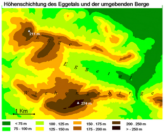
The Egge, also called the Preußisch Oldendorfer Berg is a roughly seven-kilometre-long secondary ridge of the Wiehen Hills and gives its name to the Eggetal valley in the districts of Osnabrück and Minden-Lübbecke in North Germany. The state border between North Rhine-Westphalia and Lower Saxony divides the ridge at a pass called the Durchbruch ("breakthrough") over which the road from Preußisch Oldendorf runs into the Eggetal and to Bruchmühlen, about two-thirds of the Egge belonging to Westphalia.

Eckbach River in Germany

The Eckbach is a small river in the northeastern Palatinate and the southeastern Rhenish Hesse. It is slightly over 39 kilometres (24 mi) long.

Diemerstein Forest forest

Diemerstein Forest is a part of the Palatine Forest, a mountainous region within the German state of Rhineland-Palatinate. It has an area of about 50 km².

Blättersberg mountain

The Blättersberg near Rhodt unter Rietburg in the Rhenish-Palatine county of Südliche Weinstraße is a mountain, 613.2 m above sea level (NHN), in the Palatine Forest in the German state of Rhineland-Palatinate.

Drachenfels (Central Palatinate Forest) mountain in the northern Palatine Forest, Germany

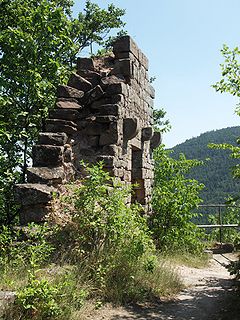
The Drachenfels is a hill in the northern part of the Palatine Forest in the German state of Rhineland-Palatinate) on the forest estate of the county town of Bad Dürkheim. At 570.8 m above sea level (NHN), it is the highest point of the Palatine Forest north of the Hochspeyerbach - Speyerbach line. The Drachenfels area has been designated as a nature reserve.

Weinbiet mountain in Germany

The Weinbiet is a hill, 554 m above sea level (NHN), in the borough of Neustadt an der Weinstraße in the German state of Rhineland-Palatinate and is one of the highest hills in the Haardt, the line of mountains and hills forming the eastern edge of the Palatine Forest and facing the Upper Rhine Plain. On the summit is an inn, the Weinbiethaus, a stone-built panorama tower with a weather station and a radio transmission mast.

Walking routes in the Palatine Forest

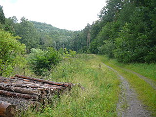
Walking routes in the Palatine Forest fall into two categories. The first are longer walking routes, most of which are maintained by the Palatine Forest Club, or PWV, and which are linked to the national and international network of long distance paths. The second category are those local circular walks and themed walking routes, some of which are of wider regional importance, and which are maintained by municipal authorities. The Palatine Forest, as part of the Palatine Forest-North Vosges Biosphere Reserve, is an important conservation area. As a result, the Palatine Forest, the bunter sandstone landscape of the Palatine Forest Nature Park, the castles in the Dahner Felsenland and the cross-border paths into Alsace and the Vosges make the region particularly popular with ramblers and walkers.

Peterskopf (Haardt) mountain

The Peterskopf, near the Palatine county town of Bad Dürkheim in the German state of Rhineland-Palatinate, is a 487-metre-high hill in the Haardt mountains. On its summit is the Bismarck tower.

Holpertal valley

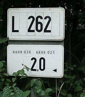
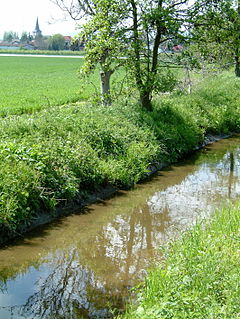
The Holpertal is a valley, just one and a half kilometres long, in the central Palatine Forest of Germany. It lies within the municipality of Ramberg in the county of Südliche Weinstraße in the state of Rhineland-Palatinate. Its V-shaped cross-section was cut by the waters of the Holperbach stream, which has incised deeply into the rock layers of the Lower Bunter. The valley floor climbs from an elevation of about 250 metres to well over 400 metres. Its slopes are covered with mixed forest and sweet chestnut. Whilst at one time, the valley produced raw materials for the traditional broom and brush-making industries, today forestry and tourism predominate.

Hohe Derst mountain in Germany

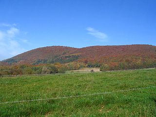
The Hohe Derst is a hill, 561 metres above sea level, in the Palatine Forest of southwest Germany. It lies within the Wasgau region and is the highest point of the Mundat Forest.

Königsberg (North Palatine Uplands) mountain in Germany

The Königsberg is a 568-metre-high hill in the collective municipality of Lauterecken-Wolfstein in the county of Kusel in the German state of Rhineland-Palatinate.

The Palatine Ridgeway in the North Palatine Uplands of Germany is 112 kilometres long and has seven recommended day stages. It is the third longest Prädikat path in the Palatinate region after the Palatine Wine Trail and Palatine Forest Trail. The long distance path was opened in autumn 2010. One year later, in September 2011, it was given its status as a Prädikat path.

References

  1. 1 2 3 LANIS. "Topographische Karte" . Retrieved 2011-12-06.
  2. Waldhaus Drei Buchen. "Waldhaus Drei Buchen heißt Sie willkommen" . Retrieved 2011-12-06.