Related Research Articles
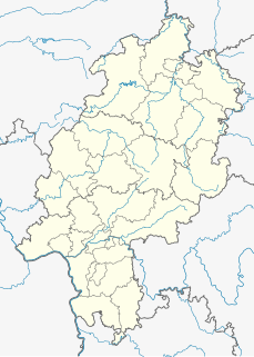
Waldeck-Frankenberg is a Kreis (district) in the north of Hesse, Germany. Neighbouring districts are Höxter, Kassel, Schwalm-Eder, Marburg-Biedenkopf, Siegen-Wittgenstein, Hochsauerland.
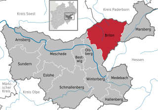
Brilon is a town in North Rhine-Westphalia, central Germany, that belongs to the Hochsauerlandkreis.

Willingen is a community in Waldeck-Frankenberg in northern Hesse, Germany, some 80 km west of Kassel.

Diemelsee is a municipality in Waldeck-Frankenberg in northwest Hesse, Germany, and is part of the low mountain region called Upland. Adorf is the district seat of this municipality.

The West Hesse Highlands, also known as the West Hessian Lowlands and Highlands, refers to a heavily forested region of the Central Uplands in Germany that lies mostly within the state of Hesse, between those elements of the Rhenish Massif right of the Rhine in the west, the Weser Uplands to the north, the Hessian Central Uplands to the east and the Wetterau to the south.
The Langenberg rises on the state border between North Rhine-Westphalia and Hesse in Germany and, at 843.2 m above sea level (NN), is the highest peak in the Rothaar mountain range, as well as the highest point in the North Rhine-Westphalia and also in the north of Germany outside the Harz Mountains.

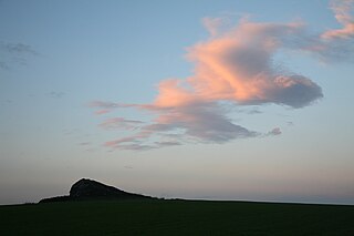
The Upland is a low mountain region forming the northeastern part of the High Sauerland and belongs the German state of Hesse, unlike the remainder of the High Sauerland which lies in Westphalia. The Upland falls within the district of Waldeck-Frankenberg, in North Hesse and corresponds to the territory of the municipality of Willingen.

The Rothaarsteig is a 154.80 km long hiking trail along the crest of the Rothaargebirge mountain range in Germany in the border region between the states of North Rhine-Westphalia (NW) and Hesse (HE). It was opened in 2001.
Auf'm Knoll in the North Hessian county of Waldeck-Frankenberg, Germany is a hill, 739.1 m above sea level (NHN), in the Upland in the Rothaar mountains. Some parts of the hill belong to North Rhine-Westphalia.
The Eder Uplands refers to a region in North Hesse in Germany. It covers several municipalities that lies around the upper reaches of the Eder river on the edge of the Rothaar Mountains. The Eder Uplands includes a large part of the old county of Frankenberg, which was absorbed into Waldeck-Frankenberg in the wake of the administrative reforms.
The Sackpfeife is a mountain, 673.3 m above sea level (NHN),, in the Rothaar Mountains on the boundary of the counties of Waldeck-Frankenberg and Marburg-Biedenkopf in the German state of Hesse.
The Hohe Egge near Ottlar in the North Hessian county of Waldeck-Frankenberg is a hill, 604.9 m above sea level (NHN), in the Upland in the Rothaar mountains.
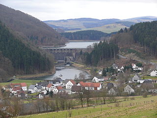
The Diemelsee or Diemel Reservoir is a reservoir with a surface area of 1.65 km² and about capacity of 19.9 million m³ on the River Diemel in the counties of Waldeck-Frankenberg in North Hesse, and Hochsauerlandkreis, Westphalia, Germany.

The Totenkopf is a hill 502.6 m above sea level (NHN), on the Brilon Heights in the counties of Hochsauerlandkreis and Paderborn, in the German state of North Rhine-Westphalia.
The Brilon Plateau is a highland area in the county of Hochsauerlandkreis in the German state of North Rhine-Westphalia. It is surrounded by the Brilon Heights, whose mountains reach a height of 670.2 m above sea level (NHN).

The Trödelsteine is the name of a mountain, 613 m above sea level (NHN), in the Heller Upland near Emmerzhausen in the county of Altenkirchen in the German state of Rhineland-Palatinate and in the county of Siegen-Wittgenstein in the state of North Rhine-Westphalia with its summit area in Rhineland-Palatinate.

The Wabern–Brilon Wald railway is a 86.7 kilometre-long, single-track, partially disused secondary railway line from Wabern in North Hesse to Brilon-Wald in North Rhine-Westphalia.
References
- ↑ "Topographical map from 1900". German Fotothek.
- ↑ "Topographical map from 1925". Landkartenarchiv.de.
- ↑ "Martin Bürgener: Geographische Landesaufnahme: Die naturräumlichen Einheiten, Page 111, Arolsen" (PDF). Bundesanstalt für Landeskunde, Bad Godesberg 1963.
| | This Hesse location article is a stub. You can help Wikipedia by expanding it. |