
Douglas County is a county in the U.S. state of Minnesota. As of the 2010 United States Census, the population was 36,009. Its county seat is Alexandria.
The Wing River is a 48.2-mile-long (77.6 km) tributary of the Leaf River in west-central Minnesota in the United States. Via the Leaf and Crow Wing rivers, it is part of the Mississippi River watershed. Wing River Township is named for the river.

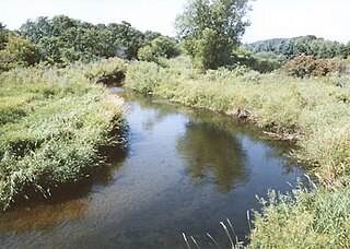
The Partridge River and its tributary the Little Partridge River are small rivers in rural west-central Minnesota in the United States. The Partridge is a 32.6-mile-long (52.5 km) tributary of the Crow Wing River, via which it is part of the Mississippi River watershed.
There are over a dozen lakes named Mud Lake within the U.S. state of Montana.
Mount Nebo is a morainic drift hill in sections 4 and 9 of Stowe Prairie Township in Todd County, Minnesota. This hill was named "for the peak east of the north end of the Dead Sea, from whence Moses viewed the Promised Land." Mount Nebo is located 2 miles north of Hewitt, Minnesota or 8 miles south of Wadena, Minnesota, in the northwest corner of Todd County. Mount Nebo has an elevation of 461 meters or 1,512 feet. Mount Nebo was site to a ski resort in the 1970s and 1980s until it was shut down. Currently Mount Nebo is site of an AT&T tower. The west side of Mount Nebo holds a wind turbine which is owned by a regional electric cooperative.

Roseburg is an unincorporated community in Franklin Township, Grant County, Indiana.
South Sioux Falls was an incorporated community located in south-central Minnehaha County, South Dakota, United States until 1955. The community was centered in present-day Sioux Falls alongside the Minnesota Ave. exit of Interstate 229, stretching from 33rd Street in the north, to 57th Street in the south 43°30′41″N96°43′46″W. Its "main street" was Minnesota Ave..

Pittwood is an unincorporated community in Middleport Township, Iroquois County, Illinois, United States.
Davis Corner is an unincorporated community in Caroline County, in the U.S. state of Virginia.
Sturgeon River is a 63.6-mile-long (102.4 km) river in the U.S. state of Michigan, flowing mostly southward through Alger County and Delta County counties on the Upper Peninsula.
West Marion Precinct, formerly township, is Congressional Township 9 South, Range 2 East of the Third Principal Meridian located in Williamson County, Illinois. It is named for the community of Marion, Illinois.

Groveland is an unincorporated community in McPherson County, Kansas, United States.
Moran Creek is a stream in Todd County, in the U.S. state of Minnesota.
Charlotte Lake is a lake in Todd County, in the U.S. state of Minnesota.
Coal Lake is a lake in Todd County, in the U.S. state of Minnesota.
Horseshoe Lake is a lake in Todd County, in the U.S. state of Minnesota.
Dower Lake is a lake in Todd County, in the U.S. state of Minnesota.
Versailles is an unincorporated community in Rutherford County, in the U.S. state of Tennessee.


