
Blaschkoallee is a Berlin U-Bahn station located on the U7. Opened in 1963 with the planned name "Buschkrug". The next station is Parchimer Allee.
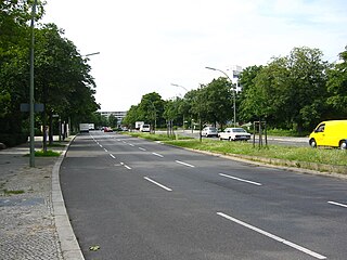
The Sonnenallee is a street in Berlin, Germany, connecting the districts of Neukölln and Treptow-Köpenick. The street is 5 km long, crossing Baumschulenstraße at its south east end and terminating at Hermannplatz in the north west. Sonnenallee was constructed at the end of the 19th century. The area around the Sonnenallee was created to cater for the rural drift to the city of that period.
Öndörshireet is a sum of Töv Province in Mongolia. Sum center former location was 47 28 N 104 52 E.

Gruta is a village in Grudziądz County, Kuyavian-Pomeranian Voivodeship, in north-central Poland. It is the seat of the gmina called Gmina Gruta. It lies approximately 13 kilometres (8 mi) east of Grudziądz and 52 km (32 mi) north-east of Toruń.
Gruszki is a village in the administrative district of Gmina Narewka, within Hajnówka County, Podlaskie Voivodeship, in north-eastern Poland, close to the border with Belarus. It lies approximately 3 kilometres (2 mi) east of Narewka, 19 km (12 mi) north-east of Hajnówka, and 54 km (34 mi) south-east of the regional capital Białystok.
Majewo is a settlement in the administrative district of Gmina Sidra, within Sokółka County, Podlaskie Voivodeship, in north-eastern Poland.
Jawor is a village in the administrative district of Gmina Zelów, within Bełchatów County, Łódź Voivodeship, in central Poland. It lies approximately 9 kilometres (6 mi) west of Zelów, 22 km (14 mi) north-west of Bełchatów, and 45 km (28 mi) south-west of the regional capital Łódź.
Wiesiołów is a village in the administrative district of Gmina Dmosin, within Brzeziny County, Łódź Voivodeship, in central Poland. It lies approximately 4 kilometres (2 mi) east of Dmosin, 16 km (10 mi) north of Brzeziny, and 29 km (18 mi) north-east of the regional capital Łódź.
Szczepany is a village in the administrative district of Gmina Działoszyn, within Pajęczno County, Łódź Voivodeship, in central Poland. It lies approximately 7 kilometres (4 mi) south-west of Działoszyn, 17 km (11 mi) south-west of Pajęczno, and 91 km (57 mi) south-west of the regional capital Łódź.
Tudorów is a village in the administrative district of Gmina Opatów, within Opatów County, Świętokrzyskie Voivodeship, in south-central Poland. It lies approximately 5 kilometres (3 mi) south-east of Opatów and 61 km (38 mi) east of the regional capital Kielce.
Międzylesie is a village in the administrative district of Gmina Secemin, within Włoszczowa County, Świętokrzyskie Voivodeship, in south-central Poland. It lies approximately 4 kilometres (2 mi) north of Secemin, 10 km (6 mi) south-west of Włoszczowa, and 55 km (34 mi) west of the regional capital Kielce.
Bonisław is a village in the administrative district of Gmina Wieczfnia Kościelna, within Mława County, Masovian Voivodeship, in east-central Poland.
Grądy Szlacheckie is a village in the administrative district of Gmina Długosiodło, within Wyszków County, Masovian Voivodeship, in east-central Poland.
Małachowo-Złych Miejsc is a village in the administrative district of Gmina Witkowo, within Gniezno County, Greater Poland Voivodeship, in west-central Poland.
Uzarzewo is a village in the administrative district of Gmina Swarzędz, within Poznań County, Greater Poland Voivodeship, in west-central Poland. It lies approximately 7 kilometres (4 mi) north-east of Swarzędz and 16 km (10 mi) east of the regional capital Poznań.
Mielno is a village in Gmina Lipnica, Bytów County, Pomeranian Voivodeship, in northern Poland. It lies approximately 15 kilometres (9 mi) south of Bytów and 55 km (34 mi) south-west of Gdańsk.
Jeleńska Huta is a village in the administrative district of Gmina Szemud, within Wejherowo County, Pomeranian Voivodeship, in northern Poland. It lies approximately 4 kilometres (2 mi) south of Szemud, 17 km (11 mi) south of Wejherowo, and 28 km (17 mi) west of the regional capital Gdańsk.
Karpówek is a settlement in the administrative district of Gmina Wilczęta, within Braniewo County, Warmian-Masurian Voivodeship, in northern Poland. It lies approximately 6 kilometres (4 mi) west of Wilczęta, 27 km (17 mi) south of Braniewo, and 62 km (39 mi) north-west of the regional capital Olsztyn.
Grzegorze is a village in the administrative district of Gmina Orzysz, within Pisz County, Warmian-Masurian Voivodeship, in northern Poland. It lies approximately 4 kilometres (2 mi) west of Orzysz, 22 km (14 mi) north of Pisz, and 92 km (57 mi) east of the regional capital Olsztyn.
Leszczno is a village in the administrative district of Gmina Przybiernów, within Goleniów County, West Pomeranian Voivodeship, in north-western Poland. It lies approximately 10 kilometres (6 mi) north-east of Przybiernów, 28 km (17 mi) north of Goleniów, and 47 km (29 mi) north-east of the regional capital Szczecin.


