Related Research Articles

Indi, New South Wales, located at 29°48'45.0"S 143°24'00.0"E is a Parish of Ularara County in north west New South Wales. It is between Milparinka, New South Wales and Wilcannia.

Fort Grey is a remote civil parish of Poole County in far North West New South Wales. located at 29.1731°S 141.0307°E.

Albert Parish, New South Wales is a remote civil parish of Yantara County near Milparinka, New South Wales.
Teltawongee is a remote civil parish located at 30.673056°S 141.952778°E in Mootwingee County western New South Wales.
Gairdners Creek is an ephemeral stream at 31.3233°S 141.4323°E in western New South Wales, that starts at an elevation of 345m and peeters out at an elevation of 265m .The Gairdners Creek drops around 79.7m over its 14.8 km length.

Langawirra is a remote civil parish of Mootwingee County in far North West New South Wales.
Gooruba, New South Wales, located at 30°23′56″S 142°11′53″E, is a remote civil parish of Mootwingee County in far North West New South Wales.
Yandaminta Creek is an ephemeral stream in Far West New South Wales that flows from near Milparinka to the South Australian border where it enters Lake Boolka. It location is at 30.03333 ° S 141.01667 ° E. Yandaminta Creek starts at an elevation of 216m and drops around 128m over its 159 km length entering the lake at an elevation of 88.4m.

Gununah Parish located at 30.000833°S 141.977222°E is a remote rural locality and civil parish of Evelyn County, New South Wales in far northwest New South Wales. located at 29°50′23″S 141°08′05″E. on the border with South Australia.
Silva located 29°07′49″S 142°21′47″ halfway between Bulloo Downs, Queensland, and Tibooburra, New South Wales, is a cadastral parish of Tongowoko County New South Wales.

Tooncurrie Parish located at 29°31′44″S 142°13′52″E just east of Tibooburra, New South Wales is a cadastral parish of Tongowoko County New South Wales. The town of Tibooburrais just outside the parish.

Peery Lake is a fresh water lake on the Paroo River, north of Wilcannia, New South Wales, Far West New South Wales.
Wonominta, New South Wales is a remote rural locality and civil parish of Evelyn County in far northwest New South Wales. located at 30°18′40″S 141°05′05″E.

The Parish of Wygah, New South Wales located at 30°00′35″S 141°37′52″ is a remote rural locality and civil parish of Evelyn County, New South Wales in far northwest New South Wales.

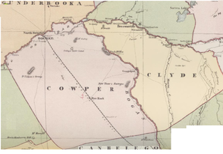
Maffra Parish, New South Wales is a Bounded locality of Bourke Shire and a civil Parish of Cowper County, New South Wales, a cadasteral division of central New South Wales.

Cullamulcha, New South Wales is a civil Parish, of the County of Delalah, a cadasteral division of New South Wales.

Muntawa Parish in the County of Killara is a civil parish of New South Wales located in Central Darling Shire at Latitude 31°01′12″S and Longitude 143°40′20″E.

Moollawoolka is a rural locality and a civil parish of Killara County, in New South Wales
Tongo Lake is a fresh water lake on the Paroo River, north of Wilcannia, New South Wales, in the far west of the state.
Coonong, New South Wales is a rural locality and civil parish of County of Landsborough located to the west of the town of Louth, New South Wales. The parish is in Bourke Shire.
References
- ↑ Peel, M. C.; Finlayson, B. L.; McMahon, T. A. (2007). "Updated world map of the Köppen–Geiger climate classification". Hydrol. Earth Syst. Sci. 11: 1633–1644. doi: 10.5194/hess-11-1633-2007 . ISSN 1027-5606.(direct: Final Revised Paper)
- ↑ Dry Lake, google maps.
- ↑ Map of The Dry Lake, NSW.
- ↑ The Dry Lake.