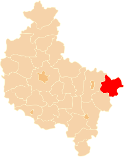
Kobyla Głowa is a village in the administrative district of Gmina Ciepłowody, within Ząbkowice Śląskie County, Lower Silesian Voivodeship, in south-western Poland. Prior to 1945 it was in Germany.
Krępiny is a village in the administrative district of Gmina Fabianki, within Włocławek County, Kuyavian-Pomeranian Voivodeship, in north-central Poland.
Rzędków is a village in the administrative district of Gmina Daszyna, within Łęczyca County, Łódź Voivodeship, in central Poland.
Dąbrowa is a village in the administrative district of Gmina Łęki Szlacheckie, within Piotrków County, Łódź Voivodeship, in central Poland.

Stare Krasnodęby is a village in the administrative district of Gmina Aleksandrów Łódzki, within Zgierz County, Łódź Voivodeship, in central Poland. It lies approximately 9 kilometres (6 mi) north-west of Aleksandrów Łódzki, 15 km (9 mi) west of Zgierz, and 21 km (13 mi) north-west of the regional capital Łódź.

Głogoczów is a village in the administrative district of Gmina Myślenice, within Myślenice County, Lesser Poland Voivodeship, in southern Poland. It lies approximately 9 kilometres (6 mi) north-west of Myślenice and 19 km (12 mi) south of the regional capital Kraków.

Bęczków is a village in the administrative district of Gmina Górno, within Kielce County, Świętokrzyskie Voivodeship, in south-central Poland. It lies approximately 4 kilometres (2 mi) north-west of Górno and 14 km (9 mi) east of the regional capital Kielce.

Łagówka is a village in the administrative district of Gmina Bogoria, within Staszów County, Świętokrzyskie Voivodeship, in south-central Poland. It lies approximately 9 kilometres (6 mi) north-west of Bogoria, 16 km (10 mi) north of Staszów, and 44 km (27 mi) south-east of the regional capital Kielce.

Mrowina-Kolonia is a village in the administrative district of Gmina Kluczewsko, within Włoszczowa County, Świętokrzyskie Voivodeship, in south-central Poland. It lies approximately 8 kilometres (5 mi) north-west of Kluczewsko, 16 km (10 mi) north-west of Włoszczowa, and 54 km (34 mi) west of the regional capital Kielce.

Wójtostwo is a village in the administrative district of Gmina Pomiechówek, within Nowy Dwór Mazowiecki County, Masovian Voivodeship, in east-central Poland. It lies approximately 9 kilometres (6 mi) east of Brody-Parcele, 16 km (10 mi) north-east of Nowy Dwór Mazowiecki, and 33 km (21 mi) north of Warsaw.
Stare Rogowo is a village in the administrative district of Gmina Stary Lubotyń, within Ostrów Mazowiecka County, Masovian Voivodeship, in east-central Poland.

Gorąca is a village in the administrative district of Gmina Krasne, within Przasnysz County, Masovian Voivodeship, in east-central Poland. It lies approximately 11 kilometres (7 mi) south of Przasnysz and 79 km (49 mi) north of Warsaw.
Biel is a village in the administrative district of Gmina Siedlce, within Siedlce County, Masovian Voivodeship, in east-central Poland.

Trzaskowice is a village in the administrative district of Gmina Chodzież, within Chodzież County, Greater Poland Voivodeship, in west-central Poland. It lies approximately 8 kilometres (5 mi) south of Chodzież and 58 km (36 mi) north of the regional capital Poznań.

Krzywa Góra is a village in the administrative district of Gmina Pokój, within Namysłów County, Opole Voivodeship, in south-western Poland. It lies approximately 7 kilometres (4 mi) south-east of Pokój, 26 km (16 mi) south-east of Namysłów, and 23 km (14 mi) north of the regional capital Opole.

Borki Małe is a village in the administrative district of Gmina Olesno, within Olesno County, Opole Voivodeship, in south-western Poland.

Zarębisko is a village in the administrative district of Gmina Sierakowice, within Kartuzy County, Pomeranian Voivodeship, in northern Poland. It lies approximately 6 kilometres (4 mi) south of Sierakowice, 22 km (14 mi) west of Kartuzy, and 50 km (31 mi) west of the regional capital Gdańsk.

Zielony Lasek is a settlement in the administrative district of Gmina Ryn, within Giżycko County, Warmian-Masurian Voivodeship, in northern Poland. It lies approximately 8 kilometres (5 mi) south-east of Ryn, 22 km (14 mi) south-west of Giżycko, and 73 km (45 mi) east of the regional capital Olsztyn.

Golec is a settlement in the administrative district of Gmina Orzysz, within Pisz County, Warmian-Masurian Voivodeship, in northern Poland. It lies approximately 16 kilometres (10 mi) north-west of Orzysz, 30 km (19 mi) north of Pisz, and 82 km (51 mi) east of the regional capital Olsztyn.

Bącznik is a village in the administrative district of Gmina Goleniów, within Goleniów County, West Pomeranian Voivodeship, in north-western Poland. It lies approximately 7 kilometres (4 mi) south-east of Goleniów and 22 km (14 mi) north-east of the regional capital Szczecin.


