Grunwald Poznań is a sports club based in Poznań, Poland, with several sections:
Gmina Michałowice is a rural gmina in Pruszków County, Masovian Voivodeship, in east-central Poland. Its seat is the village of Michałowice, which lies approximately 4 kilometres (2 mi) east of Pruszków and 11 km (6 mi) south-west of Warsaw.
Nowiny-Leśniczówka is a village in the administrative district of Gmina Żnin, within Żnin County, Kuyavian-Pomeranian Voivodeship, in north-central Poland.
Stary Dwór is a village in the administrative district of Gmina Narewka, within Hajnówka County, Podlaskie Voivodeship, in north-eastern Poland, close to the border with Belarus.

Ignaców is a village in the administrative district of Gmina Siemkowice, within Pajęczno County, Łódź Voivodeship, in central Poland. It lies approximately 3 kilometres (2 mi) south-west of Siemkowice, 10 km (6 mi) north-west of Pajęczno, and 78 km (48 mi) south-west of the regional capital Łódź.

Nowa Wieś is a village in the administrative district of Gmina Poddębice, within Poddębice County, Łódź Voivodeship, in central Poland. It lies approximately 7 kilometres (4 mi) west of Poddębice and 43 km (27 mi) west of the regional capital Łódź.

Zakępie is a settlement in the administrative district of Gmina Szczucin, within Dąbrowa County, Lesser Poland Voivodeship, in southern Poland. It lies approximately 10 kilometres (6 mi) east of Szczucin, 24 km (15 mi) north-east of Dąbrowa Tarnowska, and 95 km (59 mi) east of the regional capital Kraków.

Wólka Niska is a village in the administrative district of Gmina Sanniki, within Gostynin County, Masovian Voivodeship, in east-central Poland. It lies approximately 4 kilometres (2 mi) north of Sanniki, 29 km (18 mi) east of Gostynin, and 78 km (48 mi) west of Warsaw.
Stare Łepki is a village in the administrative district of Gmina Olszanka, within Łosice County, Masovian Voivodeship, in east-central Poland.
Brzozowo-Dąbrówka is a village in the administrative district of Gmina Dzierzgowo, within Mława County, Masovian Voivodeship, in east-central Poland.
Sulęcin Szlachecki is a village in the administrative district of Gmina Stary Lubotyń, within Ostrów Mazowiecka County, Masovian Voivodeship, in east-central Poland.

Michałowice is a village in Pruszków County, Masovian Voivodeship, in east-central Poland. It is the seat of the gmina called Gmina Michałowice. It lies approximately 6 kilometres (4 mi) east of Pruszków and 10 km (6 mi) south-west of Warsaw.
Dąbki is a village in the administrative district of Gmina Krasne, within Przasnysz County, Masovian Voivodeship, in east-central Poland.
Kawieczyno-Saksary is a village in the administrative district of Gmina Krzynowłoga Mała, within Przasnysz County, Masovian Voivodeship, in east-central Poland.
Pieńki is a village in the administrative district of Gmina Kotuń, within Siedlce County, Masovian Voivodeship, in east-central Poland.
Suchodołek is a village in the administrative district of Gmina Mordy, within Siedlce County, Masovian Voivodeship, in east-central Poland.

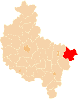
Milejów is a village in the administrative district of Gmina Kawęczyn, within Turek County, Greater Poland Voivodeship, in west-central Poland. It lies approximately 3 kilometres (2 mi) south-east of Kawęczyn, 16 km (10 mi) south of Turek, and 126 km (78 mi) south-east of the regional capital Poznań.
Ignacewo is a settlement in the administrative district of Gmina Skoki, within Wągrowiec County, Greater Poland Voivodeship, in west-central, Poland.

Mieszków is a village in the administrative district of Gmina Trzebiel, within Żary County, Lubusz Voivodeship, in western Poland, close to the German border. It lies approximately 7 kilometres (4 mi) south-east of Trzebiel, 18 km (11 mi) west of Żary, and 58 km (36 mi) south-west of Zielona Góra.

Sztutowska Kępa is a settlement in the administrative district of Gmina Sztutowo, within Nowy Dwór Gdański County, Pomeranian Voivodeship, in northern Poland. It lies approximately 2 kilometres (1 mi) south-east of Sztutowo, 12 km (7 mi) north-east of Nowy Dwór Gdański, and 37 km (23 mi) east of the regional capital Gdańsk.


