
Kothavalasa is a town in Vizianagaram district of the Indian state of Andhra Pradesh. It is located in Kothavalasa mandal of Vizianagaram revenue division. It is located 30 km from the city of Visakhapatanam

Narsipatnam is a census town in Anakapalle district of the Indian state of Andhra Pradesh. It was upgraded from a gram panchayat into municipality in 2012. The town is spread over an area of 42 km2 (16 sq mi) The resting place of the revolutionary Indian freedom fighter Alluri Sitarama Raju is located in Krishna Devi Peta village of From Narsipatnam to labasingi Village 30 km only.. labasingi most popular winter tourism place..so many Tourists enjoy -2 degree's temparature there.. Narsipatnam town is 43 km away from Tuni. And it is 72 km away from Visakhapatnam.

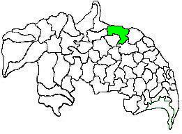
Nelli-marla is a census town in Vizianagaram district of the Indian state of Andhra Pradesh. It is in Nellimarla mandal of Vizianagaram revenue division.
Gudlavalleru is a village and Mandal in Krishna district of the Indian state of Andhra Pradesh. It is located on the Gudivada – Machilipatnam route.
Gurla is a village in Vizianagaram district of the Indian state of Andhra Pradesh, India.

Pathapatnam is a town in Srikakulam district of the Indian state of Andhra Pradesh. It is located in Pathapatnam mandal of Palakonda revenue division. Pathapatnam is located on the border of Srikakulam district of Andhra Pradesh and Gajapati district of Odisha. Parlakhemundi, the headquarters of Gajapati District, can be considered as twin town of Pathapatnam because of its close proximity. It is located around 65 km from srikakulam. It was the old capital of Paralakhemundi Gajapati Maharajah of his erstwhile kingdom.
Bommanahal is a village in Anantapur district of the Indian state of Andhra Pradesh. It is the headquarters of Bommanahal mandal in Kalyandurg revenue division.
Krosuru is a village in Palnadu district of the Indian state of Andhra Pradesh. It is the mandal headquarters of Krosuru mandal in Sattenapalli revenue division.
Pedanandipadu is a village in the Guntur district of the Indian state of Andhra Pradesh. It is located in Pedanandipadu mandal of Guntur revenue division.
Kondapi is a village in Prakasam district of the Indian state of Andhra Pradesh. It is the mandal headquarters of Kondapi mandal in Kandukur revenue division.
Kalla is a village in West Godavari district of the Indian state of Andhra Pradesh and the zonal centre of Kalla mandal. The nearest train station is Akividu (AKVD) located at a distance of 6.63 km.

Duggirala mandal is one of the 18 mandals in Guntur district of the Indian state of Andhra Pradesh. It is under the administration of Tenali revenue division and the headquarters are located at Duggirala. The mandal is bounded by Mangalagiri, Pedakakani, Tenali and Kollipara mandals. Krishna River lies to the northeast of the Duggirala mandal.
Kollur mandal is one of the 25 mandals in Bapatla district of the Indian state of Andhra Pradesh. It is under the administration of Tenali revenue division and the headquarters are located at Kollur.
Gannavaram mandal is one of the 25 mandals in Krishna district of the Indian state of Andhra Pradesh. It is under the administration of Gudivada revenue division and the mandal headquarters are located at Gannavaram. The mandal is bounded by Agiripalle, Bapulapadu, Unguturu, Vijayawada (rural) and Kankipadu mandals. The mandal is also a part of the Andhra Pradesh Capital Region under the jurisdiction of APCRDA.
Amaravathi mandal is one of the 28 mandals in Palnadu district of the Indian state of Andhra Pradesh. It is under the administration of Sattenapalli revenue division and the headquarters are located at Amaravathi. The mandal is located on the banks of Krishna River, at a distance 27 km from the district headquarters. It is bounded by Atchampet, Krosuru, Pedakurapadu, Tadikonda and Thullur mandals.

Thullur mandal is one of the 18 mandals in Guntur district of the Indian state of Andhra Pradesh. It is under the administration of Guntur Revenue Division and the headquarters are located at Thullur. The mandal is situated on the banks of Krishna River, bounded by Amaravathi, Tadikonda, Tadepalle and Mangalagiri mandals. The mandal is also a part of the new capital city of Andhra Pradesh to be developed. 18 villages from the mandal fall under the jurisdiction of Andhra Pradesh Capital City.
Bhimadole mandal is one of the 28 mandals in Eluru district of the Indian state of Andhra Pradesh. It is administered under Eluru revenue division and its headquarters are located at Bhimadole.
Tsundur mandal is one of the 25 mandals in Bapatla district of the Indian state of Andhra Pradesh. It is under the administration of Tenali revenue division and the headquarters are located at Tsundur. The mandal is bounded by Chebrolu, Tenali, Amruthalur and Ponnur mandals. The mandal is a part of Andhra Pradesh Capital Region.
Sreeparru is a village in Eluru district in the state of Andhra Pradesh in India. It is 22 km from the city of Eluru, the headquarters of Eluru district.

Biccavolu mandal is one of the 19 mandals in East Godavari district of the Indian state of Andhra Pradesh. It is under the administration of Rajahmundry revenue division and the headquarters are located at Biccavolu village. Biccavolu Mandal is bounded by Rayavaram Mandal towards South, Pedapudi Mandal towards East, Anaparthy Mandal towards west, Ramachandrapuram Mandal towards north. It is located ata distance of 41 kilometres from Rajahhmundry.


