
Jefferson Parish is a parish in the U.S. state of Louisiana. As of the 2020 census, the population was 440,781. Its parish seat is Gretna, its largest community is Metairie, and its largest incorporated city is Kenner. Jefferson Parish is included in the Greater New Orleans area.

Bridge City is an unincorporated community and census-designated place (CDP) in Jefferson Parish, Louisiana, United States. It was established in the 1930s during the construction of the Huey P. Long Bridge over the Mississippi River. The town is located on the south side of the river. It is part of the New Orleans–Metairie–Kenner metropolitan statistical area.

Harvey is a census-designated place (CDP) in Jefferson Parish, Louisiana, United States. Harvey is on the south side of the Mississippi River, within the New Orleans–Metairie–Kenner metropolitan statistical area. The majority-minority population was 20,348 at the 2010 census, down from 22,226 at the 2000 census. The 2020 census determined 22,236 people lived in the CDP.

Jefferson is a census-designated place (CDP) in Jefferson Parish, Louisiana, United States, on the north side of the Mississippi River. Jefferson is part of the New Orleans–Metairie–Kenner metropolitan statistical area. The population was 11,193 at the 2010 census, and 10,533 in 2020. It is often known by locals as "Old Jefferson", but should not be confused with Old Jefferson in East Baton Rouge Parish, Louisiana.

Kenner is a city in the U.S. state of Louisiana. It is the most populous city in Jefferson Parish, and is the largest incorporated suburban city of New Orleans. The population was 66,448 at the 2020 census, making it the sixth-most populous city in Louisiana.

Marrero is a census-designated place (CDP) in Jefferson Parish, Louisiana, United States. Marrero is on the south side of the Mississippi River, within the New Orleans–Metairie–Kenner metropolitan statistical area. The population was 32,382 at the 2020 U.S. census.
Terrytown is an unincorporated community and census-designated place (CDP) in Jefferson Parish, Louisiana, United States. It is on the "Westbank" of the Mississippi River. It is a suburb within the New Orleans–Metairie–Kenner metropolitan statistical area. The population was 23,319 at the 2010 census, and 25,278 in 2020.
Timberlane is a census-designated place (CDP) in Jefferson Parish, Louisiana, United States. The population was 10,364 in 2020. It is part of the New Orleans–Metairie–Kenner metropolitan statistical area.
Waggaman is a census-designated place and unincorporated community in Jefferson Parish, Louisiana, United States. Waggaman is on the West Bank of the Mississippi River, within the New Orleans–Metairie–Kenner metropolitan statistical area. The population was 9,835 at the 2020 census. The area was named for U.S. Senator George Augustus Waggaman (1782–1843).

Lake Pontchartrain is an estuary located in southeastern Louisiana in the United States. It covers an area of 630 square miles (1,600 km2) with an average depth of 12 to 14 feet. Some shipping channels are kept deeper through dredging. It is roughly oval in shape, about 40 miles (64 km) from west to east and 24 miles (39 km) from south to north.
The Pontchartrain Expressway is a parallel six-lane section of Interstate 10 (I-10) and U.S. Route 90 Business in New Orleans, Louisiana, USA, with a brief stand-alone section in between junctions with these highways. The designation begins on I-10 near the Orleans–Jefferson parish line at the I-610 Split. The expressway follows I-10 into the Central Business District (CBD) of New Orleans and then follows US 90 Bus. to the Crescent City Connection. The expressway takes its name from Pontchartrain Boulevard, which the expressway replaced in some areas. The Pontchartrain name is derived from Lake Pontchartrain, which New Orleans' northern border traverses.

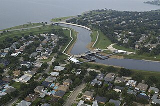
The 17th Street Canal is the largest and most important drainage canal in the city of New Orleans. Operating with Pump Station 6, it moves water into Lake Pontchartrain. The canal, along with the Orleans Canal and the London Avenue Canal, form the New Orleans Outfall Canals. The 17th Street Canal forms a significant portion of the boundary between the city of New Orleans and Metairie, Louisiana. The canal has also been known as the Metairie Outlet Canal and the Upperline Canal.

Though Hurricane Katrina did not deal the city of New Orleans a direct hit on August 29, 2005, the associated storm surge precipitated catastrophic failures of the levees and flood walls. The Mississippi River Gulf Outlet ("MR-GO") breached its levees in approximately 15 places. The major levee breaches in the city include the 17th Street Canal levee, the London Avenue Canal, and the wide, navigable Industrial Canal, which left approximately 80% of the city flooded.

The May 1995 Louisiana flood, also known as the May 1995 Southeast Louisiana and Southern Mississippi Flood, was a heavy rainfall event which occurred across an area stretching from the New Orleans metropolitan area into southern Mississippi. A storm total rainfall maximum of 27.5 inches (700 mm) was recorded near Necaise, Mississippi. Considerable flooding was caused by the rainfall including several record flood crests along impacted river systems.
The Orleans Canal is a drainage canal in New Orleans, Louisiana. The canal, along with the 17th Street Canal and the London Avenue Canal, form the New Orleans Outfall Canals. The current version of the canal is about 2 km long, running along the up-river side of City Park, through the Lakeview and Lakeshore neighborhood, and into Lake Pontchartrain. It is part of the system used to pump rain water out of the streets of the city into the Lake. The Canal has also been known as the Orleans Avenue Canal, the Orleans Outfall Canal, the Orleans Tail Race, and early on, the Girod Canal.
Louisiana's 2nd congressional district contains nearly all of the city of New Orleans and stretches west and north to Baton Rouge. The district is currently represented by Democrat Troy Carter. With a Cook Partisan Voting Index rating of D+25, it is the only Democratic district in Louisiana.

Uptown is a section of New Orleans, Louisiana, United States, on the east bank of the Mississippi River, encompassing a number of neighborhoods between the French Quarter and the Jefferson Parish line. It remains an area of mixed residential and small commercial properties, with a wealth of 19th-century architecture. It includes part or all of Uptown New Orleans Historic District, which is listed on the National Register of Historic Places.

U.S. Highway 90 Business is a business route of U.S. Highway 90 located in and near New Orleans, Louisiana. It runs 14.25 miles (22.93 km) in a general east–west direction from US 90 in Avondale to a junction with Interstate 10 (I-10) and US 90 in the New Orleans Central Business District.
U.S. Highway 90 (US 90), one of the major east–west U.S. Highways in the Southern United States, runs through southern Louisiana for 297.6 miles (478.9 km), serving Lake Charles, Lafayette, New Iberia, Morgan City, and New Orleans. Much of it west of Lafayette and east of New Orleans has been supplanted by Interstate 10 (I-10) for all but local traffic, but the section between Lafayette and New Orleans runs a good deal south of I-10.

U.S. Highway 51 (US 51) is a part of the United States Numbered Highway System that spans 1,277 miles (2,055 km) from LaPlace, Louisiana to a point north of Hurley, Wisconsin. Within the state of Louisiana, the highway travels 69.12 miles (111.24 km) from the national southern terminus at US 61 in LaPlace to the Mississippi state line north of Kentwood.
