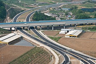
Goesan County (Goesan-gun) is a county in North Chungcheong Province, South Korea.

This is a list of the extreme points of Azerbaijan, the points that are farther north, south, east or west than any other location.
Wonji-dong is a dong, neighbourhood of Seocho-gu in Seoul, South Korea. It is a legal dong administered under its administrative dong, Yangjae 2-dong.
Baegunsan or Mount Baegun is a mountain in South Korea. Its area extends across the city of Pocheon, Gyeonggi Province(Gyeonggi-do) and into the county of Hwacheon, Gangwon Province(Gangwon-do). Baegunsan has an elevation of 904.4 m (2,967 ft).
Gokdalsan is a mountain in the county of Gapyeong County in Gyeonggi-do, South Korea. Gokdalsan has an elevation of 628 m (2,060 ft).
Seounsan is a mountain in South Korea. Its area extends across the city of Anseong, Gyeonggi-do and Jincheon County, Chungcheongbuk-do. It has an elevation of 547.7 m (1,797 ft). Seounsan translates as "West Clouds Mountain". The Cheongryongsa or "Blue Dragon Temple" is located on the Southern slope of the mountain.
Bawisan is a mountain in the city of Chuncheon, Gangwon-do in South Korea. It has an elevation of 858 m (2,815 ft).
Cheontaesan is a South Korean mountain in the counties of Geumsan, Chungcheongnam-do and Yeongdong, Chungcheongbuk-do in South Korea. It has an elevation of 714.7 m (2,345 ft).
Sangsan is a mountain of South Korea. It has an elevation of 825 metres.
Daeyasan is a mountain of South Korea. It has an elevation of 931 metres
Domyeongsan is a mountain of Chungcheongbuk-do, South Korea. It has an elevation of 642 metres (2,106 ft). Near the summit is a statue of Maitreya Buddha, presumably from the early Goryeo dynasty.
Gubyeongsan is a mountain of Chungcheongbuk-do, South Korea. It has an elevation of 876 metres.
Hwangaksan is a mountain of South Korea. It has an elevation of 1,111 metres.
Johangsan is a mountain of South Korea. It has an elevation of 954 metres.
Minjujisan is a mountain of South Korea. It has an elevation of 1,242 metres.
Nagyeongsan is a mountain of South Korea. It has an elevation of 740 metres.
Namgunjasan is a mountain of South Korea. It has an elevation of 836 metres.
Daedunsan is a mountain of Chungcheongnam-do, western South Korea. It has an elevation of 878 metres. Daedunsan has a thousand stone rods extending for 6 km. Daedun Mountain belongs to the "Old Mountain Range". The vegetation is generally 600m in height, with pine trees, oak trees, korean plum-yem trees and so on. Above that, deciduous broad-leaved trees are dense.
Seodaesan is a mountain of Chungcheongnam-do, western South Korea. It has an elevation of 904 metres.
Juwangsan is a mountain of Gyeongsangbuk-do, eastern South Korea. It has an elevation of 721 metres.


