Duneane

Last updated

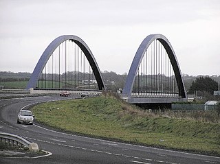
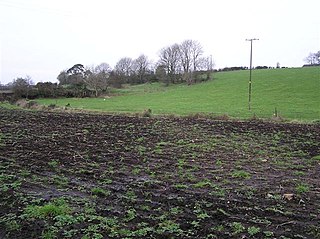
Duneane is a civil parish in County Antrim, Northern Ireland. It is situated in the historic barony of Toome Upper and contains the town of Toome. [1]

Civil parishes in Ireland administrative division of Ireland

Civil parishes are units of territory in the island of Ireland that have their origins in old Gaelic territorial divisions. They were adopted by the Anglo-Norman Lordship of Ireland and then by the Elizabethan Kingdom of Ireland, and were formalised as land divisions at the time of the Plantations of Ireland. They no longer correspond to the boundaries of Roman Catholic or Church of Ireland parishes, which are generally larger. Their use as administrative units was gradually replaced by Poor Law Divisions in the 19th century, although they were not formally abolished. Today they are still sometimes used for legal purposes.

County Antrim Place in Antrim, Northern Ireland

County Antrim is one of six counties that form Northern Ireland. Adjoined to the north-east shore of Lough Neagh, the county covers an area of 3,046 square kilometres (1,176 sq mi) and has a population of about 618,000. County Antrim has a population density of 203 people per square kilometre or 526 people per square mile. It is also one of the thirty-two traditional counties of Ireland, as well as part of the historic province of Ulster.

Northern Ireland Part of the United Kingdom lying in the north-east of the island of Ireland, created 1921

Northern Ireland is a part of the United Kingdom in the north-east of the island of Ireland, variously described as a country, province or region. Northern Ireland shares a border to the south and west with the Republic of Ireland. In 2011, its population was 1,810,863, constituting about 30% of the island's total population and about 3% of the UK's population. Established by the Northern Ireland Act 1998 as part of the Good Friday Agreement, the Northern Ireland Assembly holds responsibility for a range of devolved policy matters, while other areas are reserved for the British government. Northern Ireland co-operates with the Republic of Ireland in some areas, and the Agreement granted the Republic the ability to "put forward views and proposals" with "determined efforts to resolve disagreements between the two governments".

Contents

The name derives from the Irish: Dun Ean (fort of the birds). [2]

Irish language Goidelic (Gaelic) language spoken in Ireland and by Irish people

Irish is a Goidelic (Gaelic) language originating in Ireland and historically spoken by the Irish people. Irish is spoken as a first language in substantial areas of counties Galway, Kerry, Cork and Donegal, smaller areas of Waterford, Mayo and Meath, and a few other locations, and as a second language by a larger group of non-habitual speakers across the country.

The parish is bounded by County Londonderry, the civil parishes of Portglenone and Drummaul, and to the south by Lough Neagh. [1] It contains 48 townlands. [3] [4]

County Londonderry Place in Northern Ireland, United Kingdom

County Londonderry, also known as County Derry, is one of the six counties of Northern Ireland. Prior to the partition of Ireland, it was one of the counties of the Kingdom of Ireland from 1613 onward and then of the United Kingdom after the Acts of Union 1800. Adjoining the north-west shore of Lough Neagh, the county covers an area of 2,074 km² and today has a population of about 247,132.

Portglenone village and civil parish in County Antrim, Northern Ireland

Portglenone is a village and civil parish in County Antrim, Northern Ireland. It lies 8.5 miles (14 km) west of Ballymena. It had a population of 1,174 people in the 2011 Census. Portglenone is beside the smaller village of Glenone, from which it is separated by the River Bann.

Drummaul is a townland and civil parish in County Antrim, Northern Ireland. It is situated in the historic barony of Toome Upper and contains the town of Randalstown.

Townlands

A

Aghacarnaghan, Alder Rock, Annaghmore, Artlone

B

Ballycloghan, Ballydonnelly, Ballydugennan, Ballylenully, Ballylurgan, Ballymatoskerty, Ballynacooley, Ballynafey, Ballynamullan, Brockish

Ballycloghan is a townland in County Antrim, Northern Ireland.

Ballydonnelly is a townland in County Antrim, Northern Ireland.

Ballydugennan is a townland in County Antrim, Northern Ireland.

C

Cargin, Cargin Island, Carlane, Carmorn, Cloghogue, Creeve, Creggan

D

Derrygowan, Derryhollagh, Drumboe, Drumcullen, Drumderg, Drumraymond, Duck Island

G

Gallagh, Garriffgeery, Gortgarn, Gortgill, Greenan

H

Harvey's Rock

K

Killyfast

L

Lismacloskey

M

Moneyglass, Moneynick, Moneyrod, Muckrim, Mullaghgaun

R

Ranaghan

S

Staffordstown

T

Tamnaderry, Tamnaghmore, Toome, Tullaghbeg

People

See also

Related Research Articles

Roddy McCorley was an Irish nationalist from the civil parish of Duneane, County Antrim, modern day Northern Ireland. Following the publication of the Ethna Carbery poem bearing his name in 1902, where he is associated with events around the Battle of Antrim, he is alleged to have been a member of the United Irishmen and claimed as a participant in their rebellion of 1798.

Lambeg, County Antrim

Lambeg is a small village and civil parish in County Antrim, Northern Ireland. Located between Belfast and Lisburn, it was once a small rural village, but is now within the Greater Belfast conurbation. Lambeg is also an electoral ward of Lisburn Council. In the 2001 Census it had a population of 60 people. The civil parish of Lambeg covers areas of County Down as well as County Antrim.

Toome village in County Antrim, Northern Ireland, United Kingdom

Toome or Toomebridge, is a small village and townland on the northwest corner of Lough Neagh in County Antrim, Northern Ireland. It lies in the civil parish of Duneane in the former barony of Toome Upper, and is part of Antrim borough council. It had a population of 781 people in the 2011 Census.

Dál nAraidi

Dál nAraidi or Dál Araide was a Cruthin kingdom, or possibly a confederation of Cruthin tribes, in north-eastern Ireland during the Middle Ages. It was part of the over-kingdom of Ulaid, and its kings often contended with the Dál Fiatach for the over-kingship of the province. At its greatest extent, the borders of Dál nAraidi roughly match those of County Antrim, and they seem to occupy the same area as the earlier Robogdii of Ptolemy's Geography, a region shared with Dál Riata. Their capital was Ráth Mór outside Antrim, and their eponymous ancestor is claimed as being Fiachu Araide.

Groggan village in the United Kingdom

Groggan is a hamlet and townland near Randalstown in County Antrim, Northern Ireland. It is situated in the historic barony of Toome Upper and the civil parish of Drummaul and covers an area of 620 acres. It is within the Borough of Antrim. It had a population of 135 people in the 2011 Census.

Antrim Upper Place in Northern Ireland, United Kingdom

Antrim Upper is a barony in County Antrim, Northern Ireland. It is bordered by six other baronies: Antrim Lower to the north; Toome Upper to the west; Massereene Lower to the south-west; Belfast Upper to the south; Belfast Lower to the south-east; and Glenarm Upper to the east.

Massereene Lower Place in Northern Ireland, United Kingdom

Massereene Lower is a barony in County Antrim, Northern Ireland. To its west lies Lough Neagh, and it is bordered by four other baronies: Massereene Upper to the south; Belfast Upper to the east; Antrim Upper to the north; and Toome Upper to the north-west.

Toome Upper Place in Northern Ireland, United Kingdom

Toome Upper is a barony in County Antrim, Northern Ireland. To its south lies Lough Neagh, and it is bordered by five other baronies: Toome Lower to the north; Antrim Lower to the north-east; Antrim Upper to the east; Massereene Lower to the south-east; and Loughinsholin to the south-east. Toome Upper also formed part of the medieval territories known as the Route and Clandeboye.

Toome Lower Place in Northern Ireland, United Kingdom

Toome Lower is a barony in County Antrim, Northern Ireland. To its east lies Belfast Lough, and it is bordered by four other baronies: Toome Upper to the south; Antrim Lower to the east; Kilconway to the north; and Loughinsholin to the west. Toome Lower also formed part of the medieval territories known as the Route and Clandeboye.

Aghaboy, County Antrim

Aghaboy is a townland in County Antrim, Northern Ireland. It is situated in the historic barony of Toome Upper and the civil parish of Drummaul and covers an area of 286 acres

Aghacarnaghan human settlement in United Kingdom

Aghacarnaghan is a townland in County Antrim, Northern Ireland. It is situated in the historic barony of Toome Upper and the civil parish of Duneane and covers an area of 279 acres

Aghaloughan

Aghaloughan is a townland in County Antrim, Northern Ireland. It is situated in the historic barony of Toome Upper and the civil parish of Drummaul and covers an area of 286 acres

Annaghmore, County Antrim human settlement in United Kingdom

Annaghmore is a townland of 220 acres in County Antrim, Northern Ireland. It is situated in the civil parish of Duneane and the historic barony of Toome Upper.

Artibrannan is a townland in County Antrim, Northern Ireland, near Ballymena. It is situated in the historic barony of Toome Lower and the civil parishes of Ahoghill and Craigs and covers an area of 112 acres.

Aughalish

Aughalish is a townland in County Antrim, Northern Ireland. It is situated in the historic barony of Toome Upper and the civil parish of Drummaul and covers an area of 93 acres.

Tullynakill village in the United Kingdom

Tullynakill is a civil parish and townland in County Down, Northern Ireland. It is situated in the historic barony of Castlereagh Lower.

Leitrim, County Antrim

Leitrim is a townland in County Antrim, Northern Ireland. It is situated in the civil parish of Ballymoney and the historic Barony of Dunluce Upper.

Finvoy is a hamlet and civil parish in County Antrim, Northern Ireland. It is situated in the historic barony of Kilconway. The hamlet had a population of 187 people in the 2011 Census.

References

  1. 1 2 "Duneane". KiwiCelts. Retrieved 15 May 2013.
  2. "Duneane". Place Names NI. Retrieved 15 May 2013.
  3. "Parish of Duneane". Public Record Office NI. Retrieved 15 May 2013.
  4. "Parish of Duneane". Ulster Ancestors. Retrieved 15 May 2013.