Duparquet, Quebec

Last updated
Duparquet
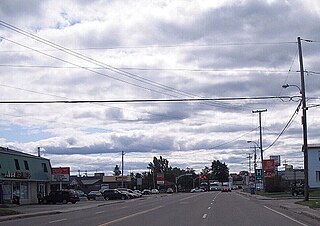
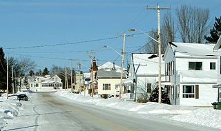
Duparquet QC.JPG
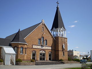
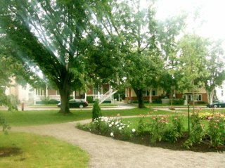
Town Hall of Duparquet
Duparquet Quebec location diagram.png
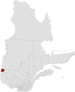
Location within Abitibi-Ouest RCM.
Canada Western Quebec location map.png
Red pog.svg
Duparquet
Location in western Quebec.
Coordinates: 48°30′N79°14′W / 48.500°N 79.233°W / 48.500; -79.233 Coordinates: 48°30′N79°14′W / 48.500°N 79.233°W / 48.500; -79.233 [1]
CountryFlag of Canada.svg  Canada
Province Flag of Quebec.svg  Quebec
Region Abitibi-Témiscamingue
RCM Abitibi-Ouest
ConstitutedApril 13, 1933
Government
[2]
  MayorGilbert Rivard
   Federal riding Abitibi—Témiscamingue
   Prov. riding Abitibi-Ouest
Area
  Total154.90 km2 (59.81 sq mi)
  Land123.63 km2 (47.73 sq mi)
Population
(2011) [3]
  Total657
  Density5.3/km2 (14/sq mi)
  Pop 2006-2011
Increase2.svg 2.8%
  Dwellings
359
Time zone UTC−5 (EST)
  Summer (DST) UTC−4 (EDT)
Postal code(s)
Area code(s) 819
HighwaysQc388.svg Route 388
Qc393.svg Route 393
Website www.duparquet.ao.ca

Duparquet is a ville in northwestern Quebec, Canada in the MRC d'Abitibi-Ouest. It covers 157.4 km² and had a population of 657 as of the Canada 2011 Census.

Ville is the modern French word of Latin origin now meaning "city" or "town", but the first meaning in the Middle Ages was "farm" and then "village". The derivative suffix -ville is commonly used in English in names of cities, towns and villages.
Quebec Province of Canada

Quebec is one of the thirteen provinces and territories of Canada. It is bordered to the west by the province of Ontario and the bodies of water James Bay and Hudson Bay; to the north by Hudson Strait and Ungava Bay; to the east by the Gulf of Saint Lawrence and the province of Newfoundland and Labrador; and to the south by the province of New Brunswick and the U.S. states of Maine, New Hampshire, Vermont, and New York. It also shares maritime borders with Nunavut, Prince Edward Island, and Nova Scotia. Quebec is Canada's largest province by area and its second-largest administrative division; only the territory of Nunavut is larger. It is historically and politically considered to be part of Central Canada.

Canada Country in North America

Canada is a country in the northern part of North America. Its ten provinces and three territories extend from the Atlantic to the Pacific and northward into the Arctic Ocean, covering 9.98 million square kilometres, making it the world's second-largest country by total area. Canada's southern border with the United States is the world's longest bi-national land border. Its capital is Ottawa, and its three largest metropolitan areas are Toronto, Montreal, and Vancouver. As a whole, Canada is sparsely populated, the majority of its land area being dominated by forest and tundra. Consequently, its population is highly urbanized, with over 80 percent of its inhabitants concentrated in large and medium-sized cities, many near the southern border. Canada's climate varies widely across its vast area, ranging from arctic weather in the north, to hot summers in the southern regions, with four distinct seasons.

Contents

History

A view of Lake Duparquet from Chemin du Lac, a waterfront road in Duparquet Lake Duparquet, Quebec.jpg
A view of Lake Duparquet from Chemin du Lac, a waterfront road in Duparquet

In 1912, a rich gold vein was discovered near Lake Duparquet by a prospector named Beattie. He set up the Beattie Gold Mine company that began operation in 1933. That same year, the new community forming at the mine was incorporated as Ville de Duparquet, named after the geographic township in which it is located. The township was named in 1916 in honour of Jean-Annet Chabreuil Du Parquet, a grenadier captain of the La Sarre Regiment, that was part of General Montcalm's army. [1]

Louis-Joseph de Montcalm French general

Louis-Joseph de Montcalm-Grozon, marquis de Montcalm de Saint-Veran was a French soldier best known as the commander of the forces in North America during the Seven Years' War.

After producing 1 million ounces of gold and killing at least 27 miners, including 4 in a landslide on 9 July 1946, the mine closed in 1956. But the owners of the mining rights are currently considering reopening it as an open-pit mine. [4]

Demographics

Population trend: [5]

Private dwellings occupied by usual residents: 312 (total dwellings: 359)

Mother tongue: [6]

Residents of note

Chicago Blackhawks hockey team of the National Hockey League

The Chicago Blackhawks are a professional ice hockey team based in Chicago, Illinois. They are members of the Central Division of the Western Conference of the National Hockey League (NHL). They have won six Stanley Cup championships since their founding in 1926. The Blackhawks are one of the "Original Six" NHL teams along with the Detroit Red Wings, Montreal Canadiens, Toronto Maple Leafs, Boston Bruins and New York Rangers. Since 1994, the club's home rink is the United Center, which they share with the National Basketball Association's Chicago Bulls. The club had previously played for 65 years at Chicago Stadium.

Johanne Morasse is a Quebec politician and teacher. She was a Member of National Assembly of Quebec for the riding of Rouyn-Noranda–Témiscamingue in the Abitibi-Témiscamingue region from 2007 to 2008. She represents the Parti Québécois.

Tim Horton Canadian ice hockey player and businessman

Miles Gilbert "Tim" Horton was a Canadian professional ice hockey player. He was a defenceman for 24 seasons in the National Hockey League. He died following a single-vehicle crash in 1974, at the age of 44. He played for the Toronto Maple Leafs, New York Rangers, Pittsburgh Penguins, and Buffalo Sabres. In 2017 Horton was named one of the 100 Greatest NHL Players in history. Also a successful businessman, Horton was the co-founder of the Tim Hortons restaurant chain.

Municipal council

Related Research Articles

Alma, Quebec Town in Quebec, Canada

Alma is a town in the Canadian province of Quebec.

Abitibi-Ouest Regional County Municipality Regional county municipality in Quebec, Canada

Abitibi-Ouest Regional County Municipality is a regional county municipality located in the Abitibi-Témiscamingue region of Quebec. Its seat is La Sarre.

Dolbeau-Mistassini City in Quebec, Canada

Dolbeau-Mistassini is a town in northern Quebec, Canada, at the confluence of the Mistassibi River, Riviere aux Rats and the Mistassini River, on Lac Saint-Jean. Dolbeau-Mistassini is in the Maria-Chapdelaine Regional County Municipality and is the commercial hub of Lac-St-Jean with big stores and shopping centres.

Roberval, Quebec City in Quebec, Canada

Roberval is a city on the south-western shore of Lac Saint-Jean in the Le Domaine-du-Roy Regional County Municipality of Quebec, Canada. With a population of 10,227 in the Canada 2011 Census, it is the fourth largest city on this lake after Alma, Dolbeau-Mistassini and Saint-Félicien. It is the seat of the Domaine-du-Roy RCM and the main service centre for the region with a hospital and some government services. It is also the seat of the judicial district of Roberval.

Malartic, Quebec City in Quebec, Canada

Malartic is a town on the Malartic River in northwestern Quebec, Canada, in the La Vallée-de-l'Or Regional County Municipality. It is located about 80 kilometres (50 mi) east of the centre of Rouyn-Noranda along Quebec Route 117 and the Canadian National Railway.

Château-Richer, Quebec City in Quebec, Canada

Château-Richer is a small town situated in the Capitale-Nationale region of Quebec, Canada. Located on the north shore of the Saint Lawrence River east of Quebec City, Château-Richer is the seat for the Côte-de-Beaupré Regional County Municipality.

Chapais, Quebec City in Quebec, Canada

Chapais is a community in the Canadian province of Quebec, located on Route 113 near Chibougamau in the Jamésie region. It is surrounded by, but not a part of, the municipality of Baie-James. The community was first settled in 1929, when prospector Léo Springer discovered deposits of copper, silver and gold in the area, and was incorporated as a city in 1955. It was named for Thomas Chapais.

Barraute, Quebec Municipality in Quebec, Canada

Barraute is a municipality in the Canadian province of Quebec, located in the Abitibi Regional County Municipality.

Preissac, Quebec Municipality in Quebec, Canada

Preissac is a municipality in the Canadian province of Quebec, located in the Abitibi Regional County Municipality. The village of Preissac itself is located at the north end of Lake Preissac.

Landrienne, Quebec Township municipality in Quebec, Canada

Landrienne is a township municipality in the Canadian province of Quebec, located in the Abitibi Regional County Municipality. It is part of the census agglomeration of Amos.

Macamic, Quebec City in Quebec, Canada

Macamic is a ville in northwestern Quebec, Canada, in the Abitibi-Ouest Regional County Municipality. It covers 202.34 km² and had a population of 2,734 in the Canada 2011 Census.

Gallichan, Quebec Municipality in Quebec, Canada

Gallichan is a municipality in northwestern Quebec, Canada, in the Abitibi-Ouest Regional County Municipality located along the banks of the Duparquet River. It had a population of 484 in the Canada 2011 Census.

Belleterre, Quebec City in Quebec, Canada

Belleterre is a ville in northwestern Quebec, Canada, in the MRC de Témiscamingue.

Rémigny, Quebec Municipality in Quebec, Canada

Rémigny is a municipality in northwestern Quebec, Canada, in the Témiscamingue Regional County Municipality.

Guérin, Quebec Township municipality in Quebec, Canada

Guérin is a township municipality in northwestern Quebec, Canada, in the Témiscamingue Regional County Municipality. It was named for James John Edmund Guerin.

Nédélec, Quebec Township municipality in Quebec, Canada

Nédélec is a township municipality in western Quebec, Canada, in the Témiscamingue Regional County Municipality.

Beaupré, Quebec City in Quebec, Canada

Beaupré is a ville in the Canadian province of Quebec, located in La Côte-de-Beaupré Regional County Municipality. The town is along the Saint Lawrence River and Route 138 at the mouth of the Sainte-Anne-du-Nord River.

Desbiens, Quebec City in Quebec, Canada

Desbiens is a ville in the Canadian province of Quebec, located in Lac-Saint-Jean-Est Regional County Municipality. It is on the shores of Lac Saint-Jean at the mouth of the Métabetchouane River.

Notre-Dame-de-Pontmain Municipality in Quebec, Canada

Notre-Dame-de-Pontmain is a municipality in the Laurentides region of Quebec, Canada, part of the Antoine-Labelle Regional County Municipality.

Métabetchouan–Lac-à-la-Croix City in Quebec, Canada

Métabetchouan–Lac-à-la-Croix is a city in Quebec, Canada, in the Saguenay–Lac-Saint-Jean region.

References

  1. 1 2 "Duparquet (Ville)" (in French). Commission de toponymie du Québec. Retrieved 2011-01-04.
  2. 1 2 "Duparquet". Répertoire des municipalités (in French). Ministère des Affaires municipales, des Régions et de l'Occupation du territoire. Retrieved 2011-01-04.
  3. 1 2 "Duparquet census profile". 2011 Census data . Statistics Canada. Retrieved 2011-01-04.
  4. Patrick Rodrigue (18 September 2009). "Une mine à ciel ouvert à Duparquet?" (in French). canoe.ca. Archived from the original on 11 July 2012. Retrieved 2010-01-04.
  5. Statistics Canada: 1996, 2001, 2006, 2011 census
  6. "Duparquet community profile". 2006 Census data . Statistics Canada. Retrieved 2011-01-04.