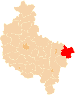
Gmina Stara Kornica is a rural gmina in Łosice County, Masovian Voivodeship, in east-central Poland. Its seat is the village of Stara Kornica, which lies approximately 15 kilometres south-east of Łosice and 131 km east of Warsaw.

Zalesie is a village in the administrative district of Gmina Stolno, within Chełmno County, Kuyavian-Pomeranian Voivodeship, in north-central Poland. It lies 13 kilometres (8 mi) north-east of Stolno, 16 km (10 mi) east of Chełmno, and 40 km (25 mi) north of Toruń.
Kobyla Łąka is a village in the administrative district of Gmina Lubień Kujawski, within Włocławek County, Kuyavian-Pomeranian Voivodeship, in north-central Poland.
Romanowo is a village in the administrative district of Gmina Michałowo, within Białystok County, Podlaskie Voivodeship, in north-eastern Poland, close to the border with Belarus.
Strzeżów Drugi is a village in the administrative district of Gmina Miechów, within Miechów County, Lesser Poland Voivodeship, in southern Poland. It lies approximately 4 kilometres (2 mi) north of Miechów and 37 km (23 mi) north of the regional capital Kraków.

Czarna Góra, is a village in the administrative district of Gmina Bukowina Tatrzańska, within Tatra County, Lesser Poland Voivodeship, in southern Poland, close to the border with Slovakia. It lies approximately 5 kilometres (3 mi) north of Bukowina Tatrzańska, 17 km (11 mi) north-east of Zakopane, and 77 km (48 mi) south of the regional capital Kraków.
Rejterówka is a village in the administrative district of Gmina Łubnice, within Staszów County, Świętokrzyskie Voivodeship, in south-central Poland. It lies approximately 4 kilometres (2 mi) south-east of Łubnice, 20 km (12 mi) south of Staszów, and 68 km (42 mi) south-east of the regional capital Kielce.
Falęcice-Wola is a village in the administrative district of Gmina Promna, within Białobrzegi County, Masovian Voivodeship, in east-central Poland.
Drewnowo-Ziemaki is a village in the administrative district of Gmina Boguty-Pianki, within Ostrów Mazowiecka County, Masovian Voivodeship, in east-central Poland.
Kolonia Zameczek is a settlement in the administrative district of Gmina Przytyk, within Radom County, Masovian Voivodeship, in east-central Poland.
Kolonia Wolanów is a village in the administrative district of Gmina Wolanów, within Radom County, Masovian Voivodeship, in east-central Poland.
Bartosz is a village in the administrative district of Gmina Sokołów Podlaski, within Sokołów County, Masovian Voivodeship, in east-central Poland. It lies approximately 3 kilometres (2 mi) south-west of Sokołów Podlaski and 86 km (53 mi) east of Warsaw.
Paciorkowa Wola Stara is a village in the administrative district of Gmina Zwoleń, within Zwoleń County, Masovian Voivodeship, in east-central Poland.
Lutkówka Druga is a village in the administrative district of Gmina Mszczonów, within Żyrardów County, Masovian Voivodeship, in east-central Poland.
Żelazno is a village in the administrative district of Gmina Krzywiń, within Kościan County, Greater Poland Voivodeship, in west-central Poland. It lies approximately 6 kilometres (4 mi) south-east of Krzywiń, 24 km (15 mi) south-east of Kościan, and 52 km (32 mi) south of the regional capital Poznań.
Stary Jaromierz is a village in the administrative district of Gmina Kargowa, within Zielona Góra County, Lubusz Voivodeship, in western Poland.
Troszki is a village in the administrative district of Gmina Dębnica Kaszubska, within Słupsk County, Pomeranian Voivodeship, in northern Poland. It lies approximately 7 kilometres (4 mi) east of Dębnica Kaszubska, 18 km (11 mi) south-east of Słupsk, and 89 km (55 mi) west of the regional capital Gdańsk.
Przytuły is a village in the administrative district of Gmina Ełk, within Ełk County, Warmian-Masurian Voivodeship, in northern Poland. It lies approximately 13 kilometres (8 mi) north of Ełk and 125 km (78 mi) east of the regional capital Olsztyn.
Nowy Dwór is a village in the administrative district of Gmina Morąg, within Ostróda County, Warmian-Masurian Voivodeship, in northern Poland. It lies approximately 4 kilometres (2 mi) north-west of Morąg, 27 km (17 mi) north of Ostróda, and 44 km (27 mi) north-west of the regional capital Olsztyn.
Mosina is a village in the administrative district of Gmina Dobrzany, within Stargard County, West Pomeranian Voivodeship, in north-western Poland. It lies approximately 6 kilometres (4 mi) north-west of Dobrzany, 23 km (14 mi) east of Stargard, and 52 km (32 mi) east of the regional capital Szczecin.