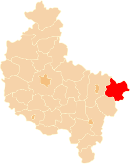
Bugaj is a village in the administrative district of Gmina Babiak, within Koło County, Greater Poland Voivodeship, in west-central Poland. It lies approximately 4 kilometres (2 mi) east of Babiak, 16 km (10 mi) north of Koło, and 123 km (76 mi) east of the regional capital Poznań.
Wiecinin is a village in the administrative district of Gmina Babiak, within Koło County, Greater Poland Voivodeship, in west-central Poland. It lies approximately 6 kilometres (4 mi) north-east of Babiak, 22 km (14 mi) north of Koło, and 123 km (76 mi) east of the regional capital Poznań.
Długie is a village in the administrative district of Gmina Chodów, within Koło County, Greater Poland Voivodeship, in west-central Poland. It lies approximately 8 kilometres (5 mi) north-west of Chodów, 25 km (16 mi) north-east of Koło, and 139 km (86 mi) east of the regional capital Poznań.

Bierzwienna Długa is a village in the administrative district of Gmina Kłodawa, within Koło County, Greater Poland Voivodeship, in west-central Poland. It lies approximately 4 kilometres (2 mi) north of Kłodawa, 21 km (13 mi) north-east of Koło, and 136 km (85 mi) east of the regional capital Poznań.
Cząstków is a village in the administrative district of Gmina Kłodawa, within Koło County, Greater Poland Voivodeship, in west-central Poland. It lies approximately 4 kilometres (2 mi) north-west of Kłodawa, 18 km (11 mi) north-east of Koło, and 134 km (83 mi) east of the regional capital Poznań.
Dębina is a village in the administrative district of Gmina Kłodawa, within Koło County, Greater Poland Voivodeship, in west-central Poland. It lies approximately 4 kilometres (2 mi) north of Kłodawa, 21 km (13 mi) north-east of Koło, and 136 km (85 mi) east of the regional capital Poznań.
Zbójno is a village in the administrative district of Gmina Kłodawa, within Koło County, Greater Poland Voivodeship, in west-central Poland. It lies approximately 6 kilometres (4 mi) north of Kłodawa, 24 km (15 mi) north-east of Koło, and 138 km (86 mi) east of the regional capital Poznań.
Arkuszewo is a village in the administrative district of Gmina Przedecz, within Koło County, Greater Poland Voivodeship, in west-central Poland. It lies approximately 6 kilometres (4 mi) north of Przedecz, 26 km (16 mi) north-east of Koło, and 138 km (86 mi) east of the regional capital Poznań.
Broniszewo is a village in the administrative district of Gmina Przedecz, within Koło County, Greater Poland Voivodeship, in west-central Poland. It lies approximately 10 kilometres (6 mi) north of Przedecz, 29 km (18 mi) north-east of Koło, and 139 km (86 mi) east of the regional capital Poznań.
Chrustowo is a village in the administrative district of Gmina Przedecz, within Koło County, Greater Poland Voivodeship, in west-central Poland. It lies approximately 10 kilometres (6 mi) north of Przedecz, 29 km (18 mi) north-east of Koło, and 139 km (86 mi) east of the regional capital Poznań.
Holenderki is a village in the administrative district of Gmina Przedecz, within Koło County, Greater Poland Voivodeship, in west-central Poland. It lies approximately 9 kilometres (6 mi) north-east of Przedecz, 29 km (18 mi) north-east of Koło, and 140 km (87 mi) east of the regional capital Poznań.
Jasieniec is a village in the administrative district of Gmina Przedecz, within Koło County, Greater Poland Voivodeship, in west-central Poland. It lies approximately 8 kilometres (5 mi) east of Przedecz, 28 km (17 mi) north-east of Koło, and 143 km (89 mi) east of the regional capital Poznań.
Józefowo is a village in the administrative district of Gmina Przedecz, within Koło County, Greater Poland Voivodeship, in west-central Poland. It lies approximately 9 kilometres (6 mi) north-east of Przedecz, 29 km (18 mi) north-east of Koło, and 142 km (88 mi) east of the regional capital Poznań.
Nowa Wieś Wielka is a village in the administrative district of Gmina Przedecz, within Koło County, Greater Poland Voivodeship, in west-central Poland. It lies approximately 10 kilometres (6 mi) north-east of Przedecz, 31 km (19 mi) north-east of Koło, and 143 km (89 mi) east of the regional capital Poznań.
Rogóźno is a village in the administrative district of Gmina Przedecz, within Koło County, Greater Poland Voivodeship, in west-central Poland. It lies approximately 11 kilometres (7 mi) north of Przedecz, 28 km (17 mi) north-east of Koło, and 138 km (86 mi) east of the regional capital Poznań.
Rybno is a village in the administrative district of Gmina Przedecz, within Koło County, Greater Poland Voivodeship, in west-central Poland. It lies approximately 8 kilometres (5 mi) north of Przedecz, 26 km (16 mi) north-east of Koło, and 137 km (85 mi) east of the regional capital Poznań.
Zalesie is a village in the administrative district of Gmina Przedecz, within Koło County, Greater Poland Voivodeship, in west-central Poland. It lies approximately 8 kilometres (5 mi) north-west of Przedecz, 22 km (14 mi) north-east of Koło, and 132 km (82 mi) east of the regional capital Poznań.
Żarowo is a village in the administrative district of Gmina Przedecz, within Koło County, Greater Poland Voivodeship, in west-central Poland. It lies approximately 8 kilometres (5 mi) north of Przedecz, 24 km (15 mi) north-east of Koło, and 133 km (83 mi) east of the regional capital Poznań.