
The Palatinate, or the Rhenish Palatinate (Rheinpfalz), is a historical region of Germany. The Palatinate occupies most of the southern quarter of the German federal state of Rhineland-Palatinate (Rheinland-Pfalz), covering an area of 2,105 square miles (5,450 km2) with about 1.4 million inhabitants. Its residents are known as Palatines (Pfälzer).
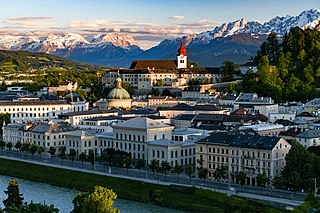
Salzburg is the fourth-largest city in Austria. In 2020, it had a population of 156,872.

Salzburg is an Austrian federal state. In German it is called a Bundesland, a German-to-English dictionary translates that to federal state and the European Commission calls it a province. In German, its official name is Land Salzburg, to distinguish it from its eponymous capital Salzburg. For centuries, it was an independent Prince-Bishopric of the Holy Roman Empire. It borders Germany and Italy.
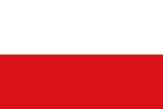
Tyrol is an Austrian federal state. It comprises the Austrian part of the historical Princely County of Tyrol. It is a constituent part of the present-day Euroregion Tyrol–South Tyrol–Trentino. The capital of Tyrol is Innsbruck.
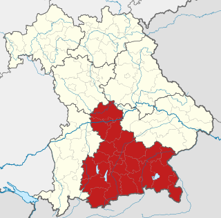
Upper Bavaria is one of the seven administrative regions of Bavaria, Germany.
Berchtesgadener Land is a Landkreis (district) in Bavaria, Germany. It is bounded by the district of Traunstein and by the state of Austria.

Lindau is a major town and island on the eastern side of Lake Constance in Bavaria, Germany. It is the capital of the county (Landkreis) of Lindau, Bavaria and is near the borders of the Austrian state of Vorarlberg, and the Swiss cantons of St. Gallen and Thurgau. The coat of arms of Lindau town is a linden tree, referring to the supposed origin of the town's name. The historic town of Lindau is located on the 0.68-square-kilometre (0.26 sq mi) island of the same name, which is connected with the mainland by a road bridge and a railway causeway leading to Lindau station.
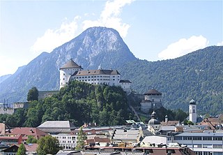
Kufstein is a town in the Austrian state of Tyrol, the administrative seat of Kufstein District. With a population of about 20,000 it is the second largest Tyrolean town after the state capital Innsbruck. The greatest landmark is Kufstein Fortress, first mentioned in the 13th century. The town was the place of origin of the Austrian noble family Kuefstein.

The Innviertel is a traditional Austrian region southeast of the Inn river. It forms the western part of the state of Upper Austria and borders the German state of Bavaria. The Innviertel is one of the four traditional "quarters" of Upper Austria, the others being Hausruckviertel, Mühlviertel, and Traunviertel.

Lofer is a market town in the district of Zell am See in the Austrian state of Salzburg.

Sonnen is a small municipality in the district of Passau in Bavaria in Germany. It is located in the Danube forest, lower Bavarian forest and is located mostly in the district Passau at a height of 700 to 900 meters. Sonnen lies 28 km from Passau, 9 km from Hauzenberg and from the forest itself 13 km. Sonnen borders with upper Austria which lies only 8 km away.

Sillian is a market town in the district of Lienz, in the Austrian state of Tyrol.
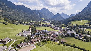
Unken is a municipality in the district of Zell am See, in the state of Salzburg in Austria.
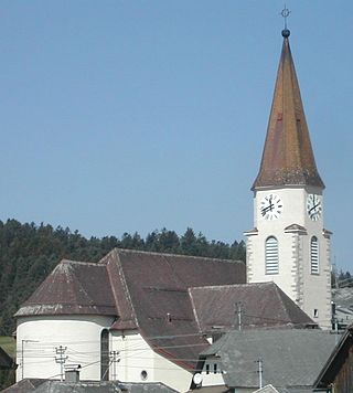
Oberkappel is a municipality in the district of Rohrbach in the state of Upper Austria.

The Stadelhorn (2,286 m) is the highest and most prominent peak in the Reiter Alm on the Austro-German border, lying on the boundary between the states of Bavaria and Salzburg.

The Deutsches Eck is the name given to the shortest and most convenient road and railway link between the Austrian metropolitan region of Salzburg and the Tyrolean Unterland with the state capital Innsbruck.
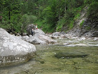
Steinbach is a river of Bavaria, Germany and of Salzburg, Austria. It is a tributary of the Saalach between Unken and Schneizlreuth.
Unken is a municipality in the district of Zell am See in the state of Salzburg in Austria.

A photo of the station.

Traunstein station is the only station of the large district town of Traunstein in the German state of Bavaria. It has four main line platform tracks and two bay platform tracks and is classified by Deutsche Bahn as a category 4 station. The station is a rail junction and is located on the Rosenheim–Salzburg, Traunstein–Ruhpolding, Traunstein–Waging and Traunstein–Garching lines.


