
Eagle Gorge is a valley in the U.S. state of Washington. [1]
Eagle Gorge was named for the fact eagles nest in the area. [2]
Eagle Gorge is a valley in the U.S. state of Washington. [1]
Eagle Gorge was named for the fact eagles nest in the area. [2]

The Snoqualmie River is a 45-mile (72 km) long river in King County and Snohomish County in the U.S. state of Washington. The river's three main tributaries are the North, Middle, and South Forks, which drain the west side of the Cascade Mountains near the town of North Bend and join near the town of Snoqualmie just above the Snoqualmie Falls. After the falls the river flows north through rich farmland and the towns of Fall City, Carnation, and Duvall before meeting the Skykomish River to form the Snohomish River near Monroe. The Snohomish River empties into Puget Sound at Everett. Other tributaries of the Snoqualmie River include the Taylor River and the Pratt River, both of which enter the Middle Fork, the Tolt River, which joins at Carnation, and the Raging River at Fall City.

The Columbia River Gorge is a canyon of the Columbia River in the Pacific Northwest of the United States. Up to 4,000 feet (1,200 m) deep, the canyon stretches for over eighty miles (130 km) as the river winds westward through the Cascade Range, forming the boundary between the state of Washington to the north and Oregon to the south. Extending roughly from the confluence of the Columbia with the Deschutes River in the east down to the eastern reaches of the Portland metropolitan area, the water gap furnishes the only navigable route through the Cascades and the only water connection between the Columbia Plateau and the Pacific Ocean. It is thus the route of Interstate 84, U.S. Route 30, Washington State Route 14, and railroad tracks on both sides.

The Wenatchee Mountains are a range of mountains in central Washington State, United States of America. A major subrange of the Cascade Range, extending east 50 miles (80 km) from the Cascade crest, the Wenatchee Mountains separate the drainage basins of the Yakima River from the Wenatchee River. The crest of the range forms part of the boundary between Chelan and Kittitas Counties.
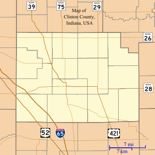
Fickle is an unincorporated community in Washington Township, Clinton County, Indiana.

Sheridan State Scenic Corridor is a state park in the Columbia River Gorge, west of Cascade Locks, Oregon. The 11-acre (4.5 ha) property, containing an old-growth forest, is located on the south side of Interstate 84 at approximately milepoint 42.5, and was not accessible by motor vehicle since I-84 was built in 1960. However, with the opening of the Eagle Creek-Cascade Locks segment of the Historic Columbia River Highway State Trail in 1998, it has become easily accessible by foot or bicycle. The park is on a triangular lot, completely surrounded by I-84 and the Mount Hood National Forest.

Eagle Creek is a tributary of the Columbia River in Multnomah and Hood River counties in the U.S. state of Oregon. It cuts through a narrow canyon in its 3,200 feet (980 m) descent to the Columbia River Gorge and is known for its concentration of 13 waterfalls in about 5 miles (8.0 km) distance. Eight major falls are on Eagle Creek and the East Fork Eagle Creek itself, while five are on its tributaries.
Tolna is an unincorporated community in York County, Pennsylvania, United States. Tolna is located near Pennsylvania Route 851.
Arthur Township is a civil township in Cass County, in the U.S. state of North Dakota.
Edgewick is an unincorporated community in King County, in the U.S. state of Washington.
Kerriston is an extinct town in King County, in the U.S. state of Washington. The GNIS classifies it as a populated place.
Page is an extinct town in King County, in the U.S. state of Washington. The GNIS classifies it as a populated place.
Reiter is an unincorporated community in Snohomish County, in the U.S. state of Washington.

Rockdale is an extinct town in the northwest United States, in King County, Washington. The GNIS classifies it as a populated place.
Stillwater is an unincorporated community in King County, in the U.S. state of Washington.
Veazie is an unincorporated community in King County, in the U.S. state of Washington.
Green Bay Terrace is an unincorporated community in Camden County, in the U.S. state of Missouri.
Shawnee Mound is an unincorporated community in northeastern Henry County, in the U.S. state of Missouri. The community is on Missouri Route 13 ten miles north of Clinton. Post Oak is three miles north in southern Johnson County. The Shawnee Mound church and cemetery are approximately one half mile to the southwest on a county road. The community is on a ridge between the headwaters of Sand Creek to the east and Honey Creek to the west.
Salmon Creek is a stream in Thurston County in the U.S. state of Washington. It is a tributary to the Skookumchuck River.
Coordinates: 47°15′40″N121°45′43″W / 47.26111°N 121.76194°W
| | This King County, Washington state location article is a stub. You can help Wikipedia by expanding it. |