This article needs additional citations for verification .(March 2009) |
| Earth3D | |
|---|---|
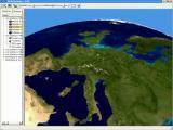 Screenshot of Earth3d running under Linux | |
| Developer | Dominique Andre Gunia |
| Initial release | August 2004 |
| Stable release | 1.0.5 February 0, 2006 |
| Repository | |
| Written in | C++, Java |
| Operating system | Windows 2000, XP & Vista, Mac OS X, Linux |
| Available in | english |
| Type | Virtual globe |
| License | GPL |
| Website | www |
Earth3D was developed as part of a diploma thesis of Dominique Andre Gunia at Braunschweig University of Technology [1] to display a virtual globe of the earth. It was developed before Google bought Keyhole, Inc and changed their product into Google Earth. Earth3D downloads its data (satellite imagery and height data) from a server while the user navigates around. The data itself is saved in a Quadtree. It uses data from NASA, USGS, the CIA and the city of Osnabrück.
Contents
One of the strengths of Earth3D is the capacity of showing meteorological phenomena, like Low-pressure areas, anticyclones, etc. in near-real time. [2]
The original version of Earth3D was developed using Trolltech's QT framework. Later a version built with Java and JOGL was developed. [3] But the demand for a Java-based version was very little. This may be because NASA's WorldWind also has an open source Java version. So most people wanted to use a C++ based globe in their applications. That was the reason why a minimalized version, the Earth3dlib was developed. It contains only the most necessary functions to display the earth itself and to add own visualizations to it.
All these three projects can be retrieved from SourceForge's CVS (C++) or Subversion (Java) repository.