Gabriel's Rebellion was a planned slave rebellion in the Richmond, Virginia, area in the summer of 1800. Information regarding the revolt was leaked before its execution, and Gabriel, an enslaved blacksmith who planned the event, and twenty-five of his followers were hanged.

Hollywood Cemetery is a historic rural cemetery located at 412 South Cherry Street in the Oregon Hill neighborhood of Richmond, Virginia. It was established in 1847 and designed by the landscape architect John Notman. It is 135-acres in size and overlooks the James River. It is the only cemetery other than Arlington National Cemetery that contains the burials of two United States Presidents, James Monroe and John Tyler.

The history of Richmond, Virginia, as a modern city, dates to the early 17th century, and is crucial to the development of the colony of Virginia, the American Revolutionary War, and the Civil War. After Reconstruction, Richmond's location at the falls of the James River helped it develop a diversified economy and become a land transportation hub.

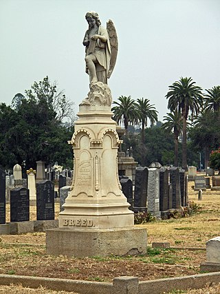
Evergreen Memorial Park & Crematory is a cemetery in the East Side neighborhood of Boyle Heights, Los Angeles, California.

Shockoe Hill is one of several hills on which much of the oldest portion of the City of Richmond, Virginia, U.S., was built. It extends from the downtown area, including where the Virginia State Capitol complex sits, north almost a mile to a point where the hill falls off sharply to the winding path of Shockoe Creek. Interstate 95 now bisects the hill, separating the highly urbanized downtown portion from the more residential northern portion.

Shockoe Bottom historically known as Shockoe Valley, is an area in Richmond, Virginia, just east of downtown, along the James River. Located between Shockoe Hill and Church Hill, Shockoe Bottom contains much of the land included in Colonel William Mayo's 1737 plan of Richmond, making it one of the city's oldest neighborhoods.

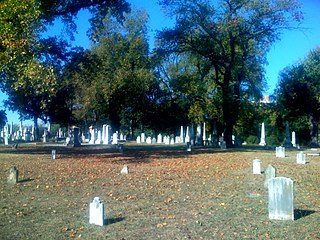
Oakwood Cemetery is a large, city-owned burial ground in the East End of Richmond, Virginia. It holds over 48,000 graves, including many soldiers from the Civil War.

The East End of Richmond, Virginia is the quadrant of the City of Richmond, Virginia, and more loosely the Richmond metropolitan area, east of the downtown.

Evergreen Cemetery is a historic African-American cemetery in the East End of Richmond, Virginia, dating from 1891.

The Shockoe Hill Cemetery is a historic cemetery located on Shockoe Hill in Richmond, Virginia.

Brandwood End Cemetery is a cemetery located in the Brandwood ward of Birmingham, England.

The VCU Medical Center is Virginia Commonwealth University's medical campus located in downtown Richmond, Virginia, in the Court End neighborhood. VCU Medical Center used to be known as the Medical College of Virginia (MCV), which merged with the Richmond Professional Institute in 1968 to create Virginia Commonwealth University. In the 1990s, the Medical College of Virginia Hospitals Authority was created to oversee MCV Hospitals. In 2004, the name of this authority was changed to the VCU Health System, and the MCV Hospitals and surrounding campus were named the VCU Medical Center. The authority oversees the employees and real estate occupied by the five schools within the VCU Medical Center. It was at this time that the MCV Campus moniker was created.

Woodland Cemetery is a historically African American cemetery in Northeast Richmond, Virginia located directly east of the Highland Park neighborhood. Opening in 1916, it was built as a resting place for the Black elite of Richmond. Woodland was laid out in the shape of an arrowhead pointing north to symbolize the way enslaved blacks once looked north to freedom.

Rosa L. Dixon Bowser was an American educator. She was the first African-American teacher hired in Richmond, Virginia. She organized the Virginia Teachers' Reading Circle, which became the Virginia State Teachers Association, the first organization representing black teachers in Virginia, serving as the organization's president from 1890 to 1892. Bowser was president of the Woman's Christian Temperance Union in Virginia, as well as founder and first president of the Richmond Woman's League. She was a correspondent for the magazine The Woman's Era, and wrote essays for national publications.

The Shockoe Hill African Burying Ground was established by the city of Richmond, Virginia, for the interment of free people of color, and the enslaved. The heart of this now invisible burying ground is located at 1305 N 5th St.
The Shockoe Bottom African Burial Ground, or known historically as the "Burial Ground for Negroes" and the "old Powder Magazine ground", is the older of two municipal burial grounds established for the interment of free people of color and the enslaved in the city of Richmond, Virginia. It is located at 1554 E Broad St., across from the site of Lumpkin's Jail, in Shockoe Bottom. The area now known as Shockoe Bottom, was historically known as Shockoe Valley. Richmond's second African Burial Ground, called the "Shockoe Hill African Burying Ground" is the larger of the two burial grounds, and is located a mile and a half away at 1305 N 5th St, on Shockoe Hill.

The Shockoe Hill Burying Ground Historic District, located in the city of Richmond, Virginia, is a significant example of a municipal almshouse-public hospital-cemetery complex of the sort that arose in the period of the New Republic following disestablishment of the Anglican Church. The District illustrates changing social and racial relationships in Richmond through the New Republic, Antebellum, Civil War, Reconstruction, and Jim Crow/Lost Cause eras of the nineteenth and twentieth centuries. The Shockoe Hill Burying Ground Historic District occupies 43 acres (17 ha) of land bounded to the south by E. Bates Street, to the north by the northern limit of the Virginia Passenger Rail Authority right-of-way at the southern margin of the Bacon's Quarter Branch valley, to the west by 2nd Street, and to the east by the historic edge of the City property at the former location of Shockoe Creek. The District encompasses most of a 28.5-acre (11.5 ha) tract acquired by the city of Richmond in 1799 to fulfill several municipal functions, along with later additions to this original tract.
The city of Richmond, Virginia has two African Burial Grounds, the "Shockoe Bottom African Burial Ground", and the "Shockoe Hill African Burying Ground". Additionally the city is home to several other important and historic African American cemeteries.


