Saratoga County is a county in the U.S. state of New York, and is the fastest-growing county in Upstate New York. As of the 2020 U.S. Census, the county's population was enumerated at 235,509, representing a 7.2% increase from the 2010 population of 219,607, representing one of the fastest growth rates in the northeastern United States. The county seat is Ballston Spa. Saratoga County is included in the Capital District, encompassing the Albany-Schenectady-Troy, New York Metropolitan Statistical Area.
Interstate 87 (I-87) is a 333.49-mile-long (536.70 km) north–south intrastate Interstate Highway located within the U.S. state of New York, and is most of the main highway between New York City and Montreal. The highway begins at exit 47 off I-278 in the New York City borough of the Bronx, just north of the Triborough Bridge and Grand Central Parkway. From there, the route runs northward through the Hudson Valley, the Capital District, and the easternmost part of the North Country to the Canadian border in the Town of Champlain. At its north end, I-87 continues into Quebec as Autoroute 15 (A-15). I-87 connects with several regionally important roads: I-95 in New York City, New York State Route 17 near Harriman, I-84 near Newburgh, and I-90 in Albany. The route is the longest intrastate Interstate Highway in the Interstate Highway System. The highway is not contiguous with I-87 in North Carolina.

Saratoga is a city in Santa Clara County, California, United States. It is located on the west side of the Santa Clara Valley, directly west of San Jose, in the San Francisco Bay Area. The population was 31,051 at the 2020 census. Located on the western edge of Silicon Valley, Saratoga is known locally for its suburban small-town feel, wineries, and high-end restaurants. Major attractions of Saratoga include Villa Montalvo, Hakone Gardens, and the Mountain Winery.

Lorraine is a town in Jefferson County, New York, United States. The population was 1,037 at the 2010 census, up from 930 in 2000. The town is named after Lorraine, a region in France.

Wantagh is a hamlet and census-designated place (CDP) in the Town of Hempstead in Nassau County, on Long Island, New York, United States. The population was 18,871 at the time of the 2010 census.

Ballston is a town in Saratoga County, New York, United States. The population was 9,776 at the 2010 census. The name is derived from an early settler, Eliphalet Ball, a Presbyterian minister who located there from Westchester County, New York in 1770.

Ballston Spa is a village and the county seat of Saratoga County, New York, United States, located southwest of Saratoga Springs. The population of the village, named after Rev. Eliphalet Ball, a Congregationalist clergyman and an early settler, was 5,409 at the 2010 census. Ballston Spa lies on the border of two towns, situated partly in the Town of Ballston and partly in the Town of Milton. The Ballston Spa School District encompassing most of the combined towns of Milton, Malta, and Ballston is often referred to locally as ‘Ballston Spa’ with the village proper being referred to as ‘The Village’ or 'Town'.
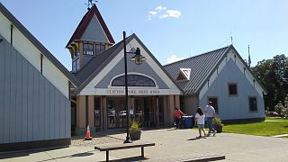
Clifton Park is a suburban town in Saratoga County, New York, United States. According to the United States Census Bureau, the 2010 population was 36,705. The name is derived from an early land patent. The town is in the southern part of the county, approximately 12 miles (19 km) north of Albany, 7 miles (11 km) northeast of Schenectady, and 10 miles (16 km) south of Saratoga Springs.

Malta is a town in Saratoga County, New York, United States. The town is in the central part of the county and is south of Saratoga Springs. The population was 14,765 as of the 2010 census.

Saratoga is a town in Saratoga County, New York, United States. The population was 5,141 at the 2000 census. It is also the commonly used, but not official, name for the neighboring and much more populous city, Saratoga Springs. The major village in the town of Saratoga is Schuylerville, which is often, but not officially, called Old Saratoga. Saratoga contains a second village, named Victory.

Cheektowaga is a town in Erie County, New York, United States. As of the 2020 census, the town has grown to a population of 89,877. The town is in the north-central part of the county, and is an inner ring suburb of Buffalo. The town is the second-largest suburb of Buffalo, after the Town of Amherst.
Broadalbin is a town in Fulton County, New York, on the eastern border of the county and northwest of Albany. The town was named after the Breadalbane Region in Scotland by an early settler. The town contains a village also called Broadalbin.
Galway is a town located in Saratoga County, New York, United States. As of the 2000 census, the town had a total population of 3,589. The town contains a village also named Galway. Both the town and village are located in the western part of the county, north of Schenectady.
Milton is a town in Saratoga County, New York, United States. The population was 17,103 at the 2000 census. Some believe that the town was named after the poet, John Milton, while other sources state that it is a shortening of "Mill-town" for the early mill activity.
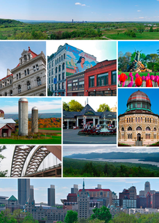
The Capital District, also known as the Capital Region, is the metropolitan area surrounding Albany, the capital of the U.S. state of New York. In the 21st century, the Capital District emerged as a major anchor of Tech Valley, the moniker describing the technologically-focused region of eastern New York State. The Capital District was first settled by the Dutch in the early 17th century and came under English control in 1664. Albany has been the permanent capital of the state of New York since 1797. The Capital District is notable for many historical events that predate the independence of the United States, including the Albany Plan of Union and The Battles of Saratoga.
New York State Route 50 (NY 50) is a 31.67-mile (50.97 km) state highway in the Capital District of New York in the United States. The southern terminus of the route is at an intersection with NY 5 in Scotia. Its northern terminus is at a junction with NY 32 in the Saratoga County hamlet of Gansevoort.
New York State Route 9P (NY 9P) is a state highway in central Saratoga County, New York, in the United States. It is an alternate route off U.S. Route 9 between Malta and Saratoga Springs that connects US 9 to the eastern shore of Saratoga Lake. NY 9P meets NY 423 in the town of Stillwater and Interstate 87 in Saratoga Springs. In its final mile, NY 9P serves the Saratoga Race Course.

The Kayaderosseras Creek, usually shortened to Kaydeross, is the largest river that lies completely within Saratoga County, New York State. It originates in the Kayaderosseras Range in the northern part of the county, passes through the towns of Corinth, Greenfield, and Milton, and serves as the boundary between the City of Saratoga Springs and the Town of Malta before emptying into Saratoga Lake.

Saratoga Lake is a lake in the eastern part of Saratoga County, New York. The lake is approximately 4.5 miles (7.2 km) long, about 1.5 miles (2.4 km) wide at its widest point, and about 95 feet (29 m) deep.