
The William Jolly Bridge is a heritage-listed road bridge over the Brisbane River between North Quay in the Brisbane central business district and Grey Street in South Brisbane, within City of Brisbane, Queensland, Australia. It was designed by Harding Frew and built from 1928 to 1932 by MR Hornibrook.

The River Teme rises in Mid Wales, south of Newtown, and flows southeast roughly forming the border between England and Wales for several miles through Knighton before entering England in the vicinity of Bucknell and continuing east to Ludlow in Shropshire. From there, it flows to the north of Tenbury Wells on the Shropshire/Worcestershire border on its way to join the River Severn south of Worcester. The whole of the River Teme was designated as an SSSI by English Nature in 1996.
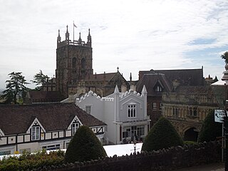
Malvern Hills is a local government district in Worcestershire, England. Its council is based in the town of Malvern, and its area covers most of the western half of the county, including the outlying towns of Tenbury Wells and Upton-upon-Severn. It was originally formed in 1974 and was subject to a significant boundary reform in 1998. In the 2011 census the population of the Malvern Hills district was 74,631.

Tenbury Wells is a market town and civil parish in the northwestern extremity of the Malvern Hills District of Worcestershire, England. Its northern border adjoins Shropshire, and at the 2021 census joint with Burford it had a population of 5,224.

There are nine bridges across the River Ouse and eighteen smaller bridges and passages across the narrower River Foss within the city of York, England.

The Leominster Canal was an English canal which ran for just over 18 miles from Mamble to Leominster through 16 locks and a number of tunnels, some of which suffered engineering problems even before the canal opened. Originally, the canal was part of a much more ambitious plan to run 46 miles from Stourport to Kington.
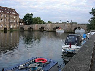
The Old Bridge between Huntingdon and Godmanchester is a well-preserved medieval stone bridge over the River Great Ouse.

The Runcorn Railway Bridge, Ethelfleda Bridge or Britannia Bridge crosses the River Mersey at Runcorn Gap between Runcorn and Widnes in Cheshire, England. It is alongside the Silver Jubilee Bridge. The bridge is recorded in the National Heritage List for England as a Grade II* Listed building.
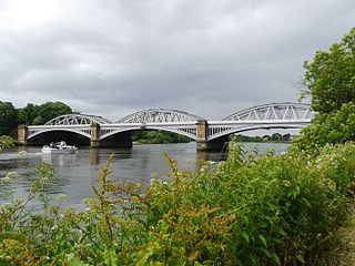
Barnes Railway Bridge is a Grade II listed railway bridge in the London Borough of Richmond upon Thames and the London Borough of Hounslow. It crosses the River Thames in London in a northwest to southeast direction at Barnes. It carries the South Western Railway's Hounslow Loop Line, and lies between Barnes Bridge and Chiswick stations. It can also be crossed on foot, and is one of only three bridges in London to combine pedestrian and rail use; the others being Hungerford Bridge and Golden Jubilee Bridges and Fulham Railway Bridge.
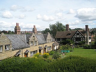
Ludford is a small village and civil parish in south Shropshire, England. The parish is situated adjacent to the market town of Ludlow and was, until 1895, partly in Herefordshire.

The Victoria Bridge crosses the River Severn between Arley and Bewdley in Worcestershire, England. At the time of its construction, the 200-foot railway bridge was the longest single span cast iron bridge in Britain.

Newnham Bridge is a village in the parish of Knighton on Teme, near Tenbury Wells, Worcestershire, England, United Kingdom.

Stopham is a hamlet and civil parish in the District of Chichester in West Sussex, England, about 1.5 miles (2.4 km) west of Pulborough on the A283 road. It is in the civil parish of Fittleworth.

Clifton upon Teme is a village and civil parish in the Malvern Hills District in the county of Worcestershire, England.
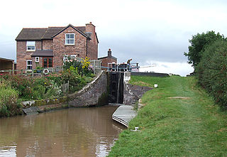
The Middlewich Branch of the Shropshire Union Canal is located in Cheshire, in the north west of England, and runs between Middlewich, where it joins the Trent and Mersey Canal, and Barbridge Junction, where it joins the main line of the Shropshire Union Canal. It is 10 miles (16 km) long, and was planned as part of the Chester Canal, which was authorised in 1772, but the company ran out of money, and construction did not begin until 1827. The Trent and Mersey insisted that there should be no direct connection at Middlewich, and instead built the short Wardle Canal to join the two, charging large compensation tolls for traffic passing along it.

Eastham is a village and civil parish in the Malvern Hills District in the county of Worcestershire, England. It had a population of 254 in 2021.

Rochford consists of two hamlets, Lower and Upper Rochford. A civil parish in the Malvern Hills District near Tenbury Wells, in the county of Worcestershire, England, Rochford is 18 miles (29 km) NW of Worcester. The River Teme, which rises in Wales, flows past Lower Rochford and joins the River Severn in Worcester. The chapelry of Rochford was an exclave of Herefordshire, part of the hundred of Wolphy. It was transferred by the Counties Act 1844 to Worcestershire.
Burford is a civil parish in Shropshire, England. It contains 13 listed buildings that are recorded in the National Heritage List for England. Of these, one is listed at Grade I, the highest of the three grades, two are at Grade II*, the middle grade, and the others are at Grade II, the lowest grade. The parish contains the village of Burford and the surrounding countryside. Some of the listed buildings are grouped around Burford House and its neighbouring St Mary's Church to the southwest of the village. Otherwise, in and around the village, the listed buildings include a bridge over the River Teme, a hotel, a hospital, a cottage, a former toll house, and two mileposts.
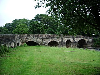
Edisford Bridge is a toll-free, nine-span bridge over the River Ribble near Clitheroe, Lancashire, England. A Grade II listed structure and a Scheduled monument, located about a mile WSW of the centre of town, it crosses the river to the civil parish of Great Mitton. The bridge carries the two-lane traffic of the B6243 Edisford Road.

Kexby Old Bridge is a historic bridge in Yorkshire, in England.


