Related Research Articles

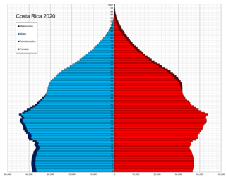
This is a demography of the population of Costa Rica including population density, ethnicity, education level, health of the populace, economic status, religious affiliations and other aspects of the population.

Ecuadorians are the people of Ecuador.

This is a demography of the population of Panama including population density, ethnicity, education level, health of the populace, economic status, religious affiliations and other aspects of the population.
The Brazilian Institute of Geography and Statistics is the agency responsible for official collection of statistical, geographic, cartographic, geodetic and environmental information in Brazil. IBGE performs a decennial national census; questionnaires account for information such as age, household income, literacy, education, occupation and hygiene levels.

Los Ríos is a province in Ecuador. The capital is Babahoyo. The province was founded on October 6, 1860. Under legislative decree. Babahoyo was made its capital on September 30, 1948.
The National Institute of Statistics and Census of Costa Rica is the governmental institution entrusted with the running of censuses and official surveys in the country. Its main office is located in San José.
Desamparados is the 3rd canton in the province of San José in Costa Rica. The canton covers an area of 118.26 km², and has a population of 206,708, making it the third most populated among the 81 cantons of Costa Rica. The capital city of the canton is also called Desamparados.
Talamanca is a canton in the Limón province of Costa Rica. The head city is Bribri, located in Bratsi district.

According to the Political Constitution of Costa Rica of 1949, in article 168, the territorial division of Costa Rica is organized by law into three types of subnational entity:
San Sebastián is the eleventh district of the San José canton, in the San José province of Costa Rica. An important residential district, San Sebastián is the third most populated and second most densely populated in the canton.
The Costa Rica 2011 Census was undertaken by the National Institute of Statistics and Census in Costa Rica. The semi-autonomous government body, INEC, was created by Census Law No. 7839 on 4 November 1998.

This is a list of national population and housing censuses.
Buenavista is a district of the San Carlos canton, in the Alajuela province of Costa Rica.
Pital is a district of the San Carlos canton, in the Alajuela province of Costa Rica.
Las Horquetas is a district of the Sarapiquí canton, in the Heredia province of Costa Rica.
Llanuras del Gaspar is a district of the Sarapiquí canton, in the Heredia province of Costa Rica.
Quitirrisí is a district of the Mora canton, in the San José province of Costa Rica.
Pozos is a district in Santa Ana canton, San José province of Costa Rica. It was created in 1907. The principal avenue of the district carries the name of Lindora, which is also used to name the district and its surroundings.
References
- ↑ INEC "Datos Preliminares - Censo 2010". Archived from the original on 2011-02-01. Retrieved 2011-02-01.
- ↑ INEC "Datos Preliminares - Censo 2010". Archived from the original on 2011-02-01. Retrieved 2011-02-01.
- ↑ Preliminary Results http://www4.elcomercio.com/Pais/crecimos__2,1_millones_en_10_anos_.aspx%5B%5D