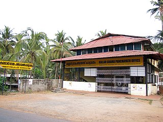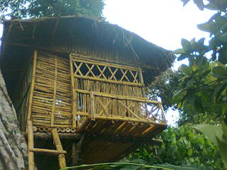
Edanad, Kasaragod

Last updated

Edanad
village
India Kerala location map.svg
Red pog.svg
Edanad
Location in Kerala, India
Coordinates: 12°36′11″N74°59′59″E / 12.6031°N 74.9998°E / 12.6031; 74.9998 Coordinates: 12°36′11″N74°59′59″E / 12.6031°N 74.9998°E / 12.6031; 74.9998
CountryFlag of India.svg  India
State Kerala
District Kasaragod
Taluk Manjeshwaram
Government
  BodyPuthige Grama Panchayat
Area
  Total6.85 km2 (2.64 sq mi)
Population
 (2011)
  Total2,922
  Density430/km2 (1,100/sq mi)
Languages
  Official Malayalam, English [1]
Time zone UTC+5:30 (IST)
PIN
671321
Vehicle registration KL-14

Edanad is a village in Manjeshwaram Taluk of Kasaragod district in Kerala, India. [2] [3]

Contents

Demographics

As of 2011 India census, Edanad village had population of 2,922 which constitutes 1,441 males and 1,481 females. The male female sex ratio was 1027 lower than state average of 1084. Edanad village has an area of 6.85 km2 with 610 families residing in it. Population in the age group 0-6 was 318 (10.9%) where 155 are males and 163 are females. Edanad had overall literacy of 89.6% lower than state average of 94%. Male literacy stands at 94.2% and Female literacy was 85.1%. [4]

Administration

Edanad village is part of Puthige Grama Panchayat. The village politically belongs to Manjeshwar (State Assembly constituency) which is part of Kasaragod (Lok Sabha constituency).[ citation needed ]

Related Research Articles

Kasaragod Municipal city in Kerala, India

Kasaragod ([kɑːsɑrɡoːɖɨ̆] formerly known in English as Kassergode, and Malayalam as Kanhirakode, is a municipal town and administrative headquarters of Kasaragod district of Kerala state in India. Established in the year 1966, Kasaragod was the first municipal town in Kasaragod district. It is the northernmost district of Kerala and is also known as Saptha Bhasha Sangama Bhoomi.

Manjeshwar Town in Kerala, India

Manjeshwar is a town and a minor port in Kasaragod district at the northern tip of Kerala. It is situated at a distance of 584 kilometres (360 mi) from the state capital Thiruvanathapuram, 28 kilometres (20 mi) north of district HQ Kasaragod and 30 kilometres (20 mi) south of Mangalore city in neighbouring Karnataka. It is a coastal town in Kasaragod district.

Bangramanjeshwar village in Kerala, India

Bangramanjeshwar (Bangramanjeshwaram) is a census town in Kasaragod district in the state of Kerala, India.

Neerchal, Kasaragod Village in Kerala, India

Neerchal is a village in Kasaragod district of Kerala state, India. Neerchal is located 12 kilometers from Kasaragod.

Badiyadka Town in Kerala, India

Badiyadka officially known as "Badiadka" is a town and gram panchayat in the Kasaragod district, state of Kerala, India.

Bayar, Kasaragod Village in Kerala, India

Bayar is a village in Kasaragod district in the state of Kerala, India. Bayar is 12 km far from the Uppala town.

Kunjathur census town in Kerala, India

Kunjathur is a village in Kasaragod district in the state of Kerala, India. It is 22 km (14 mi) south of Mangalore.
Nekraje Village in Kerala, India

Nekraje is a village in Kasaragod district in the state of Kerala, India.

Vorkady Gram Panchayat in Kerala, India

Vorkady is a Gram Panchayat in Kasaragod district in the state of Kerala, India.

Angadimogaru village in Kerala, India

Angadimogar is a village in Kasaragod district in the state of Kerala, India, that is located 17.5 km from the city of Kasaragod. It is rich in arecanut and coconut trees.

Chippar village in Kerala, India

Chippar is a village in Kasaragod district in the state of Kerala, India.

Ichilangod village in Kerala, India

Ichilangod is a village in Kasaragod district in the state of Kerala, India.

Kadambar village in Kerala, India

Kadambar is a village in Kasaragod district in the state of Kerala, India.

Meenja Village in Kerala, India

Meenja is a grama Panchayat in Manjeshwaram Taluk of Kasaragod district in the state of Kerala, India. It consists of 7 revenue villages. Kaliyoor, Koliyoor, Talakala, Meenja, Kadambar, Moodambail and Kuloor.

Mulinja village in Kerala, India

Mulinja is a village near Uppala, Kasaragod district, Kerala, India. It is a locality considered under Uppala town.

Kasaragod is a taluk which along with Hosdurg taluk, Manjeshwaram Taluk and Vellarikundu taluk constitute the Kasaragod district, Kerala, India. Its educational center is Vidyanagar. The major areas include Kasaragod municipality, Chemnad, Bedira, and Chengala. The Central Plantation Crops Research Institute is located in the taluk.

Perla, Kasaragod Town in Kerala, India

Perla is an administrative capital of Enmakaje Panchayat, which is in Kasaragod district, Kerala, India.

Hosabettu, Kasaragod Village in Kerala, India

Hosabettu is a census town in Manjeshwar Grama Panchayat of Kasaragod district in Kerala state, India.

Padre, Kasaragod Village in Kerala, India

Padre is a village in Manjeshwaram Taluk of Kasaragod district in Kerala, India.

Mugu, Kasaragod Village in Kerala, India

Mugu is a village in Manjeshwaram Taluk of Kasaragod district in Kerala, India.

References

  1. "The Kerala Official Language (Legislation) Act, 1969" (PDF).
  2. https://kasargod.nic.in  › document District Census Handbook | Website of Kasargod | India
  3. https://censusindia.gov.in  › 3...PDF Kasaragod - DISTRICT CENSUS HANDBOOK (ref page no:80,81)
  4. https://censusindia.gov.in  › 3...PDF Kasaragod - DISTRICT CENSUS HANDBOOK (ref page no:80,81)