Edgeworth Manor

Last updated

Edgeworth Manor
Edgeworth Manor - geograph.org.uk - 794585.jpg
Edgeworth Manor
Location Edgeworth, Gloucestershire, England
Coordinates 51°45′07.2″N02°04′31.08″W / 51.752000°N 2.0753000°W / 51.752000; -2.0753000
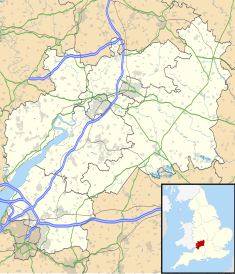
Gloucestershire UK location map.svg
Red pog.svg
Location in Gloucestershire

Edgeworth Manor is a Grade II* listed country house in Edgeworth, Gloucestershire, England. [1] It was mentioned in the Domesday Book, when it was held by Roger de Lacy. [2] Herman de Dreux, a Domesday baron, held Edgeworth manor by 1137 and was the first to use the de Edgeworth surname. [3] The manor passed to William fitz Herman by 1157 and was held by the male descendants of Herman, in some part, until at least 1379 when the manor was sold by Christine Stevenes, niece of Stephen de Edgeworth, to Thomas Raleigh. [4] The current house is mainly dated to 1685, when the previous Tudor house was replaced for Nathaniel Ridler. It underwent significant changes to south under Capel N. Tripp in 1882 and Sir Ernest George in 1899. [5]
Related Research Articles

<span class="mw-page-title-main">Tyburn</span> Former manor in Middlesex, England

Tyburn was a manor (estate) in the county of Middlesex, England, one of two which were served by the parish of Marylebone. Tyburn took its name from the Tyburn Brook, a tributary of the River Westbourne. The name Tyburn, from Teo Bourne, means 'boundary stream'.

<span class="mw-page-title-main">Domesday Book</span> 11th-century survey of landholding in England

Domesday Book is a manuscript record of the Great Survey of much of England and parts of Wales completed in 1086 at the behest of King William the Conqueror. The manuscript was originally known by the Latin name Liber de Wintonia, meaning "Book of Winchester", where it was originally kept in the royal treasury. The Anglo-Saxon Chronicle states that in 1085 the king sent his agents to survey every shire in England, to list his holdings and dues owed to him.

<span class="mw-page-title-main">Portslade Manor</span> Former manor house in East Sussex, UK

Portslade Old Manor is one of the very few examples of Norman manor houses that still exist in England. It has been deemed a Scheduled Ancient Monument, and a Grade II* listed building.

<span class="mw-page-title-main">Whitminster</span> Human settlement in England

Whitminster is a village and civil parish in Gloucestershire, England, on the A38 trunk road approximately 6 miles (10 km) south of Gloucester and 6 miles (10 km) north-west of Stroud. The parish population at the 2011 census was 881. The hamlet of Wheatenhurst is signposted from the A38 at Whitminster. Whitminster is close to Junction 13 of the M5 motorway, with Bristol, South Wales and the south Midlands all within an hour's drive.

<span class="mw-page-title-main">Modbury</span> Village in Devon, England

Modbury is a large village, ecclesiastical parish, civil parish and former manor situated in the South Hams district of the county of Devon in England. Today due to its large size it is generally referred to as a "town" although the parish council has not elected to give itself the status of a town as it could do under s.245(6) of the Local Government Act 1972, so it does not have a town council and cannot have a town mayor. It is also known informally as a "market town", as from at least 1199 the lord of the manor has held the right to hold a regular market. The village is situated on the A379 road, which links it to Plymouth and Kingsbridge. The current parish population is approximately 1,500.

<span class="mw-page-title-main">Aldringham</span> Human settlement in England

Aldringham is a village in the Blything Hundred of Suffolk, England. The village is located 1 mile south of Leiston and 3 miles northwest of Aldeburgh close to the North Sea coast. The parish includes the coastal village of Thorpeness. The mid-2005 population estimate for Aldringham cum Thorpe parish was 730.

<span class="mw-page-title-main">Beckett Hall</span>

Beckett Hall is a country house at Shrivenham in the English county of Oxfordshire. The present house dates from 1831.

<span class="mw-page-title-main">Kingscote, Gloucestershire</span> Human settlement in England

Kingscote is a village and civil parish in the Cotswold district of Gloucestershire, England, set on the uplands near the south western edge of the Cotswold hills. It is situated about two miles (3 km) east of Uley, five miles (8 km) east of Dursley and four miles (6 km) west of Tetbury. The landscape is designated an Area of Outstanding Natural Beauty. The hamlet of Newington Bagpath lies to the west of the village; the parish lands extend near to the small village of Owlpen.

<span class="mw-page-title-main">Norbury Park</span> Park and mansion in Surrey, England

Norbury Park is an area of mixed wooded and agricultural land surrounding a privately owned its Georgian manor house near Leatherhead and Dorking, Surrey. On the west bank of the River Mole, it is close to the village of Mickleham.

<span class="mw-page-title-main">Linkinhorne</span> Civil parish and village in south-east Cornwall, England

Linkinhorne is a civil parish and village in southeast Cornwall, England, United Kingdom. The village itself is situated at grid reference SX 320 736 and is approximately four miles (6.5 km) northwest of Callington and seven miles (11 km) south of Launceston. The parish population at the 2011 census including Downgate was 1,541

<span class="mw-page-title-main">Knowstone</span> Village in Devon, England

Knowstone is a village and civil parish situated in the North Devon district of Devon, England, halfway between the Mid Devon town of Tiverton, Devon and the North Devon town of South Molton. The hamlet of East Knowstone lies due east of the village. Knowstone was the birthplace of Admiral Sir John Berry (1635–1691), second son of Rev. Daniel Berry (1609–1654), vicar of Knowstone cum Molland. An elaborate mural monument erected by Sir John in 1684 to the memory of his parents survives in Molland Church.

<span class="mw-page-title-main">Swimbridge</span> Village in Devon, England

Swimbridge is a village, parish and former manor in Devon, England. It is situated 4 miles (6.4 km) south-east of Barnstaple and twinned with the town of St.Honorine Du Fay in Normandy, France. It was the home of the Rev. John "Jack" Russell who first bred the Jack Russell Terrier.

<span class="mw-page-title-main">Enfield Old Park</span>

Enfield Old Park was an ancient deer park located in Enfield. It is mentioned in the Domesday Book. The Domesday Book mentions only one other Park in Middlesex, at Ruislip, and according to Historic England both are therefore considered to be "rare and important historical sites". Today part of Old Park is built over as part of the suburb of Grange Park, but large areas also remain open and undeveloped.

Cyneweard of Laughern or simply Cyneweard was a mid-11th century Anglo-Saxon thegn and sheriff in Worcestershire, England. Probably the son of Æthelric Kiu and grand-nephew of Wulfstan Lupus, Archbishop of York (1003–1023), he was one of the leading nobles of the county at the Norman Conquest of England. On the death of Edward the Confessor he held lands in Gloucestershire and Warwickshire as well as Worcestershire.

Edward of Salisbury was a nobleman and courtier (curialis), probably part Anglo-Saxon, who served as High Sheriff of Wiltshire during the reigns of William I, William II and Henry I.

Ruislip Priory was a priory in Middlesex, England. In 1086 or 1087 the manor of Ruislip was given to Bec Abbey by Ernulf de Hesdin. An administrative centre, it had a priory before 1200. In the early 13th century the administration of Bec's manors was shared with Ogbourne Priory in Wiltshire. As one of the alien priories, Ruislip shared their varying fortunes. Ruislip was always a manor-house rather than having conventual buildings. After 1404 the manors were reallocated, Ruislip going to St Nicolas College, Cambridge. St Nicolas College was later renamed King's College.

<span class="mw-page-title-main">St Martin's Church, Ruislip</span> Church in United Kingdom

St Martin's Church is a church in the west London town of Ruislip, within the London Borough of Hillingdon. It has been designated since January 1950 by English Heritage as a Grade I listed building. The present chancel and nave date back to the 13th century. The church stands at the northern end of Ruislip High Street, near the Manor Farm site.

<span class="mw-page-title-main">Morton Manor</span>

Morton Manor is a manor house originating in the 13th century, in Brading, Isle of Wight, England. It is located 1 mile (1.6 km) southwest of Sandown Road. The fairly small 14th-century house was modified in the 19th century. Constructed of varied materials, it was refurbished and extended in the early 20th century in an Arts and Crafts style. The house has a Tudor fireplace in the dining room, with William De Morgan green glazed tiles, and the manor includes a small museum of rural life.

<span class="mw-page-title-main">Huish, Torridge</span> Village in Devon, England

Huish is a small village, civil parish and former manor in the Torridge district of Devon, England. The eastern boundary of the parish is formed by the River Torridge and the western by the Rivers Mere and Little Mere, and it is surrounded, clockwise from the north, by the parishes of Merton, Dolton, Meeth and Petrockstowe. In 2001 the population of the parish was 49, down from 76 in 1901.

Burreth is a now-deserted village in Lincolnshire.

References

  1. "Edgeworth Manor". National Heritage List for England. Historic England. Retrieved 29 March 2020.
  2. A P Baggs; A R J Jurica & W J Sheils (1976). N M Herbert & R B Pugh (eds.). "'Edgeworth: Manor and other estates' in A History of the County of Gloucester: Volume 11,". London: Bisley and Longtree Hundreds. Retrieved 25 May 2015.
  3. Edgeworth, Daniel (2018). Domesday DNA. USA: Domesday DNA. pp. 14–22. ISBN   978-1-538-08821-0.
  4. Edgeworth, Daniel (2018). Domesday DNA. USA: Domesday DNA. pp. 49–56. ISBN   978-1-538-08821-0.
  5. "Edgeworth Manor, Edgeworth". British Listed Buildings. Retrieved 25 May 2015.

51°45′07″N2°04′31″W / 51.7520°N 2.0753°W / 51.7520; -2.0753