
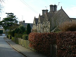
Chedworth is a village and civil parish in Gloucestershire, southwest England, in the Cotswolds. It is known as the location of Chedworth Roman Villa, administered since 1924 by the National Trust.

Sir Geoffrey Robert Clifton-Brown is a British Conservative Party politician who has served as a Member of Parliament (MP) since 1992. He has represented North Cotswolds since 2024, having previously represented Cirencester and Tewkesbury, then The Cotswolds.
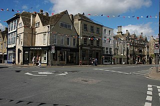
Tetbury is a town and civil parish inside the Cotswold district in Gloucestershire, England. It lies on the site of an ancient hill fort, on which an Anglo-Saxon monastery was founded, probably by Ine of Wessex, in 681. The population of the parish was 5,250 in the 2001 census, increasing to 5,472 at the 2011 census. The population further increased to 6,453 in the 2021 Census.
Cheltenham is a constituency in Gloucestershire represented in the House of Commons of the UK Parliament since 1832. As with all constituencies, it elects one Member of Parliament (MP) by the first past the post system of election at least every five years. Since 2024, its MP has been Max Wilkinson of the Liberal Democrats.

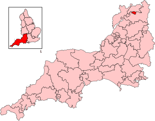
The Cotswolds was a constituency in Gloucestershire in the House of Commons of the UK Parliament. It was represented by Sir Geoffrey Clifton-Brown, a Conservative, since its 1997 creation.

Andoversford is a village and civil parish in the Cotswold District of Gloucestershire, England, about 5 miles (8 km) east of Cheltenham. The village is on the River Coln, parallel to the A40.The 2011 Census recorded the parish's population as 555. In 2019 the parish a population of 905.

Broadwell is a village and civil parish in the English county of Gloucestershire. It is about 1.5 miles (2.4 km) north of Stow-on-the-Wold, In the 2001 United Kingdom census, the parish had a population of 384. decreasing to 355 at the 2011 census.

Coln St Aldwyns is a village and civil parish in the Cotswold district of the English county of Gloucestershire.

Great Barrington is a village and former civil parish, now in the parish of Barrington, in the Cotswold district of Gloucestershire, England. It lies in the north bank of the River Windrush, 3 miles (4.8 km) west of the town of Burford, Oxfordshire. In 1931 the parish had a population of 330.
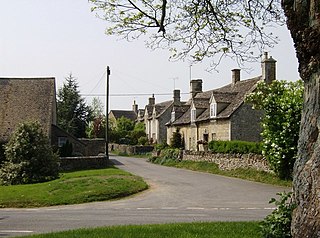
Hatherop is a village and civil parish in the Cotswolds Area of Outstanding Natural Beauty, about 2.5 miles (4.0 km) north of Fairford in Gloucestershire, England. The River Coln forms part of the western boundary of the parish.
Cold Aston is a village and civil parish in Gloucestershire, England, approximately 18 miles (29 km) to the east of Gloucester. It lies in the Cotswolds, an Area of Outstanding Natural Beauty. In the 2011 census, the population was 255.
Ozleworth is a village and civil parish in Gloucestershire, England, approximately 30 km (19 mi) south of Gloucester. It lies in the Cotswolds, an Area of Outstanding Natural Beauty.

Duntisbourne Rouse is a village and civil parish in Gloucestershire, England. It lies in the Cotswolds, an Area of Outstanding Natural Beauty. At the 2001 census, it had a population of 70.

Notgrove is a village and civil parish in Gloucestershire, England, approximately 28.5 to the east of Gloucester. It lies in the Cotswolds, a previously-named Area of Outstanding Natural Beauty, now the Cotswolds National Landscape.

Turkdean is a village and civil parish in Gloucestershire, England, approximately 30 km (19 mi) to the east of Gloucester. It lies in the Cotswolds, an Area of Outstanding Natural Beauty.

Maugersbury is a village and civil parish in Gloucestershire, England. Situated less than a mile south-east of the market town of Stow-on-the-Wold and approximately 18 miles (29 km) east of its post town, Cheltenham, Maugersbury lies within the Cotswolds, an Area of Outstanding Natural Beauty. At the 2001 United Kingdom census, the parish had a population of 149.

Poulton is a village and civil parish in the English county of Gloucestershire, approximately 24 miles (39 km) to the south-east of Gloucester. It lies in the south of the Cotswolds, an Area of Outstanding Natural Beauty. In the 2001 United Kingdom census, the parish had a population of 398, increasing to 408 at the 2011 census.

Elkstone is a village and civil parish in the English county of Gloucestershire. In the 2001 United Kingdom census, the parish had a population of 203, increasing to 248 at the 2011 census.

Windrush is a village and civil parish in Gloucestershire, England, approximately five miles southeast of Northleach. It lies in the Cotswolds on the River Windrush, from which it derives its name. The village name is first attested in the Domesday Book of 1086, where it appears as Wenric.

Syde, often in the past spelt Side, is a small village and civil parish in Gloucestershire, England. It lies in the Cotswolds, near the source of the River Frome, some six miles north west of Cirencester and seven miles east of Painswick.

