Edwards Island (Western Australia)

Last updated

Australia Western Australia location map.svg
Cercle rouge 100%25.svg
Edwards Island
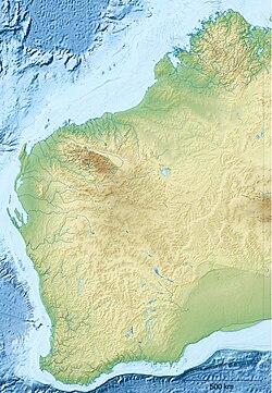
Location of Edwards Island in the Indian Ocean

Edwards Island, also known as Edward Island, is an island in Western Australia near Lancelin.

Western Australia State in Australia

Western Australia is a state occupying the entire western third of Australia. It is bounded by the Indian Ocean to the north and west, and the Southern Ocean to the south, the Northern Territory to the north-east, and South Australia to the south-east. Western Australia is Australia's largest state, with a total land area of 2,529,875 square kilometres, and the second-largest country subdivision in the world, surpassed only by Russia's Sakha Republic. The state has about 2.6 million inhabitants – around 11 percent of the national total – of whom the vast majority live in the south-west corner, 79 per cent of the population living in the Perth area, leaving the remainder of the state sparsely populated.

Lancelin, Western Australia Town in Western Australia

Lancelin is a small fishing and tourist town 127 km north of Perth, Western Australia. It is within the Shire of Gingin at the end of Wanneroo Road, and a few kilometres from the start of the Indian Ocean Drive.

The island occupies an area of 0.454 hectares (1 acre) with a maximum elevation of 5 metres (16 ft) and is situated approximately 100 metres (328 ft) off the coast. [1] It is composed of limestone and is linked to Lancelin Island by intertidal and subtidal reef platforms. Both islands are gazetted as A Class nature reserves. [2]

Limestone Sedimentary rocks made of calcium carbonate

Limestone is a carbonate sedimentary rock that is often composed of the skeletal fragments of marine organisms such as coral, foraminifera, and molluscs. Its major materials are the minerals calcite and aragonite, which are different crystal forms of calcium carbonate (CaCO3). A closely related rock is dolomite, which contains a high percentage of the mineral dolomite, CaMg(CO3)2. In old USGS publications, dolomite was referred to as magnesian limestone, a term now reserved for magnesium-deficient dolomites or magnesium-rich limestones.

Lancelin Island island in Western Australia, Australia

Lancelin Island is an island in Western Australia near Lancelin.

Reef A bar of rock, sand, coral or similar material, lying beneath the surface of water

A reef is a bar of rock, sand, coral or similar material, lying beneath the surface of water. Many reefs result from natural, abiotic processes—deposition of sand, wave erosion planing down rock outcrops, etc.—but the best known reefs are the coral reefs of tropical waters developed through biotic processes dominated by corals and coralline algae.

Along with Lancelin Island it is at the southern end of the Turquoise Coast islands nature reserve group, a chain of 40 islands spread over a distance of 150 kilometres (93 mi). [1]

Turquoise Coast (Western Australia)

Turquoise Coast is a name attributed to a section of the coastline of Western Australia in the vicinity of Jurien Bay.

The first European to discover the island was the French explorer Hamelin in 1801 aboard the Naturalist, who named Lancelin Island. [3]

Jacques Félix Emmanuel Hamelin French Navy officer

Baron Jacques Félix Emmanuel Hamelin was a rear admiral of the French navy and later a Baron. He commanded numerous naval expeditions and battles with the British Navy as well as exploratory voyages in the Indian Ocean and the South Seas.

See also

Related Research Articles

Cocoparra National Park Protected area in New South Wales, Australia

The Cocoparra National Park is a protected national park that is located in the Riverina region of New South Wales, in eastern Australia. The 8,357-hectare (20,650-acre) national park is situated 457 kilometres (284 mi) southwest of Sydney and 25 kilometres (16 mi) northeast of Griffith.

Carnac Island island in Australia

Carnac Island is a 19-hectare (47-acre), A Class, island nature reserve about 10 km (6.2 mi) south-west of Fremantle and 3.5 km (2.2 mi) north of Garden Island in Western Australia.

Breaksea Island (Western Australia) island on south coast of Western Australia

Breaksea Island in King George Sound in the Great Southern region of Western Australia is 12 kilometres (7 mi) south-east of Albany.

Wedge Island (Western Australia) locality in Western Australia

Wedge Island is a settlement located north of Lancelin and south of Cervantes on the Western Australian coast.

Guy Fawkes River river in Australia

Guy Fawkes River, a perennial stream that is part of the Clarence River catchment, is in the New England and Northern Tablelands districts of New South Wales, Australia.

Coastal regions of Western Australia

Western Australia has the longest coastline of any state or territory in Australia, at 10,194 km or 12,889 km. It is a significant portion of the coastline of Australia, which is 35,877 km.

Coffin Island island in Western Australia, Australia

Coffin Island is an island that is located in the Great Southern region of Western Australia. The island is 300 metres (984 ft) offshore from Two Peoples Bay Nature Reserve and the island is also a protected area making up part of the reserve. With an area of 28 hectares the island is made up mostly of granite.

The Becher Point Wetlands site is a wetland nature reserve in Port Kennedy on the Swan Coastal Plain of south-western Western Australia. The 677-hectare (1,670-acre) coastal site lies in the City of Rockingham, about 50 kilometres (31 mi) south of the state capital, Perth, and is largely surrounded on the landward side by residential suburbs. It comprises about 200 very small wetlands among sand ridges between Becher Point the Perth-Mandurah Road.

Dolphin Island (Western Australia) island off the Western Australian coast

Dolphin Island is an island situated in the Dampier Archipelago in the Pilbara region of Western Australia. Visitors are able to camp within 100 metres (328 ft) of the high water mark on all of the beaches on the island except for the south eastern side.

Boondelbah Island Protected area in New South Wales, Australia

Boondelbah Island, also known as the Boondelbah Nature Reserve, is a protected nature reserve and uninhabited island lying 2 kilometres (1.2 mi) off the mouth of Port Stephens on the coast of New South Wales, Australia. The 14-hectare (35-acre) reserve and island is one of two breeding sites of the nominate subspecies of the threatened Gould's petrel and, with the nearby Cabbage Tree Island which hosts the principal colony, has been classified by BirdLife International as an Important Bird Area. Both Boondelbah and Cabbage Tree Islands are gazetted nature reserves under the National Parks and Wildlife Act, 1974 (NSW), so protecting the islands' habitat from land uses incompatible with nature conservation. Access is only permitted for scientific and conservation purposes.

Brush Island Protected area in New South Wales, Australia

The Brush Island is a continental island, contained within the Brush Island Nature Reserve, a protected nature reserve, known as Mit Island in the Dhurga language of the Murramamrang people of the Yuin nation see It is located off the south coast of New South Wales, Australia. The 47-hectare (120-acre) island and reserve is situated within the Tasman Sea, approximately 2 kilometres (1.2 mi) south-east of the coastal village of Bawley Point.

Beagle Islands (Western Australia)

The Beagle Islands are a small group of islands in Western Australia, found approximately 15 kilometres (9 mi) north west of Leeman.

Escape Island island in Western Australia, Australia

Escape Island is an island near Jurien Bay in Western Australia.

Whitlock Island

Whitlock Island is an island near Jurien Bay in Western Australia.

Favorite Island island in Western Australia, Australia

Favorite Island is an island in Western Australia.

Cervantes Islands

The Cervantes Islands are a small group of islands in Western Australia, found to the south west of Cervantes.

Cook Island Nature Reserve Protected area in Australia

Cook Island Nature Reserve is a protected area in the Australian state of new South Wales located on Cook Island about 600 metres (2,000 ft) off the coastline from the headland of Fingal Head and about 4 kilometres (2.5 mi) south-east of Tweed Heads on the state's north coast.

References

  1. 1 2 "Turquoise Coast islands nature reserves management plan" (PDF). Government of Western Australia. 2004. Retrieved 5 December 2015.
  2. "Final Plan of Management for the Lancelin Island Lagoon Fish Habitat Protection Area" (PDF). Fisheries Western Australia. 1 March 2001. Archived from the original (PDF) on 4 March 2016. Retrieved 6 December 2015.
  3. "History of Lancelin". Lancelin Community Resource Centre. Archived from the original on 8 December 2015. Retrieved 6 December 2015.

Coordinates: 31°01′48″S115°19′23″E / 31.03000°S 115.32306°E / -31.03000; 115.32306

Geographic coordinate system Coordinate system

A geographic coordinate system is a coordinate system that enables every location on Earth to be specified by a set of numbers, letters or symbols. The coordinates are often chosen such that one of the numbers represents a vertical position and two or three of the numbers represent a horizontal position; alternatively, a geographic position may be expressed in a combined three-dimensional Cartesian vector. A common choice of coordinates is latitude, longitude and elevation. To specify a location on a plane requires a map projection.