
Myanmar, officially the Republic of the Union of Myanmar and also known as Burma, is a country in Southeast Asia. It is the largest country by area in Mainland Southeast Asia and has a population of about 55 million. It is bordered by India to its west, Bangladesh to its southwest, China to its northeast, Laos and Thailand to its east and southeast, and the Andaman Sea and the Bay of Bengal to its south and southwest. The country's capital city is Naypyidaw, and its largest city is Yangon.

The economy of Myanmar is the seventh largest in Southeast Asia. After the return of civilian rule in 2011, the new government launched large-scale reforms, focused initially on the political system to restore peace and achieve national unity and moving quickly to an economic and social reform program. Current economic statistics were a huge decline from the economic statistics of Myanmar in the fiscal year of 2020, in which Myanmar’s nominal GDP was $81.26 billion and its purchasing power adjusted GDP was $279.14 billion. Myanmar has faced an economic crisis since the 2021 coup d'état.

On 26 December 2004, at 07:58:53 local time (UTC+7), a major earthquake with a magnitude of 9.2–9.3 struck with an epicentre off the west coast of northern Sumatra, Indonesia. The undersea megathrust earthquake, known by the scientific community as the Sumatra–Andaman earthquake, was caused by a rupture along the fault between the Burma Plate and the Indian Plate, and reached a Mercalli intensity up to IX in some areas.
The 2004 Indian Ocean earthquake and tsunami occurred on Sunday, December 26, 2004. The earthquake itself, with a moment magnitude of around 9.1-9.3, devastated Aceh Province, Indonesia, while the tsunami affected countries all around the Indian Ocean. Nations which were affected are listed below in alphabetical order. For detailed information about each country affected by the earthquake and tsunami, see their individual articles. Countries with a smaller number of casualties, as well as those that lost citizens who were travelling abroad, are listed further on in the article.

Indonesia was the first country to be seriously affected by the earthquake and tsunami created by the 2004 Indian Ocean earthquake on 26 December 2004, swamping the northern and western coastal areas of Sumatra, and the smaller outlying islands off Sumatra. Nearly all the casualties and damage took place within the province of Aceh. The time of arrival of the tsunami was between 15 and 30 minutes after the deadly earthquake. According to the country's National Disaster Relief Coordination Agency, around 130,000 people were dead and 37,063 were missing. In addition, the UN estimated that 655,000 people were homeless and sheltering in scattered refugee camps across the province.

Sri Lanka was one of the countries struck by the tsunami resulting from the Indian Ocean earthquake on December 26, 2004. On January 3, 2005, Sri Lankan authorities reported 30,000+ confirmed deaths.
Thailand was one of the 14 countries affected by the 2004 Indian Ocean earthquake and tsunami on 26 December 2004. It left behind unprecedented damage and destruction in six provinces of Thailand, impacting 407 villages, completely destroying 47 of them, including prominent tourist resorts like Khao Lak. The disaster killed about 5,400 people in Thailand, including foreign tourists.

Human rights in Myanmar under its military regime have long been regarded as among the worst in the world. In 2022, Freedom House rated Myanmar’s human rights at 9 out 100.

The 8888 Uprising, also known as the People Power Uprising and the 1988 Uprising, was a series of nationwide protests, marches, and riots in Burma that peaked in August 1988. Key events occurred on 8 August 1988 and therefore it is commonly known as the "8888 Uprising". The protests began as a student movement and were organised largely by university students at the Rangoon Arts and Sciences University and the Rangoon Institute of Technology.
The North Korean famine, also known as the Arduous March, was a period of mass starvation together with a general economic crisis from 1994 to 1998 in North Korea. During this time there was an increase in defection from North Korea which peaked towards the end of the famine period.

Library damage resulting from the 2004 Indian Ocean earthquake has been reported in six Asian countries. On December 26, the massive 2004 Indian Ocean earthquake struck off the northwest coast of the Indonesian island of Sumatra. The resulting tsunamis killed more than 180,000 people. In addition to the loss of human lives, cultural institutions were destroyed in several Asian nations. Libraries on the Eastern coast of Sri Lanka and the northern province of Aceh on Sumatra were most severely affected by the disaster.
The print, broadcast and online mass media in Burma has undergone strict censorship and regulation since the 1962 Burmese coup d'état. The constitution provides for freedom of speech and the press; however, the government prohibits the exercise of these rights in practice. Reporters Without Borders ranked Burma 174th out of 178 in its 2010 Press Freedom Index, ahead of just Iran, Turkmenistan, North Korea, and Eritrea. In 2015, Burma moved up to 144th place, ahead of many of its ASEAN neighbours such as Singapore, as a result of political changes in the country.

Extremely Severe Cyclonic Storm Nargis was an extremely destructive and deadly tropical cyclone that caused the worst natural disaster in the recorded history of Myanmar during early May 2008. The cyclone made landfall in Myanmar on Friday, 2 May 2008, sending a storm surge 40 kilometres up the densely populated Irrawaddy delta, causing catastrophic destruction and at least 138,373 fatalities. The Labutta Township alone was reported to have 80,000 dead, with about 10,000 more deaths in Bogale. There were around 55,000 people missing and many other deaths were found in other towns and areas, although the Myanmar government's official death toll may have been under-reported, and there have been allegations that government officials stopped updating the death toll after 138,000 to minimise political fallout. The feared 'second wave' of fatalities from disease and lack of relief efforts never materialised. Damage was at $12 billion, making Nargis the costliest tropical cyclone on record in the North Indian Ocean at the time, before that record was broken by Cyclone Amphan in 2020.
The 2009 Samoa earthquake and tsunami took place on 29 September 2009 in the southern Pacific Ocean adjacent to the Kermadec-Tonga subduction zone. The submarine earthquake occurred in an extensional environment and had a moment magnitude of 8.1 and a maximum Mercalli intensity of VI (Strong). It was the largest earthquake of 2009. The earthquake initiated with a normal-faulting event with a magnitude of 8.1. Within two minutes of the earthquake rupture, two large magnitude 7.8 earthquakes occurred on the subduction zone interface. The two magnitude 7.8 earthquakes had a combined magnitude equivalent to 8.0. The event can be considered a doublet earthquake.

Severe Tropical Storm Linda, also known as Typhoon Linda, Cyclonic Storm Linda , or in the Philippines as Tropical Depression Openg, was the worst typhoon in southern Vietnam in at least 100 years, killing thousands of people and leaving extensive damage. It formed on October 31, 1997, in the South China Sea, between Indochina and the Philippines. Strengthening as it moved westward, Linda struck extreme southern Vietnam on November 2 with winds of 65 mph (105 km/h), dropping heavy rainfall. Once in the Gulf of Thailand it strengthened further to minimal typhoon status, but weakened to tropical storm strength before crossing the Malay Peninsula into the Bay of Bengal, the first storm to do so in five years. It restrengthened in the Indian Ocean to typhoon status, but increasing wind shear and weakened steering currents caused Linda to dissipate on November 9.

The 2010 Mentawai earthquake occurred with a moment magnitude of 7.8 on 25 October off the western coast of Sumatra at 21:42 local time. The earthquake occurred on the same fault that produced the 2004 Indian Ocean earthquake. It was widely felt across the provinces of Bengkulu and West Sumatra and resulted in a substantial localized tsunami that struck the Mentawai Islands.
A series of flash floods hit different areas of Thailand and Malaysia in 2010. Separate but related floods began in the Northeast and Central Thailand in early October due to abnormally late monsoon moisture over the Bay of Bengal, overflowed the Chao Phraya where the rivers meet, and affected Bangkok, and in the South were triggered by a tropical depression about two weeks later, and was later aggravated by related La Niña monsoon rains. Floods subsequently occurred in the Malaysian states of Kedah and Perlis in November 2010.
At least 29 tropical cyclones have affected Myanmar, a country adjacent to the Bay of Bengal in mainland Southeast Asia. Myanmar has witnessed some of the deadliest storms in the Bay of Bengal, including Cyclone Nargis in May 2008, which struck the low-lying Irrawaddy Delta near Yangon. Its winds and storm surge killed an estimated 140,000 people and left nearly $10 billion in damage. The country's worst natural disaster in the 20th century was a cyclone in 1968, which killed more than 1,000 people when it hit Rakhine State in northwestern Myanmar. One of the most powerful storms to ever hit the country was Cyclone Mocha, which it moved ashore northwestern Myanmar in May 2023, killing at least 413 people.
On October 14–16, 1949, a series of violent and devastating floods killed an estimated 1,000 to 40,000 people in Central America, principally Guatemala. Estimates of the death toll ranged from 1,000 to 40,000, with reliable estimates suggesting 4,000 fatalities, placing the floods as some of the deadliest in recorded history. Estimated monetary losses ranged from $15,000,000 to $40,000,000.
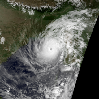
The 1994 Bangladesh cyclone was a powerful tropical cyclone in the Bay of Bengal. The cyclone closely followed the path, strength, and time of year of a deadly cyclone in 1991 that killed more than 138,000 people. The 1994 cyclone formed on April 29 as a depression, which organized and intensified significantly over the subsequent few days. On May 2, the cyclone attained winds of 215 km/h (135 mph), according to the India Meteorological Department (IMD). That day, the storm made landfall in southeastern Bangladesh, and rapidly weakened over land, before dissipating on May 3.
