
Egerton Gardens is a street and communal garden, regionally termed a garden square, in South Kensington, London SW3.

Egerton Gardens is a street and communal garden, regionally termed a garden square, in South Kensington, London SW3.
The street runs roughly south-west to north-east, off Brompton Road. Egerton Crescent, runs roughly off it, and Egerton Terrace crosses it. Historially for more than 800 years the area formed part of Brompton, parochially in the Church of England this is recognised by the name of its parish Holy Trinity Brompton . [1]
Much was built by Alexander Thorn, and the architect for most was probably Maurice Charles Hulbert. [2]
Notable houses include Mortimer House. [2]
The Franklin Hotel at 22-28 Egerton Gardens was created by combining four houses.
No 31 was designed by Thomas Henry Smith for Lieutenant-Colonel William Wetherly, but is now flats. [2]

The Royal Borough of Kensington and Chelsea is an Inner London borough with royal status. It is the smallest borough in London and the second smallest district in England; it is one of the most densely populated administrative regions in the United Kingdom. It includes affluent areas such as Notting Hill, Kensington, South Kensington, Chelsea, and Knightsbridge.
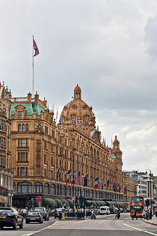
Knightsbridge is a residential and retail district in central London, south of Hyde Park. It is identified in the London Plan as one of two international retail centres in London, alongside the West End. Knightsbridge is also the name of the roadway which runs near the south side of Hyde Park from Hyde Park Corner.
Earl's Court is a district of Kensington in the Royal Borough of Kensington and Chelsea in West London, bordering the rail tracks of the West London line and District line that separate it from the ancient borough of Fulham to the west, the sub-districts of South Kensington to the east, Chelsea to the south and Kensington to the northeast. It lent its name to the now defunct eponymous pleasure grounds opened in 1887 followed by the pre–World War II Earls Court Exhibition Centre, as one of the country's largest indoor arenas and a popular concert venue, until its closure in 2014.

The Metropolitan Borough of Chelsea was a metropolitan borough of the County of London between 1900 and 1965. It was created by the London Government Act 1899 from most of the ancient parish of Chelsea. Following the London Government Act 1963, it was amalgamated with the Royal Borough of Kensington in 1965 to form the Royal Borough of Kensington and Chelsea.
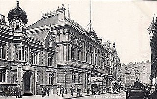
The Metropolitan Borough of Kensington was a metropolitan borough in the County of London from 1900 to 1965, which since 1901 was known as the Royal Borough of Kensington, following the death of Queen Victoria, in accordance with her wishes.

South Kensington is a district just west of Central London in the Royal Borough of Kensington and Chelsea. Historically it settled on part of the scattered Middlesex village of Brompton. Its name was supplanted with the advent of the railways in the late 19th century and the opening and naming of local tube stations. The area has many museums and cultural landmarks with a high number of visitors, such as the Natural History Museum, the Science Museum and the Victoria and Albert Museum. Adjacent affluent centres such as Knightsbridge, Chelsea and Kensington, have been considered as some of the most exclusive real estate in the world.
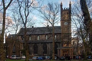
Holy Trinity Brompton with St Paul's, Onslow Square and St Augustine's, South Kensington, often referred to simply as HTB, is an Anglican church in London, England.

Brompton Road is a street located in the southern part from Knightsbridge and in the eastern part from Brompton in the Royal Borough of Kensington and Chelsea and partly the City of Westminster in London.

West Kensington, formerly North End, is an area in the ancient parish of Fulham, in the London Borough of Hammersmith and Fulham, England, 3.4 miles (5.5 km) west of Charing Cross. It covers most of the London postal area of W14, including the area around Barons Court tube station, and is defined as the area between Lillie Road and Hammersmith Road to the west, Fulham Palace Road to the south, Hammersmith to the north and West Brompton and Earl's Court to the east. The area is bisected by the major London artery the A4, locally known as the Talgarth Road. Its main local thoroughfare is the North End Road.

Brompton, sometimes called Old Brompton, survives in name as a ward in the Royal Borough of Kensington and Chelsea in London. Until the latter half of the 19th century it was a scattered village made up mostly of market gardens in the county of Middlesex. It lay southeast of the village of Kensington, abutting the parish of St Margaret's, Westminster at the hamlet of Knightsbridge to the northeast, with Little Chelsea to the south. It was bisected by the Fulham Turnpike, the main road westward out of London to the ancient parish of Fulham and on to Putney and Surrey. It saw its first parish church, Holy Trinity Brompton, only in 1829. Today the village has been comprehensively eclipsed by segmentation due principally to railway development culminating in London Underground lines, and its imposition of station names, including Knightsbridge, South Kensington and Gloucester Road as the names of stops during accelerated urbanisation, but lacking any cogent reference to local history and usage or distinctions from neighbouring settlements.

West Brompton is an area of west London, England, that straddles the boundary between the London Borough of Hammersmith and Fulham and Royal Borough of Kensington and Chelsea. The centuries-old boundary traced by Counter's Creek, probably marked the eastern edge of Fulham Manor since Saxon times and is now partly lost beneath the West London Line railway.

The Boltons is a street and garden square of lens shape in the Brompton district of the Royal Borough of Kensington and Chelsea, London, England. The opposing sides of the street face the communal gardens with large expansive houses and gardens, in what is considered the second most expensive street in the country with an average house price of £23.1m. The elliptical central gardens of the Boltons are Grade II listed on the Register of Historic Parks and Gardens.
The Franklin London - Starhotels Collezione is a luxury 5-star hotel in London, England. It is located at 22-28 Egerton Gardens, Knightsbridge on the borders of Chelsea.
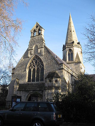
St Mary The Boltons is an Anglican church in The Boltons, Brompton, London. It is a Grade II listed building.

Onslow Square is a garden square in South Kensington, London, England.

St Augustine's, Queen's Gate, is a Grade II* listed Anglican church in Queen's Gate, Brompton, London, England. The church was built in 1865, and the architect was William Butterfield.
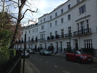
Egerton Crescent is a street in Kensington, London, that was described in 2013 as "the most expensive street in Britain".

Mortimer House is a large detached house on Egerton Gardens in the South Kensington district of London SW3. The house occupies a large corner plot on the corner of Egerton Gardens and the Brompton Road.

Lillie Bridge is a road bridge that links Old Brompton Road in the Royal Borough of Kensington and Chelsea with Lillie Road in the London Borough of Hammersmith & Fulham. It crosses two railways: the West London Line on the London Overground and the Wimbledon branch of the London Underground at West Brompton station.

Drayton Gardens is a residential street linking the areas of Chelsea and South Kensington, London SW10. It runs roughly north to south from Old Brompton Road to Fulham Road.