
Cook Strait separates the North and South Islands of New Zealand. The strait connects the Tasman Sea on the northwest with the South Pacific Ocean on the southeast, and runs next to the capital city, Wellington. It is 22 kilometres (14 mi) wide at its narrowest point, and is considered one of the most dangerous and unpredictable waters in the world. Regular ferry services run between Picton in the Marlborough Sounds and Wellington.

Øygarden is a municipality in Vestland county, Norway. It is an island municipality located in the traditional district of Midhordland, stretching along the west coast of the county. The village of Straume is the administrative centre of the municipality. Other villages in the municipality include Alveim, Blomvåg, Vikavågen, Ågotnes, Fjell, Foldnes, Knappskog, Knarrevik, Kolltveit, Landro, Sekkingstad, Skogsvåg, Klokkarvik, Tælavåg, Kausland, and Hammarsland.

Solund is a municipality in the county of Vestland, Norway. It is located in the traditional district of Sogn. Solund is the westernmost island municipality in Norway. Holmebåen on the island of Steinsøy is the westernmost point in all of Norway. Most residents of Solund live on the main islands of Sula and Ytre Sula. The administrative centre of Solund is the village of Hardbakke on Sula island. Some other villages in Solund include Kolgrov on Ytre Sula, Hersvikbygda on Sula, and Losnegard on Losna.
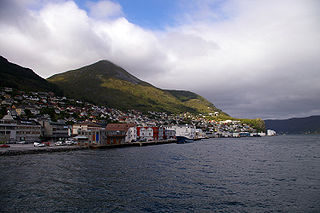
Vågsøy is a former municipality in Sogn og Fjordane county, Norway. It was located in the traditional district of Nordfjord. The municipality's administrative center was the town Måløy. Other population centers in Vågsøy included the villages of Bryggja, Deknepollen, Holvika, Kvalheim, Langeneset, Raudeberg, Refvika, Silda, Tennebø, Totland, Vedvika, and Vågsvåg. The municipality included the island of Vågsøy, several small surrounding islands, and part of the mainland.

Hitra is a municipality in Trøndelag county, Norway. The municipality covers the island of Hitra and hundreds smaller islands, islets, and skerries. It is part of the Fosen region. The administrative centre of the municipality is the village of Fillan. Other villages include Andersskogan, Ansnes, Forsnes, Hestvika, Knarrlagsund, Kvenvær, Melandsjøen, Nordbotn, Sandstad, and Ulvan.

Egersund is a town in Eigersund municipality in Rogaland county, Norway. The town is located along the southwestern coast of Norway, about 75 kilometres (47 mi) south of the city of Stavanger. The town is situated along a strait which separates the mainland from the island of Eigerøya. From 1838 until 1964, the town was also an independent municipality.

Hinnøya is the fourth largest island in Norway. The 2,204.7-square-kilometre (851.2 sq mi) lies just off the western coast of Northern Norway. The island sits on the border of Nordland and Troms og Finnmark counties. The western part of the island is in the district of Vesterålen, the southwestern part is in the Lofoten district, the southeastern part is in the Ofoten district, and the northeastern part is in Troms.
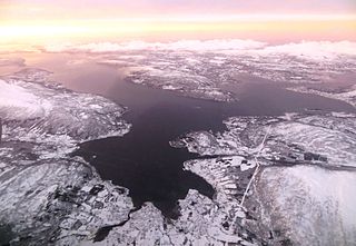
Senja (Norwegian) or Sážžá (Northern Sami) is an island in Troms og Finnmark county, Norway, Europe. With an area of 1,586.3 square kilometres (612.5 sq mi), it is the second largest island in Norway. It has a wild, mountainous outer (western) side facing the Atlantic, and a mild and lush inner (eastern) side. The island is located within Senja Municipality, which was established on 1 January 2020. The island of Senja had 7,864 inhabitants as of 1 January 2017. Most of the residents live along the eastern coast of the island, with Silsand being the largest urban area on the island. The fishing village of Gryllefjord on the west coast has a summer-only ferry connection to the nearby island of Andøya: the Andenes–Gryllefjord Ferry.
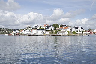
Lyngør is a village area on a group of small islands in the municipality of Tvedestrand in Agder county, off the southeast coast of Norway. The village is about 12 kilometres (7.5 mi) northeast of Tvedestrand and approximately 12 kilometres (7.5 mi) southwest of the town of Risør. The village is located on several islands located very close together and separated by small straits that are less than 100 metres (330 ft) wide. The village is located on the islands of Holmen, Odden, Lyngøya and Steinsøya. The Lyngør Lighthouse lies at the northeast edge of the village area.

Utvær is an island group in Solund Municipality in Vestland county, Norway. It is the westernmost archipelago in Norway. The main residential area on the rocky islands is also called Utvær. It lies on the western side of the Sognesjøen which is the mouth of the vast Sognefjorden. It is about 18 kilometres (11 mi) west of the municipal centre of Hardbakke. The entire archipelago is protected as the Utvær nature reserve.

Bremangerlandet is an island in Bremanger Municipality in the traditional district of Nordfjord in Vestland county, Norway. The 153-square-kilometre (59 sq mi) island is one of the largest islands in the county. The highest point on the island is the 889-metre (2,917 ft) tall mountain Svartevassegga, however the cliff at Hornelen, located 1 kilometre (0.62 mi) to the east, is more well-known and has an elevation of 860 metres (2,820 ft). The 4-kilometre (2.5 mi) long lake Dalevatnet is located in the central part of the island.

Yell Sound is the strait running between Yell and Mainland, Shetland, Scotland. It is the boundary between the Mainland and the North Isles and it contains many small islands. Sullom Voe, on the shores of which is a substantial oil terminal, is an arm of Yell Sound.

Svinøy Lighthouse is a fully automated lighthouse situated on the island of Svinøy in the sea off the Stad peninsula. It is located in the municipality of Herøy in Møre og Romsdal county, on the western coast of Norway. The island lies within sight of the mainland and it is 6 kilometres (3.7 mi) from the nearest island. The island of Skorpa is located about 11 kilometres (6.8 mi) to the east. The island is 300 metres (980 ft) east to west and 900 metres (3,000 ft) north to south. The island rises 35 metres (115 ft) out of the sea and is exposed to severe climatic conditions year round.

Vardøya is an island in Vardø Municipality in Troms og Finnmark county, Norway. The 3.7-square-kilometre (1.4 sq mi) island is the location of the town of Vardø. The island sits about 1.5 kilometres (0.93 mi) east of the mainland Varanger Peninsula. The island is connected to the mainland by the Vardø Tunnel, the first subsea tunnel that was built in Norway. The tunnel is part of the European route E75 highway, which has its terminus at the town of Vardø. The small island of Hornøya is 1.5 kilometres (0.93 mi) to the northeast of Vardøya.

Hemnskjela is an island in the municipality of Hitra in Trøndelag county, Norway. The 4.4-square-kilometre (1.7 sq mi) island is located in the Trondheimsleia strait at the mouth of the Hemnfjorden, just 2 kilometres (1.2 mi) south of the village of Sandstad on the nearby island of Hitra.

Vibberodden Lighthouse is a harbour lighthouse located in the municipality of Eigersund in Rogaland county, Norway. It was first lit in 1855, and automated in 1977. The lighthouse is located on the small island of Vibberodden, just southeast of the shore of the island of Eigerøya, marking the west side of the entrance to a narrow fjord leading to the town of Egersund. The lighthouse operates in coordination with Eigerøy Lighthouse and guides boats into the southern entrance to the Egersund harbour.
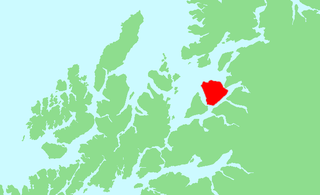
Andørja (Norwegian) or Áttir (Northern Sami) is an island in Ibestad Municipality in Troms og Finnmark county, Norway. The 135-square-kilometre (52 sq mi) island lies about 25 kilometres (16 mi) east of the town of Harstad. The island is located entirely within the present-day municipality of Ibestad, although the island itself was a separate municipality (Andørja) from 1926 until 1964. The largest population area on Andørja island is the Å - Ånstad - Laupstad area on the west coast with 205 residents (2001). Andørja Church is located in Engenes on the northwestern tip of the island.
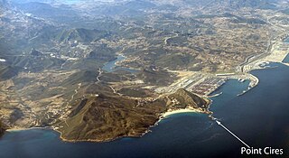
Point Cires is a promontory and two islands off the northern coast of Morocco within the Strait of Gibraltar. The islands have a lighthouse and they are about 100 metres (330 ft) from the mainland offering good anchorage. It is near the Mediterranean port of Tanger-Med within the Tanger-Tetouan-Al Hoceima region of northern Morocco.
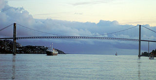
Nærøysundet is a strait in the municipalities of Nærøysund in Trøndelag county, Norway. The village of Rørvik, is located along the Nærøysundet, on the northwestern side. The 20-kilometre (12 mi) strait is crossed by the Nærøysund Bridge which connects the mainland and the island of Inner-Vikna. The shipping lane along the Norwegian coast passes through the strait, and the ship traffic is guided by the Nærøysund Lighthouse.

Nærøysund is a municipality in Trøndelag county, Norway. It is located in the traditional district of Namdalen. The municipality was established on 1 January 2020 after the merger of the old municipalities of Vikna and Nærøy. The municipality is unique in that it has two equal administrative centre: Kolvereid and Rørvik. The other main population centres of Nærøysund include Abelvær, Foldereid, Gravvik, Ottersøy, Salsbruket, Steine, Torstad, Austafjord, Garstad, and Valøya.


