Klice is a village in the administrative district of Gmina Regimin, within Ciechanów County, Masovian Voivodeship, in east-central Poland. It lies approximately 5 kilometres (3 mi) north-west of Regimin, 14 km (9 mi) north-west of Ciechanów, and 90 km (56 mi) north of Warsaw.
Dębogóra is a settlement in the administrative district of Gmina Wronki, within Szamotuły County, Greater Poland Voivodeship, in west-central Poland.
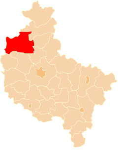
Głuchowiec is a settlement in the administrative district of Gmina Wronki, within Szamotuły County, Greater Poland Voivodeship, in west-central Poland.
Gogolice is a settlement in the administrative district of Gmina Wronki, within Szamotuły County, Greater Poland Voivodeship, in west-central Poland.
Józefowo is a former village in the administrative district of Gmina Wronki, within Szamotuły County, Greater Poland Voivodeship, in west-central Poland.
Krasnobrzeg is a settlement in the administrative district of Gmina Wronki, within Szamotuły County, Greater Poland Voivodeship, in west-central Poland.
Nadolnik is a settlement in the administrative district of Gmina Wronki, within Szamotuły County, Greater Poland Voivodeship, in west-central Poland.
Nowy Kraków is a village in the administrative district of Gmina Wronki, within Szamotuły County, Greater Poland Voivodeship, in west-central Poland.
Olesin is a village in the administrative district of Gmina Wronki, within Szamotuły County, Greater Poland Voivodeship, in west-central Poland.
Piła is a settlement in the administrative district of Gmina Wronki, within Szamotuły County, Greater Poland Voivodeship, in west-central Poland.
Pustelnia is a settlement in the administrative district of Gmina Wronki, within Szamotuły County, Greater Poland Voivodeship, in west-central Poland.
Samita is a settlement in the administrative district of Gmina Wronki, within Szamotuły County, Greater Poland Voivodeship, in west-central Poland.
Szklarnia is a village in the administrative district of Gmina Wronki, within Szamotuły County, Greater Poland Voivodeship, in west-central Poland.
Tomaszewo is a settlement in the administrative district of Gmina Wronki, within Szamotuły County, Greater Poland Voivodeship, in west-central Poland.
Warszawa is a village in the administrative district of Gmina Wronki, within Szamotuły County, Greater Poland Voivodeship, in west-central Poland.
Zdroje is a settlement in the administrative district of Gmina Wronki, within Szamotuły County, Greater Poland Voivodeship, in west-central Poland.

Ténès District is a district of Chlef Province, Algeria.
Lake Abakrytseli or Abakrytsele is a lake in the Braslau Lakes National Park of northern Belarus. It is a small lake of 0.16 km², with a length of 0.52 km and maximum width of 0.4 km. It has a basin area of 2.25 km².
Shallakh is a Syrian village located in Taftanaz Nahiyah in Idlib District, Idlib. According to the Syria Central Bureau of Statistics (CBS), Shallakh had a population of 1917 in the 2004 census.
Tha Lo railway station is a railway station located in Tha Lo Subdistrict, Phichit City, Phichit. It is located 354.266 km from Bangkok railway station and is a class 3 railway station. It is on the Northern Line of the State Railway of Thailand. The station opened on 24 January 1908 as part of the Northern Line extension from Pak Nam Pho to Phitsanulok.