Antoniewo is a village in the administrative district of Gmina Lubasz, within Czarnków-Trzcianka County, Greater Poland Voivodeship, in west-central Poland. It lies approximately 5 kilometres (3 mi) west of Lubasz, 11 km (7 mi) south-west of Czarnków, and 58 km (36 mi) north-west of the regional capital Poznań.
Bończa is a village in the administrative district of Gmina Lubasz, within Czarnków-Trzcianka County, Greater Poland Voivodeship, in west-central Poland. It lies approximately 3 kilometres (2 mi) south of Lubasz, 9 km (6 mi) south of Czarnków, and 55 km (34 mi) north-west of the regional capital Poznań.
Bzowo is a village in the administrative district of Gmina Lubasz, within Czarnków-Trzcianka County, Greater Poland Voivodeship, in west-central Poland. It lies approximately 3 kilometres (2 mi) west of Lubasz, 8 km (5 mi) south-west of Czarnków, and 59 km (37 mi) north-west of the regional capital Poznań.
Dębe is a village in the administrative district of Gmina Lubasz, within Czarnków-Trzcianka County, Greater Poland Voivodeship, in west-central Poland. It lies approximately 4 kilometres (2 mi) north-east of Lubasz, 4 km (2 mi) south-west of Czarnków, and 59 km (37 mi) north-west of the regional capital Poznań.
Goraj is a village in the administrative district of Gmina Lubasz, within Czarnków-Trzcianka County, Greater Poland Voivodeship, in west-central Poland. It lies approximately 2 kilometres (1 mi) west of Lubasz, 6 km (4 mi) south-west of Czarnków, and 59 km (37 mi) north-west of the regional capital Poznań.
Jędrzejewo is a village in the administrative district of Gmina Lubasz, within Czarnków-Trzcianka County, Greater Poland Voivodeship, in west-central Poland. It lies approximately 6 kilometres (4 mi) east of Lubasz, 8 km (5 mi) south of Czarnków, and 53 km (33 mi) north-west of the regional capital Poznań.
Kamionka is a village in the administrative district of Gmina Lubasz, within Czarnków-Trzcianka County, Greater Poland Voivodeship, in west-central Poland. It lies approximately 6 kilometres (4 mi) south of Lubasz, 10 km (6 mi) south of Czarnków, and 53 km (33 mi) north-west of the regional capital Poznań.
Krucz is a village in the administrative district of Gmina Lubasz, within Czarnków-Trzcianka County, Greater Poland Voivodeship, in west-central Poland. It lies approximately 8 kilometres (5 mi) west of Lubasz, 12 km (7 mi) south-west of Czarnków, and 61 km (38 mi) north-west of the regional capital Poznań.
Kruteczek is a village in the administrative district of Gmina Lubasz, within Czarnków-Trzcianka County, Greater Poland Voivodeship, in west-central Poland. It lies approximately 9 kilometres (6 mi) south-west of Lubasz, 14 km (9 mi) south-west of Czarnków, and 58 km (36 mi) north-west of the regional capital Poznań.
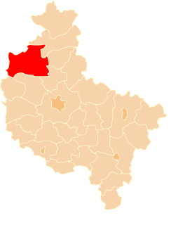
Lubasz is a village in Czarnków-Trzcianka County, Greater Poland Voivodeship, in west-central Poland. It is the seat of the gmina called Gmina Lubasz. It lies approximately 5 kilometres (3 mi) south-west of Czarnków and 59 km (37 mi) north-west of the regional capital Poznań.
Miłkówko is a village in the administrative district of Gmina Lubasz, within Czarnków-Trzcianka County, Greater Poland Voivodeship, in west-central Poland. It lies approximately 6 kilometres (4 mi) south of Lubasz, 11 km (7 mi) south-west of Czarnków, and 55 km (34 mi) north-west of the regional capital Poznań.
Miłkowo is a village in the administrative district of Gmina Lubasz, within Czarnków-Trzcianka County, Greater Poland Voivodeship, in west-central Poland. It lies approximately 6 kilometres (4 mi) south of Lubasz, 10 km (6 mi) south of Czarnków, and 54 km (34 mi) north-west of the regional capital Poznań.
Nowina is a village in the administrative district of Gmina Lubasz, within Czarnków-Trzcianka County, Greater Poland Voivodeship, in west-central Poland. It lies approximately 5 kilometres (3 mi) south-west of Lubasz, 10 km (6 mi) south-west of Czarnków, and 57 km (35 mi) north-west of the regional capital Poznań.
Prusinowo is a village in the administrative district of Gmina Lubasz, within Czarnków-Trzcianka County, Greater Poland Voivodeship, in west-central Poland. It lies approximately 5 kilometres (3 mi) east of Lubasz, 6 km (4 mi) south of Czarnków, and 55 km (34 mi) north-west of the regional capital Poznań.
Sławno is a village in the administrative district of Gmina Lubasz, within Czarnków-Trzcianka County, Greater Poland Voivodeship, in west-central Poland. It lies approximately 5 kilometres (3 mi) south-east of Lubasz, 8 km (5 mi) south of Czarnków, and 54 km (34 mi) north-west of the regional capital Poznań.
Stajkowo is a village in the administrative district of Gmina Lubasz, within Czarnków-Trzcianka County, Greater Poland Voivodeship, in west-central Poland. It lies approximately 3 kilometres (2 mi) south-west of Lubasz, 9 km (6 mi) south-west of Czarnków, and 56 km (35 mi) north-west of the regional capital Poznań.
Boruszyn is a village in the administrative district of Gmina Połajewo, within Czarnków-Trzcianka County, Greater Poland Voivodeship, in west-central Poland. It lies approximately 8 kilometres (5 mi) west of Połajewo, 14 km (9 mi) south of Czarnków, and 47 km (29 mi) north-west of the regional capital Poznań.
Rudka is a village in the administrative district of Gmina Trzcianka, within Czarnków-Trzcianka County, Greater Poland Voivodeship, in west-central Poland. It lies approximately 8 kilometres (5 mi) south of Trzcianka, 13 km (8 mi) north-west of Czarnków, and 72 km (45 mi) north-west of the regional capital Poznań.
Miały is a village in the administrative district of Gmina Wieleń, within Czarnków-Trzcianka County, Greater Poland Voivodeship, in west-central Poland. It lies approximately 11 kilometres (7 mi) south of Wieleń, 29 km (18 mi) south-west of Czarnków, and 67 km (42 mi) north-west of the regional capital Poznań.