
Socorro County is a county in the U.S. state of New Mexico. As of the 2010 census, the population was 17,866. The county seat is Socorro. The county was formed in 1852 as one of the original nine counties of New Mexico Territory. Socorro was originally the name given to a Native American village by Don Juan de Oñate in 1598. Having received vitally needed food and assistance from the native population, Oñate named the pueblo Socorro.

Socorro is a city in Socorro County in the U.S. state of New Mexico. It is in the Rio Grande Valley at an elevation of 4,579 feet (1,396 m). In 2010 the population was 9,051. It is the county seat of Socorro County. Socorro is located 74 miles (119 km) south of Albuquerque and 146 miles (235 km) north of Las Cruces.

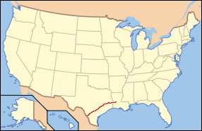
San Elizario is a city in El Paso County, Texas, United States. Its population was 13,603 at the 2010 census. It is part of the El Paso metropolitan statistical area. It lies on the Rio Grande, which forms the border between the United States and Mexico. The city of Socorro adjoins it on the west and the town of Clint lies to the north.

The name Jornada del Muerto translates from Spanish as "Single Day's Journey of the Dead Man" or even "Route of the Dead Man, though the modern literal translation is closer to "The Working Day of the Dead". It was the name given by the Spanish conquistadors to the Jornada del Muerto Desert basin, and the particularly dry 100-mile (160 km) stretch of a route through it from Las Cruces to Socorro, New Mexico. The trail led northward from central Spanish colonial New Spain, present-day Mexico, to the farthest reaches of the viceroyalty in northern Nuevo México Province. The route later became a section of the Camino Real de Tierra Adentro.

The National Hispanic Cultural Center is an institution in Albuquerque, New Mexico dedicated to Hispanic culture, arts and humanities. The campus spans 20 acres and is located along the Rio Grande in Albuquerque, New Mexico, on Avenida César Chávez and 4th St. Now presenting 700 events a year, the NHCC is home to three theatres, an art museum, library, genealogy center, Spanish-language resource center, two restaurants and the largest concave fresco in North America.

The Salinas Pueblo Missions National Monument is a complex of three Spanish missions located in the U.S. state of New Mexico, near Mountainair. The main park visitor center is in Mountainair. Construction of the missions began in 1622 and was completed in 1635.
Paraje, a Spanish term meaning in English place or spot. Paraje is a term from the original Spanish speaking settlers, in use among English speakers in the southwestern United States, particularly in New Mexico, that refers to a camping place along a long distance trail where travelers customarily stopped for the night. A paraje can be a town, a village or pueblo, a caravanserai, or simply a good location for stopping.

The Camino Real de Tierra Adentro was a Spanish 2,560-kilometre-long (1,590 mi) road between Mexico City and San Juan Pueblo, New Mexico, USA, that was used from 1598 to 1882. It was the northernmost of the four major "royal roads" that linked Mexico City to its major tributaries during and after the Spanish colonial era.

Fort Craig was a U.S. Army fort located along El Camino Real de Tierra Adentro, near Elephant Butte Lake State Park and the Rio Grande in Socorro County, New Mexico.

The Santa Fe Plaza is a National Historic Landmark in downtown Santa Fe, New Mexico in the style of traditional Spanish-American colonial cities. The plaza, or city square, was originally, and is still to this day, the center gathering place in town. Many know it as "the heart of Santa Fe". The landmark has since grown into a playground for many tourists interested in Spanish, Native American, and Mexican cultures, and includes music, design, jewelry, art and dance. It is home to annual events including Fiestas de Santa Fe, the Spanish Market, the Santa Fe Bandstand, and the Santa Fe Indian Market.
The El Camino Real de los Tejas National Historic Trail is a national historic trail covering the U.S. section of El Camino Real de Los Tejas, a thoroughfare from the 18th-century Spanish colonial era in Spanish Texas, instrumental in the settlement, development, and history of Texas. The National Park Service designated El Camino Real de los Tejas National Historic Trail as a unit in the National Trails System in 2004.
Interstate 25 (I-25) in the US state of New Mexico follows the north–south corridor through Albuquerque and Santa Fe. It replaced U.S. Route 85 (US 85), which is no longer signed, but still exists in route logs sharing the I-25 alignment. I-25 starts in New Mexico at an interchange with I-10 in Las Cruces and extends roughly 460 miles (740 km) before reaching Colorado. I-25 passes through principally rural land through central New Mexico and passes through or near the cities of Las Cruces, Truth or Consequences, Socorro, Belen, Albuquerque, Santa Fe, Las Vegas, and Raton.

The Rio Grande Trail is a proposed long distance trail along the Rio Grande in the U.S. state of New Mexico. The river extends over 1,800 total miles, some 700 miles (1,100 km) of which pass through the heart of New Mexico. It is the state's primary drainage feature and most valuable natural and cultural resource. The river and its bosque provide a wide variety of recreation, including hunting and fishing, birdwatching, river rafting, hiking, biking, and horseback riding. The river also flows through or beside numerous spectacular and geologically interesting landforms, the result of extensive volcanism and erosion of the valley within the Rio Grande Rift. Although some trail advocates would like to see the trail extended the full distance through New Mexico, from the Colorado border to the United States–Mexico border, the portion proposed for initial development extends 300 miles (480 km), from Bernalillo south to Las Cruces.
The Sevilleta National Wildlife Refuge is a protected area of New Mexico managed by the United States Fish and Wildlife Service as part of the National Wildlife Refuge System. It is located in the Chihuahuan Desert, 20 miles north of Socorro, New Mexico. The Rio Salado and the Rio Grande flow through the refuge.

The Ysleta Mission, located in the Ysleta del Sur Pueblo within the municipality of El Paso, Texas, is recognized as the oldest continuously operated parish in the State of Texas. The Ysleta community is also recognized as the oldest in Texas and claims to have the oldest continuously cultivated plot of land in the United States.

Caddo Mounds State Historic Site (41CE19) is an archaeological site in Weeping Mary, Texas. This Caddoan Mississippian culture site is composed of a village and ceremonial center that features two earthwork platform mounds and one burial mound. Located on an ancient Native American trail later named by the Spanish as El Camino Real de los Tejas, the settlement developed hundreds of years before the arrival of Europeans to the region. Archaeologists believe the site was created in approximately 800 CE, with most major construction taking place between 1100 and 1300 CE.
The Camino Real in New Mexico was the northern part of a historic roadway known as the Camino Real de Tierra Adentro that from 1598 ran from Mexico City northward through central and northern Mexico and the Trans-Pecos part of what is now Texas to San Juan Pueblo in Santa Fe de Nuevo Mexico, now the state of New Mexico.
Contadero, is a ghost town along the east bank of the Rio Grande in Socorro County, New Mexico, United States.

The Gutiérrez Hubbell House also known as the James Lawrence and Juliana Gutierrez y Chavez Hubbell House, is a historic territorial-style hacienda. The original house dates back to the 1820s, and was enlarged in the 1850s and 1860s. It is located in the village of Pajarito in the South Valley of Albuquerque, New Mexico. The house has existed under three national flags: Spain, Mexico and the United States.

The Rio Grande Valley is the river valley carved out by the Rio Grande as it flows through the American Southwest and northeastern Mexico, forming a part of the border region. In the US state of New Mexico, the river flows mostly north to south, and forms a valley near Cochiti Pueblo to the state line near El Paso, Texas along the floors of the large sedimentary basins of the Rio Grande Rift, and includes the narrow sections between the basins. It has been historically settled first by the Pueblo peoples, the Spanish, the Mexicans, and finally Anglo-Americans. As the largest river in the state, some of its most populous cities are located wholly or partially in the valley, including Albuquerque, New Mexico's largest city.