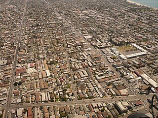
Eastside or East Side has had two different meanings in the city of Long Beach, California. The first, and more current meaning, refers to an area roughly comprising the eastern half of the city, usually excluding areas south of the east–west line made by Pacific Coast Highway/Atherton Street. This area is also called East Long Beach. The second meaning was the area east of the Los Angeles River and north of downtown Long Beach and became notable in the hip-hop gangsta rap of the 1990s.

Belmont Heights is a district in the south-east portion of the city of Long Beach, California, United States, bordering Bluff Park, Bluff Heights, Recreation Park, Belmont Park, Belmont Shore, and the Pacific Ocean. The district commemorates the old City of Belmont Heights, which was incorporated in 1908 and annexed to Long Beach in 1909. Belmont Heights' borders are Ocean Boulevard and Livingston Drive to the south, Redondo Avenue on the west, 7th Street to the North, and Nieto Avenue to the east. The area is mostly residential, but also has an active business district, the strip of Broadway east of Redondo Avenue.

California's 44th congressional district is a congressional district in the U.S. state of California. The district is centered in South Los Angeles and the Los Angeles Harbor Region. It is currently represented by Democrat Nanette Barragán. The 44th district was created as a result of the redistricting cycle after the 1980 census.

El Dorado Regional Park is a park in Long Beach, California, United States. It is on the east side of the city.
The Imperial Highway is a west-east thoroughfare in the counties of Los Angeles, Orange, Riverside, San Diego, and Imperial in the U.S. state of California. The main portion of the existing route begins at Vista Del Mar in Los Angeles near the Los Angeles International Airport and ends at the Anaheim–Orange city line at Via Escola where it becomes Cannon Street. Historically, the Imperial Highway extended from Vista Del Mar to Calexico, where a portion of the highway still exists. The original route was replaced with other highways, leading the older portions of the Imperial Highway to fall out of use.

West Long Beach is a working-class neighborhood in Long Beach, California.

North Long Beach is a predominantly working-class area of Long Beach, California. The neighborhood is bounded to the west, north and east by the Long Beach city limits, and to the south by a Union Pacific railroad track and the Bixby Knolls neighborhood. The north boundary with Paramount is only a few blocks north of the Artesia Freeway.

Wrigley is a group of neighborhoods in Long Beach, California. It includes the neighborhoods North Wrigley, South Wrigley, Southeast Wrigley and Wrigley Heights. Its name derives from William Wrigley Jr., the owner and founder of the famed Wrigley Spearmint Gum Empire in Chicago. It was one of the first communities established in Long Beach. With the exception of Wrigley Heights, the area is developed throughout on a gridiron street pattern.
Bixby Knolls is a neighborhood in Long Beach, California, named after the Bixby family.
The Broadway business corridor in Long Beach, California is loosely defined as a three-mile stretch of East Broadway between Downtown Long Beach and Belmont Shore. It includes the area around Bixby Park sometimes referred to as a "gayborhood" because of the concentration of gay-owned and/or gay-friendly businesses. The Gay and Lesbian Center of Greater Long Beach is located on nearby 4th Street.
The Long Beach Public Library (LBPL) is an American public library system located in Long Beach, California.

Bluff Heights is a neighborhood and historic district in Long Beach, California, composed mainly of Craftsman bungalows constructed from approximately 1910 to 1923.

Founded in 1915, the Greater Los Angeles Area Council (GLAAC) (#033) served most of the City of Los Angeles as well as several other cities in the greater Los Angeles area. It was one of five Boy Scouts of America councils in Los Angeles County, California. Since its founding in 1915, the Los Angeles Area Council has brought its purpose and values to millions of youth. The Council served 54,567 youth in the Greater Los Angeles Area in 2008 alone.
Los Altos is a residential neighborhood located in eastern Long Beach.
Hellman is a neighborhood in the city of Long Beach, California.

Rosecrans Avenue is a major west-east thoroughfare in Los Angeles and Orange Counties, California, USA. It has a total length of 27.5 miles (44.3 km). The street is named after U.S. Union General William S. Rosecrans, who purchased 13,000 acres (5,300 ha) of Rancho Sausal Redondo southwest of Los Angeles in 1869. Rosecrans Avenue was originally named Drexel Avenue, and ran through the Rosecrans Rancho which is part of modern-day Gardena.
Dominguez Channel is a 15.7-mile-long (25.3 km) stream in southern Los Angeles County, California, in the center of the Dominguez Watershed of 133 square miles (340 km2).
South of Conant is a neighborhood located in Long Beach, California that lies just north of Spring Street, south of Conant Street, east of Clark Avenue, and west of Woodruff Avenue; and includes Wardlow Park. It is known for its LGBTQ+ community.

Naval Air Station Los Alamitos Naval Outlying Landing Fields were a set airfield near Naval Air Station Los Alamitos to support the training of US Navy pilots during World War 2. The support airfields are called Naval Outlying Landing Field (NOLF). For the war, many new trained pilots were needed. The Naval Outlying Landing Fields provided a place for pilots to practice landing and take off without other air traffic. The remotes sites offered flight training without distractions. Most of the new pilots departed to the Pacific War after training. The Outlying Landing Fields had little or no support facilities. Naval Air Station Los Alamitos opened in 1942 and was transferred to the US Army in 1977 as Los Alamitos Army Airfield. Most of the Outlying fields closed in 1945, having completed the role of training new pilots. To open the needed Outlying Landing Fields quickly, the Navy took over local crop dusting and barnstorming airfields. Naval Air Station Los Alamitos was also called Los Alamitos Naval Reserve Air Base. During the war Marine Corps Air Station El Toro also used the outlying Landing Field. The Timm N2T Tutor was the most common plane used for training on the outlying landing fields.
El Dorado Park Estates is a neighborhood in Long Beach, California.
