Neighborhoods of Long Beach, California

Last updated
Neighborhood map of the City of Long Beach, CA LB Neighborhoods.jpg
Neighborhood map of the City of Long Beach, CA

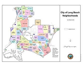
Long Beach, California, is composed of many different neighborhoods. Some neighborhoods are named after thoroughfares, while others are named for nearby parks, schools, or city features.

Contents

Officially recognized neighborhoods

Location
4th Street Corridor
7th Street
Addams
Alamitos Beach
Alamitos Heights
Arlington
Bay Harbor
Belmont Heights
Belmont Park
Belmont Shore
Bixby Hill
Bixby Knolls
Bixby Park
Bixby Village
Bluff Heights
Bluff Park
Bryant
California Heights
Carmelitos
Carroll Park
Central Area
College Park Estates
College Square
Coolidge Triangle
Cypress
Dairy
DeForest Park
Del Lago
Downtown Long Beach
East Village
El Dorado Lakes
El Dorado Park Estates
El Dorado North
El Dorado South
Franklin Neighborhood
Hamilton Neighborhood
Hellman
Houghton Park, North Long Beach
Imperial Estates
Island Village
Lakewood Village
Lindbergh Neighborhood
Longwood
Los Altos
Los Cerritos/Virginia Country Club
Lower West Side
Magnolia District
Marina Pacifica
McKinley Neighborhood
Memorial Heights
Naples
Nehyam (formerly Grant) [1]
Palo Verde
Paramount Neighborhood
Park Estates
Peninsula
Plaza
Ramona Park
Rancho Estates
Recreation Park
Rose Park
St. Francis
Saint Mary's (St. Mary Medical Center)
SEADIP
Starr King
Stearns Park
Sunrise
Sutter
Traffic Circle
Upper West Side
University Park Estates
Washington School
West Long Beach
West Village
Willmore
Wrigley
Zaferia
[2]

Source: [3]

Other neighborhoods

Related Research Articles

<span class="mw-page-title-main">Long Beach, California</span> City in California, United States

Long Beach is a coastal city in southeastern Los Angeles County, California, United States. It is the 44th-most populous city in the United States, with a population of 451,307 as of 2022. A charter city, Long Beach is the 7th-most populous city in California, the 2nd-most populous city in Los Angeles County, and the largest city in California that is not a county seat.

<span class="mw-page-title-main">Shoreline, Washington</span> City in Washington, United States

Shoreline is a city in King County, Washington, United States. It is located between the city limits of Seattle and the Snohomish County border, approximately 9 miles (14 km) north of Downtown Seattle. As of the 2020 census, the population of Shoreline was 58,608, making it the 22nd largest city in the state. Based on per capita income, one of the more reliable measures of affluence, Shoreline ranks 91st of 522 areas in the state of Washington to be ranked.

<span class="mw-page-title-main">Scarborough Bluffs</span> Escarpment in Toronto, Canada

The Scarborough Bluffs, also known as The Bluffs, is an escarpment in the Scarborough district of Toronto, Ontario, Canada. There are nine parks along the bluffs, with Bluffers Park being the only one with a beach. Forming much of the eastern portion of Toronto's waterfront, the Scarborough Bluffs stands above the shoreline of Lake Ontario. At its highest point, the escarpment rises 90 metres (300 ft) above the coastline and spans a length of 15 kilometres (9.3 mi).

<span class="mw-page-title-main">Downtown Long Beach</span> Neighborhood in Los Angeles, California, United States

Downtown Long Beach, California, United States is the location for most of the city's major tourist attractions, municipal services and for numerous businesses. There are many hotels and restaurants in the area that serve locals, tourists, and convention visitors.

<span class="mw-page-title-main">Wrigley, Long Beach</span> Neighborhood of Long Beach in Los Angeles, California, United States

Wrigley is a group of neighborhoods in Long Beach, California. It includes the neighborhoods North Wrigley, South Wrigley, Southeast Wrigley and Wrigley Heights. Its name derives from William Wrigley Jr., the owner and founder of the famed Wrigley Spearmint Gum Empire in Chicago. It was one of the first communities established in Long Beach. With the exception of Wrigley Heights, the area is developed throughout on a gridiron street pattern.

Bixby Knolls is a neighborhood in Long Beach, California, named after the Bixby family.

<span class="mw-page-title-main">Wardlow station</span> Los Angeles Metro Rail station

Wardlow station is an at-grade light rail station on the A Line of the Los Angeles Metro Rail system. The station is located on the A Line's exclusive right-of-way that parallels Pacific Place, at its intersection with Wardlow Street, after which the station is named, in the Wrigley neighborhood of Long Beach, California.

<span class="mw-page-title-main">The Cove, Stamford, Connecticut</span> Neighborhood in Stamford, Connecticut, US

The Cove is a neighborhood located in the southeast corner of Stamford, Connecticut. It is an area of mostly modest homes with some very expensive homes along the shoreline.

<span class="mw-page-title-main">Miller/Knox Regional Shoreline</span> Bayside park

Miller/Knox Regional Shoreline is a 295-acre (1.19 km2) bayside park near the Brickyard Cove neighborhood of the Point Richmond District in Richmond, California.

California Heights is a historic neighborhood of Long Beach, California.

<span class="mw-page-title-main">Long Beach Police Department (California)</span> Law enforcement agency in Long Beach, California

The Long Beach Police Department provides law enforcement for the city of Long Beach, California.

Los Altos is a residential neighborhood located in eastern Long Beach.

<span class="mw-page-title-main">Alamitos Beach, Long Beach, California</span> Neighborhood in Long Beach, California, US

Alamitos Beach is a coastal neighborhood in the southern portion of the city of Long Beach, California. Although it was in unincorporated Los Angeles County when annexed by the City of Long Beach, it had been planned as its own community with a townsite.

Alamitos Heights is a neighborhood in the south-east portion of the city of Long Beach, California, United States.

<span class="mw-page-title-main">Bixby family</span> California real estate family

The Bixby family is an American family that was heavily involved in the development of California ranches and real estate in the 19th and 20th centuries. Through various companies, they controlled at one time or another large swathes of California real estate, much of it derived from Mexican land grants. Over several generations, their holdings included Rancho Los Cerritos and Rancho Los Alamitos, and parts of Rancho San Justo and Rancho Palos Verdes, totaling well over 100,000 acres. Parts of the towns of Long Beach, Bellflower, Paramount, Signal Hill, Lakewood, and Los Alamitos emerged from former Bixby-held lands. Within Long Beach, the neighborhoods Bixby Hill, Bixby Knolls, and Bixby Village are named after the family, as well as Bixby Park in the Alamitos Beach neighborhood.

References

  1. Echeverry, Sebastian (4 September 2021). "'A matter of respect': Long Beach group picks new neighborhood name to honor Tongva tribe". Long Beach Post News.
  2. "Neighborhoods". maps.longbeach.gov.
  3. Canalis, John (June 7, 2008). "Park Estates to mark its east end with sign". Long Beach Press-Telegram . Archived from the original on December 10, 2008. Retrieved 2008-06-08.