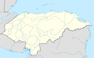
La Libertad is a municipality in the Honduran department of Comayagua.

San Luis is a municipality in the Honduran department of Comayagua.

La Venta is a municipality in the south of the Honduran department of Francisco Morazán.

Nueva Armenia is a municipality in the Honduran department of Francisco Morazán.

Villafranca is a town and municipality located in the province and the autonomous community of Navarre, northern Spain.

Rebecca Spit Marine Provincial Park is a provincial park in British Columbia, Canada, located on the east side of Quadra Island, near the city of Campbell River.

Sélibaby is a capital town and department of the Guidimaka Region, Mauritania. It is located at around 15°9′33″N12°11′00″W. It is divided into a number of "quartiers" which include "College", "Silo", 'Ferlo", "nezaha", "saada", "el jedida" "Bambaradougou" amongst many others. Selibaby also has a regional hospital, funded by the Chinese government and partially staffed by Chinese doctors and is the headquarters of the regional director of health. Selibaby is a centre for NGOs who operate in the region.
There are several lakes named Mud Lake within the Canadian province of Alberta.
The Squamish Nation, Sḵwx̱wú7mesh Úxwumixw in Sḵwx̱wú7mesh Sníchim, is an Indian Act government originally imposed on the Squamish (Sḵwx̱wú7mesh) by the Federal Government of Canada in the late 19th century. The Squamish are Indigenous to British Columbia, Canada. Their band government comprises 16 elected councillors, serving four-year terms, with an elected band manager. Their main reserves are near the town of Squamish, British Columbia and around the mouths of the Capilano River, Mosquito Creek, and Seymour River on the north shore of Burrard Inlet in North Vancouver, British Columbia.
The Lower Similkameen Indian Band or Lower Smelqmix, is a First Nations band government in the Canadian province of British Columbia. Their office is located in the village of Keremeos in the Similkameen region. They are a member of the Okanagan Nation Alliance.

Steamer South American was a Great Lakes steamer built by the Great Lakes Engineering Works at Ecorse, Michigan. It was built in 1913/14 for the Chicago, Duluth & Georgian Bay Transit Company. The vessel was launched on February 21, 1914 and was the newer of two near-sister ships, the older one being the North American.
Little Sackville River is a river in Halifax Regional Municipality, Nova Scotia, Canada.
The Nazko First Nation is a First Nations government of the Dakelh people in the north-central Interior of British Columbia. Its reserves are located around the community of Nazko, British Columbia, which is 120 km west of Quesnel and southwest of Prince George.
Lone Fountain is an unincorporated community located in Augusta County, Virginia, United States. It has a very small population. Its area is 1 square mile (2.6 km2).
The Nezinscot River is a 15-mile-long (24 km) river in Maine. It runs east from the confluence of its East Branch and West Branch in Buckfield to its mouth on the Androscoggin River in Turner.
Little Cedar River is a 56.7-mile-long (91.2 km) river in Menominee County in the U.S. state of Michigan.
Pilot Knob Station, a former stage station of the Butterfeild Overland Mail, located near Andrade, California. It was placed 10 miles west of the Fort Yuma stage station on the road along the Colorado River, in California, and 18 miles east of the Cooke's Wells Station in Baja California. It was subsequently used by the Union Army as station for its troops and supply wagons during the American Civil War and was a stage station again after the Civil War until the Southern Pacific Railroad, arrived in Yuma, Arizona ending the need for the stage line from California.
Division No. 1, Subdivision L is an unorganized subdivision on the Avalon Peninsula in Newfoundland and Labrador, Canada. It is in Division 1 and contains the unincorporated communities of Bareneed, Black Duck Pond, Blow Me Down, Coley's Point South, Hibb's Cove, Pick Eyes, Port de Grave, Ship Cove and The Dock
The City of Happy Valley, formerly the District Council of Meadows, was a local government area in South Australia from 1935 until 1997.
Northwest Township is a township in St. Louis County, in the U.S. state of Missouri. Its population was 32,245 as of the 2010 census.


