History
There is no evidence about the presence of human beings in before the Middle Ages in this territory. [2]
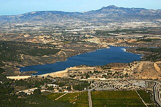
The history of El Raal was very related to the Segura River and the irrigation canals. [3]
The first document references about this area have their dates in the years 1257 and 1271. [2]
In the Modern Age there are references about this district and their concrete date is the year 1452. This consisted of a tax collection. [2]
During the Trienio Liberal (1820-1823) El Raal reached in establishing its own local government and the name of the municipality was 'Villa Constitucional de El Raal de Teatinos'. This status endured three years. [3]
In the 20th century, there was a large increase in population. There were 1,559 inhabitants in the district in the year 1900. Forty years later its population was 3,367. There were 5,171 inhabitants in the year 1963. There was a drop in population from that year, and the number of residents in the year 1972 was 3958. There was again an increase in population from that year, and there were 5,132 people living in El Raal in the year 1996. [3]

Murcia is a city in south-eastern Spain, the capital and most populous city of the autonomous community of the Region of Murcia, and the seventh largest city in the country. It had a population of 447,182 inhabitants in 2018. The total population of the metropolitan area was 689,591 in 2010. It is located on the Segura River, in the southeast of the Iberian Peninsula. It has a climate with hot summers, mild winters, and relatively low precipitation.

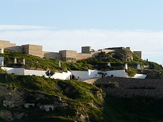
Mazarrón is a municipality in the autonomous community and province of Murcia, southeastern Spain. The municipality has an area of 318.7 square kilometres (123.1 sq mi), and a population of 31,562 inhabitants in 2019. A military fort built between 1930 and 1936 during the reign of Alfonso XIII of Spain and the Second Spanish Republic exists as a tourist attraction on the old road between Mazarrón and Cartagena, and although it is accessible from the Bay of Mazarrón it is not in the municipality itself.

Totana is a municipality in the Region of Murcia in Spain. It has a population of 32008. The local economy is largely dependent on agriculture and related industries. It has a railway station providing a service on the Cercanías Murcia/Alicante commuter line, providing connections to Alicante and Murcia.

Calasparra is a municipality in the autonomous community of Murcia, Spain. It shares borders with Cieza, Mula, Cehegín, Moratalla and province of Albacete.

La Unión is situated in the Region of Murcia in the southeast of Spain. It has an area of 24.6 km², and had a population of 19,907 at 1 January 2018,. It has the elevation of 86 m. Its average annual temperature is 17 °C. It has balmy winters. The sun shines 320 days per year. La Unión is situated in one of the sunniest areas in Europe; this kind climate makes possible the many leisure activities, popular fiestas, sports, and cultural activities that are held in the town. The town is linked by regular train to Cartagena which allows views of the past industrial heritage of the area and the more modern occupations of agriculture and tourism. La Unión lies within the built-up area of Cartagena and is surrounded on all landward sides by the City of Cartagena.

Las Torres de Cotillas is a Spanish municipality in the autonomous community of Murcia and is located in the eastern half.

Alhama de Murcia is a Spanish municipality in the autonomous community of the Region of Murcia. It is located in the north of the southern half of the region. The municipality shares borders with Librilla in its north, Murcia in its northeast, Fuente Álamo de Murcia in its east, Mazarrón in its south, Totana in its west and Mula in its northwest.
Puerto Lumbreras is a Spanish municipality in the autonomous community of Murcia. It has a population of 15,780 (2020) and an area of 139 km². It is located in the southwestern end of Region of Murcia and is adjacent to Andalusia.
Santomera is a Spanish municipality in the autonomous community of Murcia. It has a population of 16,105 (2018) and an area of 44.2 km2. It shares borders with Fortuna in the north, with Murcia in its west and south and with the province of Alicante in the east.
Torre-Pacheco is a municipality in the autonomous community of Murcia in southeastern Spain. It covers an area of 189.4 km² and its population in 2019 was 35,676. The only high ground in the municipality is Cabezo Gordo hill, the location of the protected Sima de las Palomas archeological site. The town has one secondary education institution, the I.E.S. Gerardo Molina.
Sangonera la Verde is a village located in the Garden of Murcia (Spain) and is placed in the south-western quarter of Murcia municipality. It has a population of 11,651 inhabitants.

Aledo is a municipality in the Region of Murcia, southern Spain.

El Palmar is a village and the most populated district in Murcia, Spain. It is part of the municipality of Murcia. 24,266 people resided in the territory in 2020.

Jerónimo y Avileses is a village and a district in Murcia, Spain. It is part of the municipality of Murcia and is located in the south-east of the municipality. It has an area of 39.437 km2 and had a population of 1,701 in 2020.
Valladolises y Lo Jurado is a village and a district in Murcia, Spain. It is part of the municipality of Murcia. Valladolises y Lo Jurado is located in the south end and shares borders with Fuente Álamo de Murcia in its south. The district has an area of 42.614 km2 and was inhabited by 775 people in 2020.
Llano de Brujas is a district in Murcia, Spain. It is part of the municipality of Murcia and it is located in the northeastern quarter. This district has an area of 7.3 km2 and was inhabited by 5,830 people in 2020.

Algezares is a village and a district in Murcia, Spain. It is part of the municipality of Murcia and is almost located in the centre. It has an area of 24.74 km2, and had a population of 5,620 in 2020.

Raspay is a village in the municipality of Yecla, eastern Spain. Its population consisted of 100 inhabitants in the year 2017.

El Algar is a district of the Spanish municipality Cartagena. It is located in the east of Cartagena and has an area of 26.659 km2. It shares borders with Lentiscar at its north, San Félix at its east, La Unión municipality at its south east, El Beal at its south-west and a coastal salty lagoon named Mar Menor at its north-west. In the year 2019, 7961 people were registered as inhabitants of the district.
San Antonio Abad is a district of the Spanish municipality Cartagena. It is located in the south of the territory, has an area of 9.738 km2 and a population of 45,335.