El Santo (Cuba)

Last updated
El Santo
Villa Clara Map - El Santo (Encrucijada).png
El Santo (red) in Encrucijada (orange) in Villa Clara (yellow)
Cuba (location map).svg
Red pog.svg
El Santo
Villa Clara Province location map.png
Red pog.svg
El Santo
Encrucijada (Cuba) location map.png
Red pog.svg
El Santo
Coordinates: 22°42′31″N79°41′07″W / 22.70861°N 79.68528°W / 22.70861; -79.68528
Country Cuba
Province Villa Clara
Municipality Encrucijada
Area
[1]
  Total1.144 km2 (0.442 sq mi)
Population
 (2012) [1]
  Total2,787
  Density2,400/km2 (6,300/sq mi)

El Santo is a ward (consejo popular) in Encrucijada, Cuba.

Contents

Geography

Towns inside of the ward include:

Environmental issues

El Santo is near the Sagua la Chica River, which has a possible chance to flood, making danger to people who live in the wards of La Sierra and El Santo. Incase this happens there are 21 evacuation centers which are always stocked up with food. [2]

In 2018, a flood from the Sagua la Chica River happened. Vega Redonda, Pavón, El Santo, Siete Pazos and others had a total of a thousand people evacuated, according to Eduardo Monteagudo, President of Encrucijada and Alberto López Díaz, President of Villa Clara Province, making it the most affected towns in Villa Clara. [3] [4] [5] [6] [7]

In 2012, there was another flood in El Santo and Jibacoa, these are a result of the dams on La Quinta Lake and Minerva Lake. Tierra Fría and Embarcadero, close to El Santo, were the most threatened by flooding. [8]

History

El Santo was a former barrio of Encrucijada. [9] [10] [11] [12] [13]

Culture

The absent Santeño (El Santeño ausente) was a holiday celebrated from 1952-59 in El Santo, later reformed in 1979. Activities that are done out are the pilgrimage to the tomb of the veterans of the Cuban War of Independence, homage to the old masters, events on the Sagua la Chica River, popular dances, congas outings, fireworks, and offering foods and drinks. The Parrandas are also celebrated in El Santo. [14]

Related Research Articles

<span class="mw-page-title-main">Sagua La Grande</span> Municipality in Villa Clara, Cuba

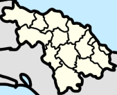
Sagua la Grande is a municipality located on the north coast of the province of Villa Clara in central Cuba, on the Sagua la Grande River. The city is close to Mogotes de Jumagua, limestone cliffs. Many cays of the Sabana-Camaguey Archipelago are located off the northern coast. People born in Sagua are called "sagueros".

<span class="mw-page-title-main">Camajuaní</span> Municipality in Villa Clara, Cuba

Camajuaní is a municipality and town in the Villa Clara Province of Cuba.

<span class="mw-page-title-main">Encrucijada</span> Municipality in Villa Clara, Cuba

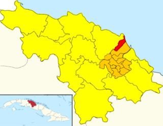
Encrucijada is a municipality and town in the Villa Clara Province of Cuba. It was founded in 1850 and established as a municipality in 1910.

<span class="mw-page-title-main">Quemado de Güines</span> Municipality in Villa Clara, Cuba

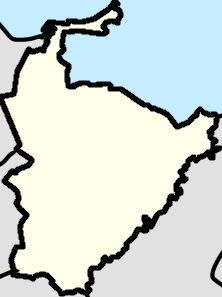
Quemado de Güines is a municipality and town in the Villa Clara Province of Cuba. It was founded in 1667.

Sagua la Chica River is a river of northern Cuba, that flows through Villa Clara Province. Arising in the hills of Placetas, it flows north for 45 miles and empties into the Bay of Buena Vista.

<span class="mw-page-title-main">San Antonio de las Vueltas</span> Village in Villa Clara, Cuba

San Antonio de las Vueltas, also known as Vueltas, is a village and consejo popular in central northern Cuba, belonging to the municipality of Camajuaní, Villa Clara Province. With a population of 13,805 it is the most populated village in the municipality after Camajuaní.

<span class="mw-page-title-main">Sagua la Chica</span> Rural settlement and Ward in Villa Clara, Cuba

Sagua la Chica also known as Sagua is a Rural Settlement and consejo popular (ward) in Camajuani, Cuba. It has a population of 1,447 people. Sagua la Chica has the same name as the Sagua la Chica river and is 174 mi away from the capital of Havana.

<span class="mw-page-title-main">Calabazar de Sagua</span> Village in Villa Clara, Cuba

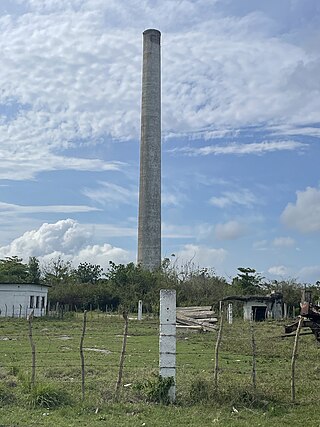
Calabazar de Sagua, also shortened as Calabazar, is a Cuban village and consejo popular of the municipality of Encrucijada, in Villa Clara Province, Cuba. In 2011 it had a population of 7,912.

<span class="mw-page-title-main">Vega Alta, Cuba</span> Village in Villa Clara, Cuba

Vega Alta is a small town in Camajuaní, Villa Clara, Cuba and a ward. It is in the vicinity of the Sagua la Chica River, with neighboring towns such as Canoa, Chicharón, Rincón, La Lebiza, La Luz, La Catalina, La Doncella, and El Cubano.

<span class="mw-page-title-main">La Quinta, Cuba</span> Village in Villa Clara, Cuba

La Quinta, also known as Quinta, Quinto, and Poblado la Quinta is a small town and ward home of 1,026 in Camajuani, Villa Clara, Cuba. Nearby towns are Romano, La Mano, Piedra, Aguijón, Matilde Blanquizal, and La Flora.

<span class="mw-page-title-main">Canoa, Cuba</span> Hamlet in Villa Clara, Cuba

Canoa or La Canoa is a small town in Villa Clara Province, Cuba, in the vicinity of the Sagua la Chica River. Nearby towns include Vega Alta, La Levisa, Chicharón, Paso Real, Santa Ana, La Doncella, and La Catalina. “Canoa” translates to “Canoe” in Spanish and shares the name with Arroyo La Canoa, a stream north of Canoa.

<span class="mw-page-title-main">Luis Arcos Bergnes, Cuba</span> Ward in Villa Clara, Cuba

Luis Arcos Bergnes also known as Carmita is a small town and a ward in Camajuani, Villa Clara, Cuba. With a population of 2,279 it is considered a village.

<span class="mw-page-title-main">José María Pérez, Cuba</span> Place in Villa Clara, Cuba

José María Pérez also known as Fe is a consejo popular (ward) and a town in Camajuaní, Cuba nearby towns include Salamanca, Canada De Agua, Prudencia, Fénix, Orovio, and Los Maestros. The town is known as Fe because of the Central in the town, Central José María Pérez, was formerly known as Central Fe.

<span class="mw-page-title-main">Constancia (Encrucijada)</span> Ward in Villa Clara Province, Cuba

Abel Santamaria also known as Constancia and is a ward and a town in Encrucijada, Villa Clara Province, Cuba. It’s the birthplace of Abel Santamaría, a Cuban revolutionary that fought for the 26th of July Movement and his sister Haydée Santamaría.

<span class="mw-page-title-main">La Sierra (Encrucijada)</span> Ward in Villa Clara, Cuba

La Sierra is a town and ward in Encrucijada, Cuba.

<span class="mw-page-title-main">Tuinicú (Encrucijada)</span> Hamlet in Villa Clara, Cuba

Tuinicú, also known as Tunicú is a small hamlet in Encrucijada, Cuba

<span class="mw-page-title-main">Paso Real (Encrucijada)</span> Hamlet in Villa Clara, Cuba

Paso Real is a hamlet in Encrucijada, Cuba.

Cayo Hueso is a hamlet, a UBPC, and the 48th zone of the ward of Abel Santamaria in Encrucijada, Cuba.

Vega Redonda is a hamlet in Encrucijada, Cuba.

<span class="mw-page-title-main">Encrucijada Sur</span> Ward in Encrucijada

Encrucijada Sur is a consejo popular (ward) in Encrucijada, Villa Clara Province, Cuba.

References

  1. 1 2 "El Santo (Encrucijada, Provinz Villa Clara, Kuba) - Einwohnerzahlen, Grafiken, Karte, Lage, Wetter und Web-Informationen". www.citypopulation.de. Retrieved 2023-01-04.
  2. "Encrucijada sigue de cerca los efectos de Ian". Telecubanacán (in Spanish). 2022-09-27. Retrieved 2022-12-31.
  3. "Protegidas personas y bienes ante intensas lluvias (+ Fotos)". Granma.cu (in Spanish). Retrieved 2022-12-31.
  4. 14ymedio. "Alberto deja graves inundaciones en el centro de Cuba y más de 5.000 evacuados". 14ymedio (in Spanish). Retrieved 2023-01-04.
  5. "Evacuados en Villa Clara vecinos del poblado de El Santo". ANC (in Spanish). Retrieved 2023-01-04.
  6. "Protegidas personas y bienes ante intensas lluvias (+ Fotos)". Granma.cu (in Spanish). Retrieved 2023-01-04.
  7. Noticias, Agencia Cubana de. "Evacuados en Villa Clara vecinos del poblado de El Santo". www.acn.cu (in European Spanish). Retrieved 2023-01-04.
  8. "Encrucijada". alocubano.wordpress.com (in Spanish). Retrieved 2023-01-04.
  9. Guije.com. "Encrucijada" (in Spanish). Retrieved 2007-10-09.
  10. censo, Cuba Dirección general del (1919). Census of the Republic of Cuba 1919. Maza, Arroyo y Caso, s. en c., printers.
  11. Café, Instituto Cubano de Estabilización del (1938). Boletín (in Spanish).
  12. censo, Cuba Dirección général del (1920). Estados que comprenden el número de habitantes y electores de la República: según la enumeración practicada en 15 de septiembre de 1919, publicados en edición extraordinaria de la "Gaceta oficial" de 28 de abril de 1920, por acuerdo de la Junta Nacional del Censo de 9 de abril del propro año, y que se reproducen en este folleto en cumplimiento de dicho acuerdo (in Spanish). Imprenta y papeleria de Rambla, Bouza y ca.
  13. Censo, Cuba Dirección General del (1945). Republica de Cuba: censo de 1943 (in Spanish). P. Fernandez.
  14. EPP. "Villa_Clara - Encrucijada". Villa_Clara (in European Spanish). Retrieved 2023-01-04.