A seaside resort is a city, town, village, or hotel that serves as a vacation resort and is located on a coast. Sometimes the concept includes an aspect of official accreditation based on the satisfaction of certain requirements, such as in the German Seebad. Where a beach is the primary focus for tourists, it may be called a beach resort.

Gairloch is a village, civil parish and community on the shores of Loch Gairloch in Wester Ross, in the North-West Highlands of Scotland. A tourist destination in the summer months, Gairloch has a golf course, a museum, several hotels, a variety of shops, takeaway restaurants, a community centre, a leisure centre with sports facilities, a local radio station, beaches and nearby mountains. Gairloch is one of the principal villages on the North Coast 500 route.

The Salinas Valley is one of the major valleys and most productive agricultural regions in California. It is located west of the San Joaquin Valley and south of San Francisco Bay and the Santa Clara Valley.

Labcorp Drug Development presently known as Fortrea is a contract research organization headquartered in Burlington, North Carolina, providing nonclinical, preclinical, clinical and commercialization services to pharmaceutical and biotechnology industries. Formerly called Covance, the company is a spin-off from Labcorp, which employs more than 70,000 people worldwide.

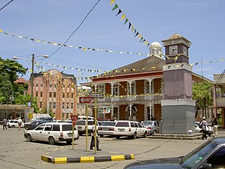
Kilkee is a small coastal town in County Clare, Ireland. It is in the parish of Kilkee, formerly Kilfearagh. Kilkee is midway between Kilrush and Doonbeg on the N67 road. The town is popular as a seaside resort. The horseshoe bay is protected from the Atlantic Ocean by the Duggerna Reef.

Sandycove is a suburb of Dublin, Ireland. It is southeast of Dún Laoghaire and Glasthule, and northwest of Dalkey. It is a popular seaside resort and is well known for its bathing place, the Forty Foot, which in the past was reserved for men only but is now available for mixed bathing. The locale features in the opening of Ulysses by James Joyce.

Manly is a beach-side suburb of northern Sydney, in the state of New South Wales, Australia. It is 17 kilometres (11 mi) north-east of the Sydney central business district and is currently one of the three administrative centres of the local government area of Northern Beaches Council. Manly has a long-standing reputation as a tourist destination, owing to its attractive setting on the Pacific Ocean and easy accessibility by ferry.

Baldoyle is a coastal suburb of Dublin's northside. It is located in the southeastern part of the jurisdiction of Fingal, Ireland, developed from a former fishing village.

Portland, with its capital town Port Antonio, is a parish located on Jamaica's northeast coast. It is situated to the north of St Thomas and to the east of St Mary in Surrey County. It is one of the rural areas of Jamaica, containing part of the Blue Mountains, where the Jamaican Maroon communities of Moore Town and Charles Town are located.

Sea bathing is swimming in the sea or in sea water and a sea bath is a protective enclosure for sea bathing. Unlike bathing in a swimming pool, which is generally done for pleasure or exercise purposes, sea bathing was once thought to have curative or therapeutic value. It arose from the medieval practice of visiting spas for the beneficial effects of the waters. The practice of sea bathing dates back to the 17th century but became popular in the late 18th century. The development of the first swimsuits dates from the period as does the development of the bathing machine.
Port Antonio is the capital of the parish of Portland on the northeastern coast of Jamaica, about 100 km from Kingston. It had a population of 12,285 in 1982 and 13,246 in 1991. It is the island's third largest port, famous as a shipping point for bananas and coconuts, as well as one of its most important tourist attractions, tourism being a major contributor to the town's economy.

The Pamba River is the longest river in the Indian state of Kerala after Periyar and Bharathappuzha, and the longest river in the erstwhile former princely state of Travancore. The Sabarimala Temple, dedicated to Lord Ayyappa, is located on the banks of the river Pamba.
The Burin Peninsula is a peninsula located on the south coast of the island of Newfoundland in the province of Newfoundland and Labrador. Marystown is the largest population centre on the peninsula.
Hope Island is a suburb in the City of Gold Coast, Queensland, Australia. In the 2021 census, Hope Island had a population of 14,522 people.
Gay naturism or LGBT naturism concerns a lifestyle of gay people in which nudity, especially in a communal context, is viewed as natural, positive and healthy. While naturist clubs and resorts in the United States date back to the 1930s, gay naturist organizations did not emerge until the early 1980s. Separate from official naturist clubs, gay individuals have long congregated in locally-known gay beaches in many countries, especially in Europe and North America.

Merrymeeting Bayis a large freshwater tidal bay located in the U.S. state of Maine. Merrymeeting Bay's unusual geography defies common landform terms. It is not what is usually meant by the word bay. It is somewhat like an estuary but it has fresh water with very little salt. Geologically it is described as an "inland delta" and biologically as "tidal riverine."
Ħondoq ir-Rummien, the coastline below the village of Qala, Gozo, Malta is dotted with traditional salt pans, some of which are still actively used to harvest salt throughout the summer months. On this coast is a small cove, Ħondoq ir-Rummien, which is used by snorkelers because of its deep and clear water and the small caves at sea level. Access to the sea is from bathing ladders. The cove has a view of Comino. There is also a small white sand beach sheltered by a small promontory on the southwest side.

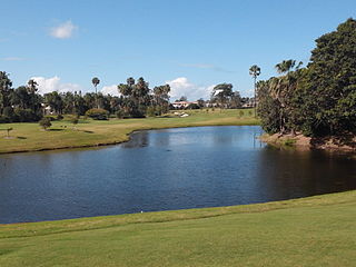
Sanctuary Cove is a gated community and town in the suburb of Hope Island in the City of Gold Coast, Queensland, Australia. It is completely self-contained residential environment with its own shopping centre and entertainment facilities, with the addition of many of the facilities of a holiday resort, such as boating marinas and golf courses.

Australia is the driest habitable continent on Earth and its installed desalination capacity has been increasing. Until a few decades ago, Australia met its demands for water by drawing freshwater from dams and water catchments. As a result of the water supply crisis during the severe 1997–2009 drought, state governments began building desalination plants that purify seawater using reverse osmosis technology. Approximately one percent of the world's drinkable water originates from desalination plants.

Crystal Cove State Marine Conservation Area (SMCA) is one of a cluster of four adjoining marine protected areas that extend offshore of Newport Beach in Orange County on California’s south coast. The SMCA covers 3.45 square miles of near shore waters. Crystal Cove protects marine life by limiting the removal of marine wildlife from within its borders, including tide pools. Take of all living marine resources is prohibited except: recreational take of finfish by hook-and-line or by spearfishing, and lobster and sea urchin is allowed. Commercial take of coastal pelagic species by round haul net, spiny lobster by trap, and sea urchin is allowed.
