Elim, Drenthe

Last updated
Elim
Herfoarme PKN-tsjerke fan Elim.jpg
Church in Elim
Elim vlag.svg
2010-NL-P03-Drenthe-positiekaart-gemnamen.jpg
Red pog.svg
Elim
Location in province of Drenthe in the Netherlands
Netherlands location map.svg
Red pog.svg
Elim
Elim (Netherlands)
Coordinates: 52°40′48″N6°34′39″E / 52.6799°N 6.5776°E / 52.6799; 6.5776
Country Netherlands
Province Drenthe
Municipality Hoogeveen
Area
[1]
  Total13.12 km2 (5.07 sq mi)
Elevation
[2]
12 m (39 ft)
Population
 (2021) [1]
  Total2,335
  Density180/km2 (460/sq mi)
Time zone UTC+1 (CET)
  Summer (DST) UTC+2 (CEST)
Postal code
7916 [1]
Dialing code 0528

Elim is a village in Drenthe (province of The Netherlands) and is part of the Hoogeveen municipality.

Contents

History

Before 1786, there were only swamps in this part of the Netherlands. After the drainage of the swamps, people started to harvest peat, which was transported to the west of the Netherlands. [3] The people who harvested the peat built houses on the land and started a small community, on the present place of Elim, called "Het Dwarsgat". [4] In 1915, the village became known as Elim. The name Elim is from the Bible, Exodus 15:27 : "there were twelve wells of water, and seventy date palms," and the Israelites "camped there near the water". [4]

Related Research Articles

<span class="mw-page-title-main">Hoogeveen</span> Municipality in Drenthe, Netherlands

Hoogeveen is a municipality and a town in the Dutch province of Drenthe.

<span class="mw-page-title-main">Barger-Compascuum</span> Village in Drenthe, Netherlands

Barger-Compascuum is a village in the Dutch municipality of Emmen. It is in a peat-producing region of Drenthe. Veenpark, an open-air museum, is dedicated to the peat history of the region.

<span class="mw-page-title-main">Norg</span> Village in Drenthe, Netherlands

Norg is a village in the northeastern Netherlands. It is located in the municipality of Noordenveld, Drenthe. It used to be an independent municipality until 1998. Norg is home to two windmills.

<span class="mw-page-title-main">Vledderveen, Drenthe</span> Village in Drenthe, Netherlands

Vledderveen is a village in the Dutch province of Drenthe. It is a part of the municipality of Westerveld, and lies about 26 km northwest of Hoogeveen.

<span class="mw-page-title-main">Bovensmilde</span> Village in Drenthe, Netherlands

Bovensmilde is a village in the Netherlands' province of Drenthe. It is a part of the municipality of Midden-Drenthe, and lies about six kilometers (3.7 mi) southwest of Assen.

<span class="mw-page-title-main">Zuidlaarderveen</span> Village in Drenthe, Netherlands

Zuidlaarderveen is a village in the Dutch province of Drenthe. It is a part of the municipality of Tynaarlo, and lies about 17 km northeast of Assen.

<span class="mw-page-title-main">Erica, Emmen</span> Town in Drenthe, Netherlands

Erica is a town in the north-eastern Netherlands. It is located in Emmen, Drenthe. It started as a peat and buckwheat colony.

<span class="mw-page-title-main">Dalerveen</span> Village in Drenthe, Netherlands

Dalerveen is a village in the Netherlands and it is part of the Coevorden municipality in Drenthe.

<span class="mw-page-title-main">Dalerpeel</span> Village in Drenthe, Netherlands

Dalerpeel is a village in the Netherlands and it is part of the Coevorden municipality in Drenthe.

<span class="mw-page-title-main">Klazienaveen</span> Place in Drenthe, Netherlands

Klazienaveen is a town to the southeast of Emmen in the Dutch province of Drenthe. It is located approx 5 km (3.1 mi) from the German border. Klazienaveen started as a peat colony owned by Willem Albert Scholten. It has been named after Klaassien Sluis, the wife of Scholten.

<span class="mw-page-title-main">Emmer-Compascuum</span> Village in Drenthe, Netherlands

Emmer-Compascuum is a village in the Netherlands and is part of the Emmen municipality in Drenthe.

<span class="mw-page-title-main">Nieuw-Weerdinge</span> Village in Drenthe, Netherlands

Nieuw-Weerdinge is a village in the Netherlands and is part of the Emmen municipality in Drenthe.

<span class="mw-page-title-main">Veenoord</span> Village in Drenthe, Netherlands

Veenoord is a village in the Netherlands and it is part of the Emmen municipality in Drenthe. It forms a single urban area with Nieuw-Amsterdam. Vincent van Gogh stayed in the Scholte Inn during his Drenthe period.

<span class="mw-page-title-main">Weiteveen</span> Village in Drenthe, Netherlands

Weiteveen is a village in the Netherlands and is part of the Emmen municipality in Drenthe.

<span class="mw-page-title-main">Oranjedorp</span> Village in Drenthe, Netherlands

Oranjedorp is a village in the Netherlands and it is part of the Emmen municipality in Drenthe.

<span class="mw-page-title-main">Altena, Drenthe</span> Village in Drenthe, Netherlands

Altena is a village in the northeastern Netherlands. It is located in the municipality of Noordenveld, Drenthe, 2 km southwest of Peize.

<span class="mw-page-title-main">Nieuw-Roden</span> Village in Drenthe, Netherlands

Nieuw-Roden is a village in the Netherlands and is part of the Noordenveld municipality in Drenthe.

<span class="mw-page-title-main">Appelscha</span> Village in Friesland, Netherlands

Appelscha is a village in the municipality of Ooststellingwerf in the province of Friesland, Netherlands. It has just under 4,800 inhabitants.

<span class="mw-page-title-main">Bourtange moor</span> Bog area in northern Germany and Netherlands

The Bourtanger Moor was a bog in eastern parts in the Dutch provinces of Drenthe and Groningen and the bordering German districts of Bentheim and Emsland. A remaining stretch on the border between Drenthe and the districts Emsland and Betheim is now a nature reserve, the Internationaler Naturpark Bourtanger Moor-Bargerveen.

<span class="mw-page-title-main">Echten, Drenthe</span> Village in Drenthe, Netherlands

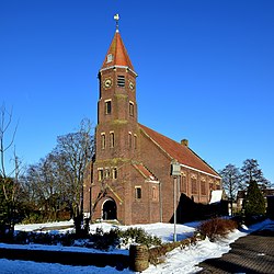
Echten is a village in the Dutch province of Drenthe and is part of the De Wolden municipality. The havezate Huis te Echten is located in the village.

References

  1. 1 2 3 "Kerncijfers wijken en buurten 2021". Central Bureau of Statistics. Retrieved 12 March 2022.
  2. "Postcodetool for 7916PA". Actueel Hoogtebestand Nederland (in Dutch). Het Waterschapshuis. Retrieved 12 March 2022.
  3. "Elim". Plaatsengids (in Dutch). Retrieved 12 March 2022.
  4. 1 2 "Elim". Etymologiebank (in Dutch). Retrieved 12 March 2022.