
Macon County Airport is a public use airport in Macon County, North Carolina, United States. Owned by the Macon County Airport Authority, it is located three nautical miles (6 km) northwest of central business district of Franklin, North Carolina, in the Iotla Valley of the Great Smoky Mountains. This airport is included in the National Plan of Integrated Airport Systems for 2017–2021, which categorized it as a general aviation facility.

Lynchburg Regional Airport, also known as Preston Glenn Field, is a public use airport in Campbell County, Virginia, United States. It is located at the intersection of Route 29 South and Route 460, five nautical miles southwest of the central business district of the City of Lynchburg, which owns the airport. Originally known as Preston Glenn Airport, it was named for Lt. Preston Glenn, a Lynchburg native who died while serving in World War I as an Army Air Corps pilot. Mostly used for general aviation, the airport is also served by one commercial airline, American Eagle Airlines flying on behalf of American Airlines with Canadair Regional Jet aircraft to Charlotte Douglas International Airport in Charlotte, North Carolina..

North Perry Airport is a public airport in the City of Pembroke Pines, 5 miles (8 km) west of the central business district of Hollywood, in Broward County, Florida, United States. The airport is owned by the Broward County Aviation Department. It is a general aviation airport devoted to private and business light aircraft activity.

Coastal Carolina Regional Airport is a public airport located three miles (5 km) southeast of central business district of New Bern, a town in Craven County, North Carolina, United States. EWN covers 785 acres of land.
Lincolnton–Lincoln County Regional Airport is a public use airport located five nautical miles (9 km) east of the central business district of Lincolnton, a city in Lincoln County, North Carolina, United States. It is owned by the City of Lincolnton & Lincoln County. According to the FAA's National Plan of Integrated Airport Systems for 2009–2013, it is a general aviation airport.

Raleigh Exec: The Raleigh Executive Jetport @ Sanford-Lee County or Raleigh Exec Jetport at Sanford-Lee CountyFAA Airport Master Record for TTA is a public use airport located seven nautical miles northeast of the central business district of Sanford, a city in Lee County, North Carolina, United States. It is owned by the Sanford-Lee County Regional Airport Authority and was previously known as Sanford-Lee County Regional Airport. This airport is included in the National Plan of Integrated Airport Systems for 2011–2015, which categorized it as a reliever airport for Raleigh-Durham International Airport.
Elkin Municipal Airport is a public airport in Surry County, North Carolina, United States, three miles northeast of Elkin. It is owned by the Town of Elkin; the National Plan of Integrated Airport Systems for 2011–2015 called it a general aviation facility.

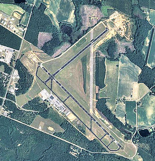
Western Carolina Regional Airport is a county-owned public-use airport located two nautical miles (3.7 km) west of the central business district of Andrews, in Cherokee County, North Carolina, United States. It was formerly known as Andrews-Murphy Airport.
Michael J. Smith Field is a public airport located one mile (2 km) north of the central business district of Beaufort and northeast of Morehead City, in Carteret County, North Carolina, United States. It is owned by the Beaufort-Morehead City Airport Authority.
Curtis L. Brown Jr. Field is a town owned, public use airport located two nautical miles (4 km) southeast of the central business district of Elizabethtown, a town in Bladen County, North Carolina, United States. It is included in the National Plan of Integrated Airport Systems for 2011–2015, which categorized it as a general aviation facility.
Columbus County Municipal Airport is a county-owned, public-use airport in Columbus County, North Carolina, United States. It is located three nautical miles (6 km) south of the central business district of Whiteville, North Carolina. This airport is included in the National Plan of Integrated Airport Systems for 2011–2015, which categorized it as a general aviation facility.
Davidson County Airport is a public use airport in Davidson County, North Carolina, United States. It is owned by the Davidson County Airport Authority and located three nautical miles (6 km) southwest of the central business district of Lexington, North Carolina. It is included in the National Plan of Integrated Airport Systems for 2011–2015, which categorized it as a general aviation facility.
Pittsburgh–Monroeville Airport is a public-use airport located one nautical mile (1.8 km) north of the central business district of Monroeville, in Allegheny County, Pennsylvania, United States. The airport is privately owned by the estate of Helen M. Brown and is also known as the Harold W. Brown Memorial Field.

Moton Field Municipal Airport is a public-use airport located three nautical miles north of the central business district of Tuskegee, a city in Macon County, Alabama, United States. The airport is owned by the City of Tuskegee. It is included in the FAA's National Plan of Integrated Airport Systems for 2011–2015, which categorized it as a general aviation facility.
Bradford Field is a private-use airport located three miles (4.8 km) east of the central business district of Huntersville, a town in Mecklenburg County, North Carolina, United States. It is privately owned by W. O. & Cecil D. Bradford. It was opened in the late 1960s by the Bradford brothers at the request of a few private aircraft owners in the town of Huntersville. The original turf airport in Huntersville was little more than a fenced in cow pasture located at one end of the Meacham farm south of Huntersville. A minor aircraft accident involving a Piper J-3 "Cub" and the subsequent FAA investigation led to the closing of Meacham field, and the forced relocation of the two aircraft hangared there.
Statesboro–Bulloch County Airport is a public airport located three miles (5 km) northeast of the central business district of Statesboro, a city in Bulloch County, Georgia, United States. It is owned by the City of Statesboro and Bulloch County. Currently, there is no commercial service to the airport.

Weedon Field is a city-owned, public-use airport located three nautical miles north of the central business district of Eufaula, a city in Barbour County, Alabama, United States.

Simmons Army Airfield is a military use airport located in Cumberland County, North Carolina, United States. It is located on the southeast portion of Fort Bragg and supports the aviation needs of the XVIII Airborne Corps, the 82nd Airborne Division, Special Operations, U.S. Army Reserve and U.S. National Guard aviation units.
Wilson's Airport is a privately owned, public use airport located four nautical miles south of the central business district of Hickory, a city in Catawba County, North Carolina, United States.
Shiflet Field is a public use airport located three nautical miles (6 km) north of the central business district of Marion, a city in McDowell County, North Carolina, United States. It is owned by the Marion Airport Commission.


