
Cheval is an unincorporated census-designated place in Hillsborough County, Florida, United States. The population was 10,702 at the 2010 census, up from 7,602 at the 2000 census.

University is an unincorporated census-designated place in Hillsborough County, Florida, United States. The population was 41,163 at the 2010 census, up from 30,736 at the 2000 census. The University of South Florida is located just southeast of the community, within the Tampa city limits. The community is also known as "University West", mainly due to its location in relation to the university. The community is often notoriously referred to by locals as "Suitcase City" due to the high rate of transients.

Karnak is a village in Pulaski County, Illinois, United States. The population was 619 at the 2000 census.

Creekside is a home rule-class city in Jefferson County, Kentucky, United States. The population was 305 at the 2010 census.

Allouez Township is a civil township of Keweenaw County in the U.S. state of Michigan. As of the 2000 census, the township population was 1,584.

Clinton Charter Township is a charter township and a census-designated place (CDP) of Macomb County in the U.S. state of Michigan. It is a part of Metro Detroit. As of the 2010 census, the township had a total population of 96,796, and is Michigan's most populous township. It is also the tenth largest municipality in Michigan. The township sports relatively wide socioeconomic diversity; for the most part, it is a mix of middle class communities, but it includes many upscale, exclusive areas that many notable people, such as Eminem, call home. Clinton Township is home to many parks, notably George George Memorial Park. The main branch of the Clinton River, for which the township was named, runs through Clinton Township.

Pasadena Hills is a city in St. Louis County, Missouri, United States. The population was 930 at the 2010 census. The entire city is listed on the National Register of Historic Places.
Cable is a town in Bayfield County, Wisconsin, United States. Its population was 825 at the 2010 U.S. census. The census-designated place of Cable and the unincorporated communities of Leonards and Radspur are located in the town.

Wyocena is a town in Columbia County, Wisconsin, United States. The population was 1,543 at the 2000 Census. The Village of Wyocena is located within the town. Wyocena is part of the Madison, WI Metropolitan Statistical Area.

El Jobean is an unincorporated community in Charlotte County, Florida, United States. It is located off County Road 776, on the northern banks of the Myakka River. The community is part of the Punta Gorda Metropolitan Statistical Area.
Anthony is an unincorporated community in Marion County, Florida, United States. It is located on County Road 200A. The community is part of the Ocala Metropolitan Statistical Area. Although it is unincorporated, Anthony has a post office with ZIP code 32617.
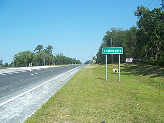
Fellowship is an unincorporated community in Marion County, Florida, United States. It is located near the intersection of U.S. 27 and County Road 464. The community is part of the Ocala Metropolitan Statistical Area.

Lowell is an unincorporated community in Marion County, Florida, United States, located near the intersection of County Road 329 and County Road 25A. The community is part of the Ocala Metropolitan Statistical Area.

Martin is an unincorporated community in Marion County, Florida, United States, located on County Road 25A. The community is part of the Ocala Metropolitan Statistical Area.
Rainbow Lakes Estates is an unincorporated community in Marion County, Florida, United States, established as a Municipal Services District. The community is part of the Ocala Metropolitan Statistical Area. This community is northwest of Rainbow Springs a natural spring located in Rainbow Springs State Park which is nearby. There are various community owned and maintained facilities as well as paved roads. A large percentage of the platted building lots are unimproved. It is located in the western part of the county, off US 41, several miles north of Dunnellon. Although the community is predominantly in Marion County, a small part of the western section falls into Levy County.

Zuber is an unincorporated community in Marion County, Florida, United States. It is located near the intersection of State Road 326 and County Road 25A. Its commerce is supported by its proximity to Interstate 75.
29.859°N 82.438°W
Waters Lake is an unincorporated community in Gilchrist County, Florida, United States. It is located about 5 miles (8.0 km) south of Craggs, just east of State Road 47 on a lake of the same name, for which it is named.
The United States Border Patrol operates 71 traffic checkpoints, including 33 permanent traffic checkpoints, near the Mexico–United States border. The stated primary purpose of these inspection stations is to deter illegal immigration and smuggling activities. After the September 11 attacks in 2001, they took on the additional role of terrorism deterrence. These checkpoints are located between 25 and 75 miles of the Mexico–United States border along major U.S. highways; near the southern border of the contiguous United States. Their situation at interior locations allow them to deter illegal activities that may have bypassed official border crossings along the frontier. The checkpoints are divided among nine Border Patrol sectors. There are a number of these checkpoints near the northern border of the contiguous U.S. as well ; within 100 miles (160 km) of the Canada–U.S. border.
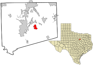
Coyote Flats is a city in Johnson County in the U.S. state of Texas. As of the 2010 census, before the community was incorporated, the population was 312.


