Related Research Articles
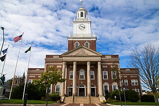
Strafford County is a county in the U.S. state of New Hampshire. As of the 2020 census, the population was 130,889. Its county seat is Dover. Strafford County was one of the five original counties identified for New Hampshire in 1769. It was named after William Wentworth, 2nd Earl of Strafford in the mistaken belief that he was the ancestor of governor John Wentworth – although they were distantly related, William had no descendants. The county was organized at Dover in 1771. In 1840, the size of the original county was reduced with the creation of Belknap County.

Portsmouth is a city in Rockingham County, New Hampshire, United States. At the 2020 census it had a population of 21,956. A historic seaport and popular summer tourist destination on the Piscataqua River bordering the state of Maine, Portsmouth was formerly the home of the Strategic Air Command's Pease Air Force Base, since converted to Portsmouth International Airport at Pease.

Franklin is a city in Merrimack County, New Hampshire, United States. At the 2020 census, the population was 8,741, the lowest figure of New Hampshire's 13 cities. Franklin includes the village of West Franklin.

Deerfield is a town in Rockingham County, New Hampshire, United States. The population was 4,855 at the 2020 census, up from 4,280 in 2010. Deerfield is the location of the annual Deerfield Fair.

Stratham is a town in Rockingham County, New Hampshire, United States. The town had a population of 7,669 at the 2020 census. It is bounded on the west by the Squamscott River. The town is the home of the only U.S. Lindt & Sprüngli factory and the headquarters of the Timberland Corporation.
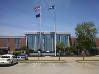
Dover is a city in Strafford County, New Hampshire, United States. The population was 32,741 at the 2020 census, making it the most populous city in the New Hampshire Seacoast region and the fifth most populous city in New Hampshire.

Durham is a town in Strafford County, New Hampshire, United States. The population was 15,490 at the 2020 census, up from 14,638 at the 2010 census. Durham is home to the University of New Hampshire.

St. Paul's School is a college-preparatory, coeducational boarding school in Concord, New Hampshire, affiliated with the Episcopal Church. The school's 2,000-acre (8.1 km2), or 3.125 square mile, campus serves 540 students, who come from 37 states and 28 countries.
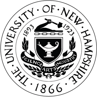
The University of New Hampshire (UNH) is a public land-grant research university with its main campus in Durham, New Hampshire, United States. It was founded and incorporated in 1866 as a land grant college in Hanover, moved to Durham in 1893, and adopted its current name in 1923.

New Hampshire Route 107 is a 69.108-mile-long (111.219 km) north–south state highway in eastern New Hampshire. It connects Laconia in the Lakes Region with Seabrook on the Atlantic coast. The southern terminus of NH 107 is at U.S. Route 1 in Seabrook near the entrance to Seabrook Station Nuclear Power Plant. The northern terminus is at U.S. Route 3 on the Laconia/Gilford town line.

The Lamprey River is a 50.2-mile-long (80.8 km) river in southeastern New Hampshire, the United States. It rises in Meadow Lake in Northwood, and flows south, then generally east through Raymond, Epping, Lee, Durham and finally Newmarket. Here, it meets Great Bay, a tidal inlet of the Atlantic Ocean, to which it is connected by a tidal estuary, the Piscataqua River. The river from the Bunker Pond Dam in Epping to the confluence with the Piscassic River is part of the designated National Wild and Scenic River System.
Lesbian, gay, bisexual, transgender, and queer (LGBTQ) people in the U.S. state of New Hampshire enjoy the same rights as non-LGBTQ people, with most advances in LGBT rights occurring in the state within the past two decades. Same-sex sexual activity is legal in New Hampshire, and the state began offering same-sex couples the option of forming a civil union on January 1, 2008. Civil unions offered most of the same protections as marriages with respect to state law, but not the federal benefits of marriage. Same-sex marriage in New Hampshire has been legally allowed since January 1, 2010, and one year later New Hampshire's civil unions expired, with all such unions converted to marriages. New Hampshire law has also protected against discrimination based on sexual orientation since 1998 and gender identity since 2018. Additionally, a conversion therapy ban on minors became effective in the state in January 2019. In effect since January 1, 2024, the archaic common-law "gay panic defence" was formally abolished; by legislation implemented within August 2023.

Dover Senior High School, known colloquially as Dover High School (DHS), or Dover High School and Career Technical Center, serves the city of Dover and the towns of Barrington and Nottingham, New Hampshire. It serves roughly 1,300 students with general education and vocational education programs as part of the Dover School District. Linked by a road to Dover Middle School, the campus borders the Bellamy River. An alternative school is located across the road from the school, whose students are typically allowed to attend classes at both schools.

Ann L. McLane Kuster is an American lawyer and politician who served as the U.S. representative for New Hampshire's 2nd congressional district from 2013 to 2025. A member of the Democratic Party, she previously worked as a lobbyist.
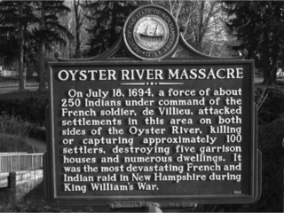
The Raid on Oyster River, also known as the Oyster River Massacre, happened during King William's War, on July 18, 1694, when a group of Abenaki and some Maliseet, directed by the French, attacked an English settlement at present-day Durham, New Hampshire.

Miles Smith Farm is a family-owned grass-fed beef farm located on Whitehouse Road in Loudon, New Hampshire, United States. Currently a working family farm with stonewalls built by the original owner, Miles Smith, its 26 acres (11 ha) have a panoramic view of the Merrimack Valley to the southwest.
Sheila LaBarre is an American murderer and possible serial killer. She was sentenced to two consecutive life sentences, with no prospect of parole after being convicted of killing two men, Kenneth Countie and Michael Deloge, in Epping, New Hampshire. At the time of the crimes, LaBarre lived in Epping on a farm.
Emery Farm is a historic farm property at 16 Emery Lane in Stratham, New Hampshire. The farmhouse, built about 1740, is a fine example of period architecture, with later 19th century stylistic alterations. The property is notable as one of New Hampshire's first market garden farms, a practice adopted by John Emery in 1855. The property was listed on the National Register of Historic Places in 2017.
Emery Farm may refer to:
References
- 1 2 "Emery Farm will soon open a cafe" . Retrieved 25 February 2017.
- ↑ Pfeiffer, Sacha (5 September 2007). "Emery Farm preserves the land, and a way of life" . Retrieved 25 February 2017.
- ↑ "Emery Farm | The Town of Durham New Hampshire". www.ci.durham.nh.us. Retrieved 2024-11-24.
- ↑ Press Release, Community (November 22, 2019). "Emery Farm Blog- New Market and Cafe".
- ↑ "Man who sexually assaulted workers at N.H. farm sentenced to 255 years". www.boston.com. Associated Press. Retrieved 2024-11-24.
- ↑ "The Menu Makers". UNH Today. 2015-11-24. Retrieved 2024-11-24.