Related Research Articles
The Global 200 is the list of ecoregions identified by the World Wide Fund for Nature (WWF), the global conservation organization, as priorities for conservation. According to WWF, an ecoregion is defined as a "relatively large unit of land or water containing a characteristic set of natural communities that share a large majority of their species dynamics, and environmental conditions". For example, based on their levels of endemism, Madagascar gets multiple listings, ancient Lake Baikal gets one, and the North American Great Lakes get none.
The Kipengere Range, also known as the Livingstone Mountains, lies entirely in Njombe Region in southwest Tanzania at the northern end of Lake Nyasa. Near Lake Nyasa they are known as the Kinga Mountains. It is a plateau-like ridge of mountains running southeastwards from the basin of the Great Ruaha River in the north to that of the Ruhuhu River in the south, and forms part of the eastern escarpment of the East African Rift. The range is mostly clad in montane grasslands, renowned for their botanical diversity and displays of flowers, with montane evergreen forests mostly in stream valleys.

Mount Nimba Strict Nature Reserve is a protected area and UNESCO World Heritage Site located in both Guinea and Côte d'Ivoire, extending over a total of area of 175.4 km2, with 125.4 km2 in Guinea, and 50 km2 in Côte d'Ivoire. The reserve covers significant portions of the Nimba Range, a geographically unique area with unusually rich flora and fauna, including exceptional numbers of single-site endemic species, such as Nimbaphrynoides, the Nimba otter shrew, and multiple species of horseshoe bats. Its highest peak is Mount Richard-Molard at 1,752 m (5,750 ft), which is the highest peak of both countries.
The Udzungwa Mountains are a mountain range in south-central Tanzania. The mountains are mostly within Iringa Region, south of Tanzania's capital Dodoma. The Udzungwa Mountains are part of the Eastern Arc Mountains, and are home to a biodiverse community of flora and fauna with large numbers of endemic species.
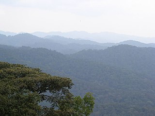
The Albertine Rift montane forests is a tropical moist broadleaf forest ecoregion in east-central Africa. The ecoregion covers the mountains of the northern Albertine Rift, and is home to distinct Afromontane forests with high biodiversity.

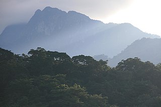
The New Guinea Highlands, also known as the Central Range or Central Cordillera, is a long chain of mountain ranges on the island of New Guinea, including the island's tallest peak, Puncak Jaya, Indonesia, 16,024 ft (4,884 m), the highest mountain in Oceania. The range is home to many intermountain river valleys, many of which support thriving agricultural communities. The highlands run generally east-west the length of the island, which is divided politically between Indonesia in the west and Papua New Guinea in the east.

The Central Range montane rain forests is a tropical moist forest ecoregion on the island of New Guinea. The ecoregion covers the Central Range of the New Guinea Highlands, which extends along the spine of the island. The montane rain forests of the ecoregion are distinct from the surrounding lowland forests, and are home to many endemic plants and animals.

The Central Range sub-alpine grasslands is a montane grasslands and shrublands ecoregion on the island of New Guinea. The ecoregion covers the highest-elevation portions of the New Guinea Highlands, which extend along the spine of the island. The high elevations support rare tropical sub-alpine and alpine habitats, including many endemic plants and animals.
The Southern Highlands is a highland region in southwestern Tanzania, at the northern end of Lake Malawi. The highlands include portions of Mbeya, Njombe, Rukwa, Ruvuma, and Songwe regions, bordering Malawi, Mozambique, and Zambia. Mbeya is the largest city in the highlands.

The Guinean montane forests are a tropical moist broadleaf forest ecoregion of West Africa.
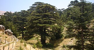
The Southern Anatolian montane conifer and deciduous forests ecoregion, in the Mediterranean forests, woodlands, and scrub biome, is in the eastern Mediterranean Basin.
The Nimba Range forms part of the southern extent of the Guinea Highlands, adjacent to the Toura Mountains. The highest peak is Mount Nimba on the border of Liberia, Côte d'Ivoire and Guinea, at 1,752 m (5,748 ft), and at the intersection of the Nimba and Toura Mountains. "Mount Nimba" may refer either to Mount Richard-Molard or to the entire range. Other peaks include Grand Rochers at 1,694 m (5,558 ft), Mont Sempéré at 1,682 m (5,518 ft), Mont Piérré Richaud at 1,670 m (5,480 ft), Mont Tô at 1,675 m (5,495 ft), and Mont LeClerc 1,577 m (5,174 ft), all of them are located in Guinea. Mount Nimba Strict Nature Reserve of Guinea and Côte d'Ivoire covers significant portions of the Nimba Range.
The Rubeho Mountains are a mountain range in central Tanzania. The mountains in Dodoma and Morogoro regions, southeast of Tanzania's capital Dodoma. The Rubeho Mountains are part of the Eastern Arc Mountains, and are home to a biodiverse community of flora and fauna with large numbers of endemic species.

The Vogelkop montane rain forests is a tropical moist forest ecoregion in western New Guinea. The ecoregion covers the mountains of western New Guinea's Bird's Head and Bomberai peninsulas.

The Northern New Guinea montane rain forests is a tropical moist forest ecoregion in northern New Guinea. The ecoregion covers several separate mountain ranges lying north of New Guinea's Central Range and south of the Pacific Ocean.

Mamberamo Foja Wildlife Reserve is a large protected area on New Guinea, in Indonesia's Papua Province. It covers an area of 16,610 km2, and extends along the Mamberamo River and its tributaries from the foothills of the Central Range to the Pacific Ocean.
The Wondiboy Peninsula, also known as the Wondiwoi, Wandammen, Wondama, or in old sources Mandamy is a mountainous peninsula in Wondama Bay Regency, Western New Guinea. It extends northwards from the Bird's Neck Isthmus into Cenderawasih Bay, and is composed administratively of the Rasiei, Wondiboy, Wasior and Teluk Duairi Districts (kecamatan) within the regency. At the northern end of the peninsula the land breaks up into a series of islands which form Roon District, of which the largest is Roon Island.
The Bird's Neck Isthmus is an isthmus in western New Guinea. It connects the main mass of the island to its two large western peninsulas, the Bird's Head Peninsula, also known as the Vogelkop or Doberai Peninsula, and the Bomberai Peninsula. The isthmus is mostly covered in lowland tropical rain forest.
The Weyland Mountains, also known as the Kobowre Mountains, are a mountain range in Western New Guinea. The Weyland Mountains are the westernmost mountains in New Guinea's Central Range, which extends eastwards to the island's southeastern tip.
The Kumawa Mountains are a mountain range in Western New Guinea. The Kumawa Mountains are a coastal range located on the southwestern Bomberai Peninsula. They are in West Papua Province in the Indonesian portion of New Guinea.
References
- 1 2 UNEP-WCMC (2024). Protected Area Profile for Enarotali from the World Database on Protected Areas. Retrieved 7 March 2024.
- ↑ Central Range montane rain forests. DOPA Explorer. Accessed 7 March 2024.