Suffolk is a ceremonial county in the East of England and East Anglia. It is bordered by Norfolk to the north, the North Sea to the east, Essex to the south, and Cambridgeshire to the west. Ipswich is the largest settlement and the county town.

Hadleigh is an ancient market town and civil parish in the Babergh district of Suffolk, England. The town is situated next to the River Brett, between the larger towns of Sudbury and Ipswich. It had a population of 8,253 at the 2011 census. The headquarters of Babergh District Council were located in the town until 2017.
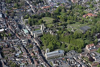
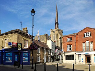
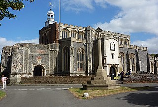
Bury St Edmunds, commonly referred to locally as Bury is a cathedral as well as market town and civil parish in the West Suffolk district, in the county of Suffolk, England. The town is best known for Bury St Edmunds Abbey and St Edmundsbury Cathedral. Bury is the seat of the Diocese of St Edmundsbury and Ipswich of the Church of England, with the episcopal see at St Edmundsbury Cathedral. In 2011 it had a population of 45,000. The town, originally called Beodericsworth, was built on a grid pattern by Abbot Baldwin around 1080. It is known for brewing and malting and for a British Sugar processing factory, where Silver Spoon sugar is produced. The town is the cultural and retail centre for West Suffolk and tourism is a major part of the economy.
Mid Suffolk is a local government district in Suffolk, England. The district is primarily a rural area, containing just three towns, being Stowmarket, Needham Market and Eye. Its council was based in Needham Market until 2017 when it moved to shared offices with neighbouring Babergh District Council in Ipswich, outside either district. In 2021 it had a population of 103,417.

Babergh District is a local government district in Suffolk, England. In 2021 it had a population of 92,300. The district is primarily a rural area, containing just two towns, Sudbury and Hadleigh, which was the administrative centre until 2017 when the council moved to shared offices with neighbouring Mid Suffolk District Council in Ipswich, outside either district. The district is named after the medieval Babergh Hundred, which covered part of the area.
East Bergholt is a village in the Babergh District of Suffolk, England, just north of the Essex border.

Stowmarket is a market town and civil parish in the Mid Suffolk district, in Suffolk, England, on the busy A14 trunk road between Bury St Edmunds to the west and Ipswich to the southeast. The town lies on the Great Eastern Main Line (GEML) between Diss and Needham Market, and lies on the River Gipping, which is joined by its tributary, the River Rat, to the south of the town.
Thomas Gainsborough School, formerly Great Cornard Upper School, is a secondary school and sixth form in the village of Great Cornard, part of the town of Sudbury in the English county of Suffolk that educates approximately 1,400 pupils.

Long Melford, colloquially and historically also referred to as Melford, is a large village and civil parish in the Babergh district, in the county of Suffolk, England. It is on Suffolk's border with Essex, which is marked by the River Stour, 3 miles (4.8 km) from Sudbury, approximately 16 miles (26 km) from Colchester and 14 miles (23 km) from Bury St Edmunds. It is one of Suffolk's "wool towns" and is a former market town. The parish also includes the hamlets of Bridge Street and Cuckoo Tye. In 2011 the parish had a population of 3918.

Suffolk County Council is the upper-tier local authority for the county of Suffolk, England. It is run by 75 elected county councillors representing 63 divisions. It is a member of the East of England Local Government Association.

Ipswich High School is a co-educational private school at Woolverstone Hall near Ipswich, England. Formerly an exclusive school for girls, it was converted to co-education in 2018 following acquisition by the China-oriented investment banker London & Oxford Group.
Shotley is a village and civil parish 8 miles (13 km) south-east of Ipswich in the English county of Suffolk. It is in the Babergh district and gives its name to the Shotley peninsula between the Rivers Stour and Orwell. The parish includes the village of Shotley and the settlements of Shotley Gate and Church End. In 2011 civil parish had a population of 2,342. In reference to the 2021 census, the population of Shotley was 550.
Wherstead is a village and a civil parish located in the county of Suffolk, England. Wherstead village lies 3 miles (4.8 km) south of Ipswich on the Shotley peninsula. It is in the Belstead Brook electoral division of Suffolk County Council.

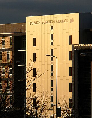
Ipswich Borough Council is the local authority for Ipswich, a non-metropolitan district with borough status in Suffolk, England. It is the second tier of a two-tier system, fulfilling functions such as refuse collection, housing and planning, with Suffolk County Council providing county council services such as transport, education and social services.
The Shotley Peninsula is a rural area east of the A137 Ipswich-Colchester road located between the rivers Stour and Orwell in Suffolk, England. The peninsula is named after the settlements of Shotley and Shotley Gate which are situated near its south-eastern tip. Other villages on the peninsula include Chelmondiston, Erwarton (Arwarton), Freston, Harkstead, Holbrook, Stutton, Tattingstone, Wherstead and Woolverstone.
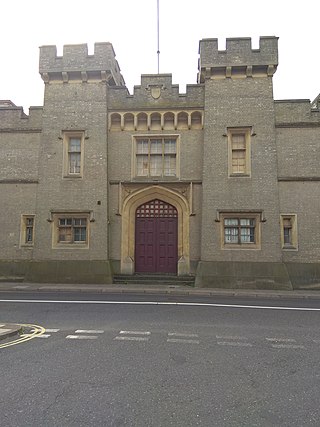
East Suffolk County Hall is a historic building located in St Helen's Street in Ipswich. The building, which was the headquarters of East Suffolk County Council until 1974 and then of Suffolk County Council until 2004, is a Grade II listed building.
Grafton House is the headquarters for Ipswich Borough Council and Smartest Energy. Located on Russell Road opposite Endeavour House, Grafton House is a 6-storey building and was designed by Consarc Consulting Architects and construction was completed in 2006 as part of the Ipswich Village Development. The building consists of mixed retail units at ground level including a coffee shop and 60,000 sq feet of office space. Grafton House was also classed as 'very good' by BREEAM standards.
The Ipswich Village Development is a 125-acre area, situated around Portman Road stadium, Ipswich England. The main road of the development is Russell Road which was built to House TXU Corporation and bring the corporation under one roof however Suffolk County Council bought the building after the energy company hit financial difficulties, Russell Road is also home to the Ipswich Crown Court and is also home Ipswich Borough Council and Smart Energy are located opposite in Grafton House. Ipswich Crown Court is located at the start of Russell Road as well as number of government and political companies being housed on the road.

East Suffolk is a local government district in Suffolk, England. The largest town is Lowestoft, which contains Ness Point, the easternmost point of the United Kingdom. The second largest town is Felixstowe, which has the country's largest container port. On the district's south-western edge it includes parts of the Ipswich built-up area. The rest of the district is largely rural, containing many towns and villages, including several seaside resorts. Its council is based in the village of Melton. The district was formed in 2019 as a merger of the two previous districts of Suffolk Coastal and Waveney. In 2021 it had a population of 246,058. It is the most populous district in the country not to be a unitary authority.

The 2021 Suffolk County Council election took place on 6 May 2021 as part of the 2021 local elections in the United Kingdom. All 75 councillors were elected from 63 electoral divisions, which return either one or two county councillors each, by first-past-the-post voting, for a four-year term of office.