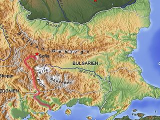
The Struma or Strymónas is a river in Bulgaria and Greece. Its ancient name was Strymṓn. Its drainage area is 17,330 km2 (6,690 sq mi), of which 10,797 km2 (4,169 sq mi) in Bulgaria, 6,295 km2 (2,431 sq mi) in Greece and the rest in north Macedonia. It takes its source from the Vitosha Mountain in Bulgaria, runs first westward, then southward, forming a number of gorges, enters Greek territory at the Kula village. In Greece it is the main waterway feeding and exiting from Lake Kerkini, a significant centre for migratory wildfowl. The river flows into the Strymonian Gulf in Aegean Sea, near Amphipolis in the Serres regional unit. The river's length is 415 kilometres.

Gabrovo is a city in central northern Bulgaria, the administrative centre of Gabrovo Province.

Livingston Island is an Antarctic island in the South Shetland Islands, Western Antarctica lying between the islands of Greenwich and Snow. It was the first land discovered south of 60° south latitude in 1819, an event that marked the end of a centuries-long pursuit of the mythical Terra Australis Incognita and the beginning of the exploration and utilization of real Antarctica. The name Livingston, although of unknown derivation, has been well established in international usage since the early 1820s.

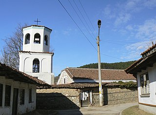
Boboshevo is a town in Western Bulgaria. It is located in Kyustendil Province and is close to the towns of Kocherinovo and Rila.

Karnobat is a town in the Burgas Province, Southeastern Bulgaria. It is the administrative centre of the homonymous Karnobat Municipality. As of December 2009, the town has a population of 18,480 inhabitants.

Opaka is a town in Targovishte Province in northeast Bulgaria. As of December 2009, the town had a population of 2,873 and covers an area of 57 square kilometres (22 sq mi). It is 70 kilometres (43 mi) south of the city of Rousse on the border with Romania and 250 kilometres (160 mi) northeast of the Bulgarian capital, Sofia. Archeologists have found evidence of Thracian, Roman and Slavonic settlements in the area. Near the village of Krepcha, a stone monastery is the site of the oldest known Old Bulgarian Cyrillic inscription, dated from around 920 CE. A 2nd century Thracian tumulus containing various artifacts, including six leaves of a golden wreath and bronze figurines, was excavated in 2011.

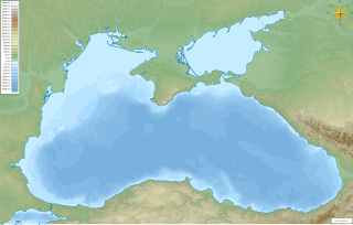
Strandzha is a mountain massif in southeastern Bulgaria and the European part of Turkey. It is in the southeastern part of the Balkans between the plains of Thrace to the west, the lowlands near Burgas to the north, and the Black Sea to the east. Its highest peak is Mahya Dağı in Turkey, while the highest point on Bulgarian territory is Golyamo Gradishte. The total area is approximately 10,000 km2 (3,861 sq mi).

Etropole is a town in western Bulgaria, part of Sofia Province. It is located close to the northern slopes of the Balkan Mountains in the valley of the Iskar River 80 km (49.71 mi) from Sofia.

Poibrene is a village in the Panagyurishte municipality, western Bulgaria. It is located 18 km (11 mi) west of the town and has 850 inhabitants. The large dam Topolnitsa is 1 km west of the village. Several monuments there commemorate participants in the April Uprising. Due to the dam, the baths and the clear natural environment, many citizens of Panagyurishte have summer houses in or near the village.

Sredets is a town in Burgas Province in southeastern Bulgaria. It is located near Lake Mandrensko and the northern slopes of Strandzha. Sredets is the administrative centre of Sredets Municipality.

Rila is a town in southwestern Bulgaria, in Rila Municipality, part of Kyustendil Province. It is the administrative centre of Rila Municipality, which lies in the southeastern part of Kyustendil Province.

Draslajca is a village in the south-western region of the Republic of Macedonia.
Bezmer is a village (село) in southeastern Bulgaria, located in the Tundzha Municipality of the Yambol Province. It is located 10 km (6 mi) west of the town of Yambol.

Dobroslavtsi is a village (село) in western Bulgaria, located in the Sofia-city (Sofiya-Grad) Province. It is located 15 km (9 mi) from the city of Sofia.

Golemo Selo is a small village located between the towns of Dupnitsa and Bobov Dol in Kyustendil Province, western Bulgaria. The village name means "big village". The population of the village is 573 inhabitants. At the borders of the village, to the south-west, is situated the Bobov Dol Power Plant.

Berende is a village in Dragoman Municipality, Sofia Province, in the westernmost part of Bulgaria near the border with Serbia.

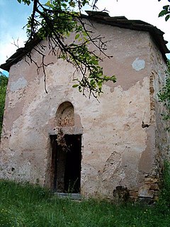
Stob is a village in southwest Bulgaria, administratively part of Kocherinovo Municipality, Kyustendil Province. Located at the foot of the Rila mountains and not far from the Rila Monastery, Stob was first mentioned in the 7th century and has been in continuous or near-continuous existence since then. Stob is notable for the Stob Earth Pyramids, a natural rock phenomenon in the vicinity of the village.

Devetàshka cave is a large karst cave around 7 km (4.3 mi) east of Letnitsa and 15 km (9.3 mi) northeast of Lovech, near the village of Devetaki on the east bank of the river Osam, in Bulgaria. The site has been continuously occupied by Paleo humans for tens of thousands of years, served as a shelter for various faunal species during extensive periods and is now home to nearly 30,000 bats.

Buzludzha is a historical peak in the Central Balkan Mountains, Bulgaria. The mountain is located to the east of the Shipka Pass near the town of Kazanlak and is a site of historical importance. The peak is 1,441 metres high. It was renamed to Hadzhi Dimitar in 1942 but remains popularly known as Buzludzha. The summit is built up of limestone and granite. Its slopes are covered with grassy vegetation; its foothills and the neighbouring peaks sustain beech forests.


