Paskalevo Паскалево | |
---|---|
Village | |
Country | |
Province | Dobrich Province |
Municipality | Dobrichka |
Time zone | EET (UTC+2) |
• Summer (DST) | EEST (UTC+3) |
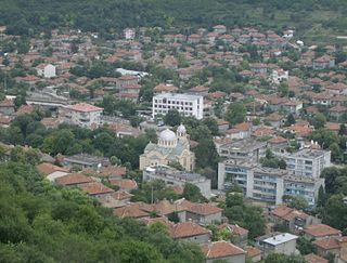
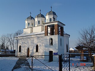
Paskalevo (Bulgarian : Паскалево) is a village in the municipality of Dobrichka, in Dobrich Province, in northeastern Bulgaria. [1]
Bulgarian, is an Indo-European language and a member of the Southern branch of the Slavic language family.
Dobrich Province is a province in northeastern Bulgaria, part of Southern Dobruja geographical region. It is bounded on east by the Black Sea, on south by Varna Province, on west by Yambol & Sliven provinces, on north by Shumen & Varna provinces. It is divided into 8 municipalities. At the 2011 census, it had a population of 186,016.
Formerly, the village was known as Ezi bey (Ези бей) and in Romanian as Ezibei, because it was founded as the chiflik of a 16th-century local Ottoman chieftain (bey) named Ezi. Ethnic Bulgarians settled in the early 19th century, with a further group of settlers brought in by priest Paskal in 1848. These Bulgarians originated from the Sliven and Yambol regions, though they had briefly emigrated to Bessarabia to escape Ottoman persecution after the Russo-Turkish War of 1828–29. [2]
Romanian is an Eastern Romance language spoken by approximately 24–26 million people as a native language, primarily in Romania and Moldova, and by another 4 million people as a second language. It is an official and national language of Romania and Moldova. In addition, it is also one of the official languages of the European Union.
Chiflik, or chiftlik, is a Turkish term for a system of land management in the Ottoman Empire. Before the chiflik system the Empire used a non-hereditary form of land management called the Timar System. Starting as the Empire began to collapse, powerful military officers started to claim land from the Sultan's holding allowing them to pass the land onto their sons thus creating the Chiflik system. This form of land management lasted from the sixteenth century to the collapse of the Ottoman Empire in 1919.
The Ottoman Empire, historically known in Western Europe as the Turkish Empire or simply Turkey, was a state that controlled much of Southeast Europe, Western Asia and North Africa between the 14th and early 20th centuries. It was founded at the end of the 13th century in northwestern Anatolia in the town of Söğüt by the Oghuz Turkish tribal leader Osman I. After 1354, the Ottomans crossed into Europe, and with the conquest of the Balkans, the Ottoman beylik was transformed into a transcontinental empire. The Ottomans ended the Byzantine Empire with the 1453 conquest of Constantinople by Mehmed the Conqueror.
Between 1918 and 1940, the village was part of Caliacra County of the Kingdom of Romania, returning to Bulgarian control with the Treaty of Craiova. It was renamed to Paskalevo in honour of priest Paskal in 1942. [2]
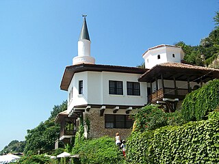
Caliacra County was a county (județ) of Romania in the interwar period, in Southern Dobruja, with the seat at Bazargic.
The Kingdom of Romania was a constitutional monarchy that existed in Romania from 26 March 1881 with the crowning of prince Karl of Hohenzollern-Sigmaringen as King Carol I, until 1947 with the abdication of King Michael I of Romania, and the Romanian parliament proclaiming Romania a socialist republic.
Sveti Vlas, is a town and seaside resort on the Black Sea coast of Bulgaria, located in Nesebar municipality, Burgas Province. As of July 2007, it has a population of 3,869.
Nikopol is a town in northern Bulgaria, the administrative center of Nikopol municipality, part of Pleven Province, on the right bank of the Danube river, 4 kilometres downstream from the mouth of the Osam river. It spreads at the foot of steep chalk cliffs along the Danube and up a narrow valley. As of December 2009, the town has a population of 3,892 inhabitants.
Provadia is a town in northeastern Bulgaria, part of Varna Province, located in a deep karst gorge along the Provadia River not far from the Bulgarian Black Sea Coast. It is the administrative centre of Provadia Municipality. As of December 2009, the town has a population of 12,901 inhabitants.
Kırklareli is a city in the European part of Turkey.
Tutrakan is a town in northeastern Bulgaria, an administrative centre of the homonymous municipality, part of Silistra Province. It is situated on the right bank of the Danube opposite the Romanian town of Oltenița, in the very west of Southern Dobruja, 58 km east of Rousse and 62 km west of Silistra. As of December 2009, the town has a population of 9,476 inhabitants.
Radinovo is a village in Maritsa Municipality, Plovdiv Province, Southern Bulgarian. Its name is sometimes seen as Radenovo. As of 2006 the population is 720.
Dragalevtsi is a quarter of Sofia, part of Vitosha municipality and situated in the southwestern part of the city, at the foot of Vitosha mountain. A former village incorporated into the city in the 20th century, Dragalevtsi is today an affluent quarter built up with luxurious one-family country houses, villas and hotels.
'Lesnovo' is a village in Central Western Bulgaria, part of Elin Pelin Municipality, Sofia Province. As of 2006 it has 1,829 inhabitants. The village came into existence in the 16-17th centuries. Lesnovo has a three-domed Eastern Orthodox church of 'St. Archangel Michael', a rare design in Bulgaria, dating back to the early 20th century; it also features pointed arches. Lesnovo Airport, a small newly-constructed private air strip, located on the South-Easterntern outskirts of the village has compromised the rural peace and quiet of this part of the countryside.
Grivitsa is a village in Pleven Municipality, Pleven Province, central northern Bulgaria. It is primarily known as the site of one of the key engagements in the Siege of Plevna during the Russo-Turkish War of 1877–1878.
Krushari is a village in northeastern Bulgaria, part of Dobrich Province. It is the administrative centre of Krushari Municipality, which lies in the northwestern part of the province. Krushari is located 32 kilometres from the provincial capital of Dobrich, 85 kilometres from Varna and around 70 kilometres from Balchik and Silistra.
Tervel is a town in northeastern Bulgaria, part of Dobrich Province. It is the administrative centre of Tervel Municipality, which lies in the westernmost part of the province. As of December 2009, the town has a population of 6,667 inhabitants.
Medkovets is a village in northwestern Bulgaria, part of Montana Province. It is the administrative centre of the homonymous Medkovets Municipality, which lies in the northern part of Montana Province.
Kaynardzha is a village in northeastern Bulgaria, part of Silistra Province. It is the administrative centre of Kaynardzha Municipality, which lies in the easternmost part of Silistra Province, in the historical region of Southern Dobruja, close to the Romanian border.
Tsarev Brod is a village in northeastern Bulgaria, part of Shumen municipality, Shumen Province. As of 2008, it has a population of 1,344 and the mayor is Stefan Zhivkov. The village lies at 43°20′N27°01′E, 224 metres above mean sea level in the eastern stretches of the Danubian Plain. Until 1934, its name was Endzhe or Enidzhe.
Kovachevitsa is a village in Garmen Municipality, in Blagoevgrad Province, Bulgaria.
Leshten is a mountainous village in Garmen Municipality, in Blagoevgrad Province, Bulgaria. It is situated in the Dabrash part of the Rhodope Mountains, 5 kilometers north of Garmen, 75 kilometers southeast of Blagoevgrad and 2 kilometers south of Gorno Dryanovo on the road between Garmen and Kovachevitsa.
Dobrevo is a village in the municipality of Dobrichka, in Dobrich Province, in northeastern Bulgaria.
Kozloduytsi is a village in the municipality of Dobrichka, in Dobrich Province, in northeastern Bulgaria.
Karali is a village in Gabrovo Municipality, in Gabrovo Province, in northern central Bulgaria.
Kazashka Reka is a village in the municipality of Avren, in Varna Province, northeastern Bulgaria.
Coordinates: 43°38′N27°50′E / 43.633°N 27.833°E
A geographic coordinate system is a coordinate system that enables every location on Earth to be specified by a set of numbers, letters or symbols. The coordinates are often chosen such that one of the numbers represents a vertical position and two or three of the numbers represent a horizontal position; alternatively, a geographic position may be expressed in a combined three-dimensional Cartesian vector. A common choice of coordinates is latitude, longitude and elevation. To specify a location on a plane requires a map projection.
This Dobrich Province, Bulgaria location article is a stub. You can help Wikipedia by expanding it. |