Enghavevej

Last updated
Enghavevej
Enghavevej 01.jpg
Length2,180 m (7,150 ft)
Location Copenhagen, Denmark
Quarter Vesterbro/Kongens Enghave
Nearest metro station Enghave Plads
Coordinates 55°39′51.38″N12°32′32.46″E / 55.6642722°N 12.5423500°E / 55.6642722; 12.5423500
North end Vesterbrogade
Major
junctions
Sønder Boulevard
South end Sydhavns Plads

Enghavevej is a major street in the Vesterbro and Kongens Enghave districts of Copenhagen, Denmark. It runs from Vesterbrogade in the north to Sydhavns Plads in the south, linking Kingosgade with Sydhavnsgade and Borgbjergsvej.

Contents

History

18th and 19th centuries

Enghavevej, 1860 Enghavevej (1850).jpg
Enghavevej, 1860

The name Kongens Enghave (The King's Meadow Garden) is known from 1683 and referred to an area used for production of animal feed for the king's horses. The road was created in 1795 when the area was divided into 22 estates and sold. The road continued all the way to Gammel Køge Landevej. The only buildings along the road were the farms Frederiksholm, Larsens Minde, Lises Minde Frederikslund and Wilhelms Minde. [1]

In 1871, Frederiksholm was acquired by two brothers and converted into a brickworks. Frederiksholm Brickworks produced many of the bricks that were used in the construction of Vesterbro. The brickworks closed in 1918.

20th century

The tramway depot photographed by Frederik Riise Enghavevej - Sporvognsremise.jpg
The tramway depot photographed by Frederik Riise

Arbejdernes Kooperative Byggeselskab (The Workers' Cooperative Building Association) started redeveloping the area shortly after its foundation in 1913.

In 1915, Copenhagen Tramways line 3 was extended from Enghave Plads to a tram loop at Frederiksholm (now Sydhavns Plads). On 15 October 1937, Line 3 was extended to Mozarts Plads. A large remise and workshop complex for the trams was also built at the street.

The outer part of Enghavevej was in 1933 renamed Ellebjergvej, Stubmøllevej, Wagnersvej and Glucksvej. The section from Sydhavns Plads to Mozarts Plads was in 1949 renamed Borgbjergsvej.
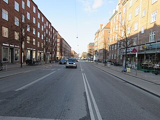
Notable buildings

No. 80-82: CPH Skatepark StreetMekka 2.jpg
No. 80-82: CPH Skatepark

The former Enghavevej School is from 1894–95 and was designed by Ludvig Fenger.

Vega (No. 40) is one of Copenhagen's leading venues for contemporary music. The building is a former assembly building constructed for the labour union in 1956 to a Modernist design by Vilhelm Lauritzen. It was listed on the Danish registry of protected buildings and places in 1995. [2]

The former Copenhagen Tramways remise complex (No. 80-82) has been converted into a centre for street culture and street sports. The activities include Street basketball, parkour, dance, street soccer, street art, beat production, and DJing. It comprises Copenhagen Skatepark and StreetMekka (No. 82D).

No. 170: Vesterbro Fire Station Vesterbro Brandstation 2019.jpg
No. 170: Vesterbro Fire Station

Vesterbro Fire Station (No. 170) was inaugurated on 1 November 1929. The building was designed by city architect Poul Holsøe. [3] The adjacent Bavnehøj School was built 1928-29 to a design by Poul Holsøe in collaboration with Tage Rue.

The housing estate at No. 120 was the first development constructed by Arbejdernes Kiooperative Byggeforening shortly after its foundation in 1913. It is built to a National Romantic design by Christian Mandrup-Poulsen with loggias and Mansard roofs. The housing estate at No. 92-142 was built for Arbejdernes Andels Boligforening (AAB, "The Workers Cooperative Housing Association") in 1945-1946. It was designed by Knud Hansen. Enghaven I (No. 172-84) is from 1932–33 and was designed by Arthur Wittmaack and Vilhelm Hvalsøe.

Public art

Thomas Vincotte's 1885 group sculpture Le dompteur de chevaux seen from Enghavevej Hestebetvingeren (Kobenhavn).jpg
Thomas Vinçotte's 1885 group sculpture Le dompteur de chevaux seen from Enghavevej

In the central reservation of Bavnehøj Allé, facing Enghavevej, stands a copy of Thomas Vinçotte's 1885 group sculpture Le dompteur de chevaux (Horse Tamer).

Transport

The nearest Copenhagen Metro station is Enghave Plads.

Enghave station S-train opened at the street in 1934. It closed on 3 July 2016 as it was replaced by Carlsberg station 200 metres further west. The far end of the street is served by Sydhavn station.

Cultural references

Tipskiosken at Enghavevej 184 was used as a location in the 1984 feature film Midt om natten . [4]

Related Research Articles

<span class="mw-page-title-main">Kongens Enghave</span>

Kongens Enghave, commonly known as Sydhavnen or the postal district of 2450 Copenhagen SV (southwest) is a district in southern Copenhagen. While its core is a largely pre-WWII former working class district, it also contains an upscale residential area along the harbour having been developed after 2000, scattered industrial areas, large parks such as Valbyparken and Sydhavnstippen, allotment gardens and parts of Vestre Kirkegård, the city's largest cemetery.

<span class="mw-page-title-main">Valby</span> District of Copenhagen

Valby ( ) is one of the 10 official districts of Copenhagen Municipality, Denmark. It is in the southwestern corner of Copenhagen Municipality, and has a mixture of different types of housing. This includes apartment blocks, terraced housing, areas with single-family houses and allotments, plus the remaining part of the old Valby village, around which the district has formed, intermingled with past and present industrial sites.

<span class="mw-page-title-main">Istedgade</span> Street in Copenhagen Municipality, Denmark

Istedgade is a 1-kilometer straight street in the district of Vesterbro in the Danish capital, Copenhagen. It starts at Copenhagen Central Station and runs parallel to Vesterbrogade to Enghave Plads and Enghaveparken. From the station in the cheap hotel district, it runs through the porn, prostitution and drugs area to modern Vesterbro, where 1900s tenement style blocks have undergone significant modernisation. It is generally considered the heart of Vesterbro and was a main traffic artery until 2013 where the street had traffic reducing measures installed.

<span class="mw-page-title-main">M4 (Copenhagen Metro)</span>

The M4 of the Copenhagen Metro connects Nordhavn in the north with Sydhavn in the south. The central part of the line shares tracks with the City Circle Line (M3).

Districts of Copenhagen are often based on informal designations based on historic origins, often with alternative names and loosely defined boundaries. Copenhagen Municipality is divided into 10 official administrative districts but they often comprise areas of a heterogeneous character which are informally not seen as one district. Some districts have earlier been official subdivisions and thus have semi-official boundaries. Copenhagen postal code designations often correspond to district boundaries but in some cases differ from them, as an example parts of the city centre has the postal code København V which is generally associated with Vesterbro.

<span class="mw-page-title-main">Enghaveparken</span> Park in Copenhagen Municipality, Denmark

Enghaveparken is a public park in the Vesterbro district of Copenhagen, Denmark. It was laid out in the late 1920s to cater for the citizens of the expanding city. The park is completely closed off while undergoing comprehensive renovations June 2018-December 2019.

<span class="mw-page-title-main">Christ Church, Copenhagen</span> Church in Copenhagen, Denmark

Christ Church is a Church of Denmark parish church situated on Enghave Plads in the Vesterbro district of Copenhagen, Denmark. It was designed by Valdemar Koch, who also built several other churches in Copenhagen around that time. Completed in 1900, it was the first new church to be opened in the fast-growing neighbourhood to relieve the pressure on St. Mathew's. Its style is inspired by Italian Romanesque church architecture.

<span class="mw-page-title-main">Halmtorvet</span> Public square

Halmtorvet is a public square in the Vesterbro district of Copenhagen, Denmark. It is located next to Copenhagen Central Station in front of the Meat District. The oblong square eventually turns into Sønder Boulevard, a broad street with a park strip in its central reserve, which continues to Enghavevej at Enghave station.

<span class="mw-page-title-main">Havneholmen, Copenhagen</span>

Havneholmen is a mixed-use development located on reclaimed land off Kalvebod Brygge in the harbor of Copenhagen, Denmark. It is located just east of the shopping centre Fisketorvet from which it is separated by a narrow canal, although it is annexed to mainland Kalvebod Brygge at its southern end.

<span class="mw-page-title-main">Copenhagen Fire Department</span>

The Greater Copenhagen Fire Department forms the largest municipal fire brigade in Denmark with more than 1000 employees. This includes firefighters, ambulance personnel, administration and service workers and workers in fire prevention.

<span class="mw-page-title-main">Enghave Plads</span> Public square in Copenhagen

Enghave Plads is a central public square of the Vesterbro district in Copenhagen, Denmark. It is located where Istedgade reaches Enghavevej, which separates the square from Enghave Park.

<span class="mw-page-title-main">Vesterbro Pharmacy</span> Building in Copenhagen

Vesterbro Pharmacy operated from 1795 to 1992 in the Vesterbro district of Copenhagen, Denmark. Its former buildings on Vesterbrogade, one facing the street and two in the courtyard on the rear, were listed in 1972; all three date from the second half of the 19th century.

<span class="mw-page-title-main">A/S Københavns Telefonkiosker</span> Defunct operator of manned telephone kiosks in Copenhagen, Denmark

A/S Københavns Telefonkiosker, often referred to as KTK, was an operator of staffed telephone kiosks in Copenhagen, Denmark. The first telephone kiosks were installed in 1896 to an Art Nouveau-influenced National Romantic design by Fritz Koch. A new and somewhat larger model was introduced in 1913 but Koch's original design was again used when a number of new telephone kiosks were installed in 1929.

<span class="mw-page-title-main">Bernstorffsgade</span> Street in Copenhagen, Denmark

Bernstorffsgade is a street located next to Central Station and Tivoli Gardens in central Copenhagen, Denmark. It runs from Vesterbrogade in the northwest to Kalvebod Brygge on the harborfront in the southeast, and marks the boundary between the districts Indre By and Vesterbro.

<span class="mw-page-title-main">Valdemarsgade</span> Street in Copenhagen, Denmark

Valdemarsgade is a street in the Vesterbro district of Copenhagen, Denmark. It runs from Vesterbrogade in the north to Sønder Boulevard in the south, intersecting Istedgade and Dybølsgade on the way. St. Matthew's Church, Vesterbro's oldest and largest church, is located in the street. Most of the street is lined with five-storey, late 18th-century apartment blocks but its northern end stands out from the surrounding neighbourhood with its low, detached buildings with small front gardens. One of the properties, De Suhrske Friboliger, is listed on the Danish registry of protected buildings and places.

<span class="mw-page-title-main">Enghave Plads station</span> Copenhagen metro station

Enghave Plads station is an underground Copenhagen Metro station located at Enghave Plads in the Vesterbro district of Copenhagen, Denmark. The station is on the City Circle Line (M3), between Copenhagen Central Station and Frederiksberg Allé, and is in fare zone 1. Nearby landmarks include the music venue Vega, Enghave Park and the shopping and restaurant street Istedgade.

<span class="mw-page-title-main">Kingosgade</span>

Kingosgade is a street straddling the border between Vesterbro and Frederiksberg in Copenhagen, Denmark. It runs from Vesterbrogade in the south to Frederiksberg Allé in the north, linking Enghavevej with Alhambravej.

<span class="mw-page-title-main">Ny Carlsberg Vej</span> Street in Vesterbro, Copenhagen

Ny Carlsberg Vej is a street in the Vesterbro district of Copenhagen, Denmark. It runs from Sønder Boulevard in the east to the point where Pile Allé turns into Valby Langgade at the southeastern corner of the park Søndermarken in the west. The last cobbled part of the street passes through the Carlsberg neighbourhood. This section of the street is spanned by the Dipylon Building and the Elephant Tower, both of which were designed by Vilhelm Dahlerup in the ornate Historicist style and are among the most iconic buildings of the former Carlsberg brewery site.

Vesterfælledvej is a street in the Vesterbro district of Copenhagen, Denmark. The street runs from Vesterbrogade at Sorte Hest in the north to Vigerslev Allé in the south. The Carlsberg and Humleby neighbourhoods are located on the west side of the street.

<span class="mw-page-title-main">Frederiksholm Brickworks</span>

Frederiksholm Brickworks was a brickyard in the Kongens Enghave district of Copenhagen, Denmark. It was founded in 1871 and closed in 1918. One of its old clay pits was later converted into the Teglværkshavnen harbour bason. Its olf main building was converted into an orphanage. It is the oldest surviving building in the Kongens Enghave district of Copenhagen.

References

  1. "Fra stenalderen til nu". Kgs. Enghave Lokalhistoriske Arkiv (in Danish). Retrieved 7 November 2019.
  2. "Sag: Folkets Hus". Kulturstyrelsen (in Danish). Retrieved 7 November 2019.
  3. "Poul Holsøe". Kunstindeks Danmark (in Danish). Retrieved 7 November 2019.
  4. "Tipskiosken v/ Sydhavnen Station". danskefilm.dk (in Danish). Retrieved 29 December 2019.