Ephraim Island

Last updated

Ephraim Island
Geography
Location Gold Coast Broadwater
Area9.6 ha (24 acres)
Administration
Australia
StateQueensland
Local Government Area City of Gold Coast

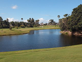
Ephraim Island is luxury residential development located in the suburb of Paradise Point in the north of Gold Coast, Australia. The development is a joint-venture between Lewis Land and Mirvac. The island has an area of 9.6 hectares and was once covered by mangroves. [1] The development is distinctive for inhabiting an artificial island in the Broadwater, connecting to the mainland by a 400-metre bridge.

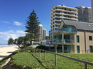
Paradise Point is a coastal suburb on the Gold Coast in Queensland, Australia. At the 2006 Census, Paradise Point had a population of 19,139. After development of Ephraim Island and Sovereign Islands, by 2011 the census for Paradise Point neighbourhood alone was 5,930.

Gold Coast, Queensland City in Queensland, Australia

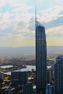
The Gold Coast is a coastal city in the Australian state of Queensland, approximately 66 kilometres (41 mi) south-southeast of the state capital Brisbane and immediately north of the border with New South Wales. With a census-estimated 2016 population of 569,997, the Gold Coast is the sixth-largest city in Australia, making it the largest non-capital city, and Queensland's second-largest city.

Mirvac

Mirvac is a real estate group, listed on the Australian Stock Exchange ("ASX") with activities across the property investment and development spectrum, as well as retail services.

The island, its landmass sculpted into a conspicuous albeit backwards "e" from an aerial view, is divided into two sections. The southern division, the 'tail' of the "e", is covered mostly by undeveloped salt mud-lands. The design provides water frontage to every apartment. [1] The northern 'eye' of the island has been developed to include a marina, 12 larger buildings (the largest topping 11 stories), a restaurant and up to 30 separate beach houses open to the Broadwater. The marina has a capacity of 115 berths. [2]

The island was cleared for development long before any construction began. According to locals, the area was devoid of vegetation from as far back as 1992 due to legal confrontations with concerned members of the community. In 2003, the developers (acknowledged as Mirvac and Lewisland) were given a green light by the Gold Coast City Council and started construction. The site was once the largest residential construction project in Queensland. [1] 20% of the island has had its natural habitat preserved. [1]

City of Gold Coast Local government area in Queensland, Australia

The City of Gold Coast is the local government area spanning the Gold Coast, Queensland, Australia and surrounding areas. Based on resident population in the 2016 census, it is the second largest local government area in Australia. Its council maintains a staff of over 2,500. It was established in 1948, but has existed in its present form since 2008.

The project is complete as of mid-2008.

Some scenes for the feature film Jucy (2010) were shot on the island. [3]

<i>Jucy</i> (film) 2010 Australian comedy film directed by Louise Alston

Jucy is an Australian comedy feature film produced in 2010 about the womance between two best female friends. The film was written by Stephen Vagg, directed by Louise Alston and produced by Kelly Chapman. It is the second in a planned "quarter life crisis" trilogy from Vagg and Alston following the 2007 romantic comedy All My Friends Are Leaving Brisbane.

See also

Related Research Articles

Q1 (building) skyscraper in Australia

Q1 is a 322.5-metre (1,058 ft) skyscraper in Surfers Paradise, Queensland, Australia. The residential tower on the Gold Coast lost its title as the world's tallest residential building to the 337-metre (1,106 ft) The Marina Torch in Dubai on 29 April 2011. It is now the sixth-tallest residential tower in the world and is the tallest building in Australia and the Southern Hemisphere, and the second-tallest free-standing structure in the Southern Hemisphere, behind the Sky Tower in Auckland, New Zealand. The Q1 officially opened in November 2005.

Main Beach, Queensland Suburb of Gold Coast, Queensland, Australia

Main Beach is an affluent beachside coastal suburb on the Gold Coast in Queensland, Australia. At the 2016 census, Main Beach had a population of 3,883.

Southport, Queensland Suburb of Gold Coast, Queensland, Australia

Southport is a coastal suburb and the central business district near the midpoint of Gold Coast, Queensland, Australia and has one of the city's largest communities. As of the 2016 Census, Southport had a population of 31,908.

Gold Coast Seaway channel and breakwater in the Gold Coast, Queensland, Australia

The Gold Coast Seaway or Southport Seaway is the main navigation entrance from the Pacific Ocean into the Gold Coast Broadwater and southern Moreton Bay and is one of Australia’s most significant coastal engineering projects. It is located at the northern end of the Southport Spit where the Nerang River enters the Pacific Ocean. The channel was constructed between 1984 and 1986, primarily to facilitate the safe passage of sea-faring vessels. The passage was previously known as the Southport Bar. The mouth of the Nerang River was once located further south in Broadbeach. The main driving force for this movement is the northward drift of sand along the coast. This northward drift was responsible for the unstable and shifting conditions of the bar, which made crossing it so hazardous for small boats. The southern training wall of the Gold Coast Seaway is the northern end of the Gold Coast Oceanway.

Gold Coast Broadwater

The Gold Coast Broadwater, also known as Southport Broadwater, Gold Coast Harbour and The Broadwater, is a large shallow estuary of water located in the Gold Coast district of South East Queensland, Australia. The estuary reaches from the locality of Southport in the south, to the southern section of the UNESCO World Heritage Listed Moreton Bay in the north. Separated via the Seaway from the Coral Sea by a thin strip of land called Stradbroke Island, the original body of water was a lagoon created from water deposited from the Nerang River. Part of the Broadwater is contained within the Moreton Bay Marine Park.

Southport Spit

The Spit is a spit and neighbourhood within and the northern end of Main Beach, City of Gold Coast, Queensland, Australia. It is a permanent sand spit that separates the Southport Broadwater from the Pacific Ocean.

Coomera River river in Queensland, Australia

The Coomera River is a perennial river located in the South East region of Queensland, Australia. Its catchment lies within the Gold Coast and Scenic Rim Region local government areas and covers an area of 489 square kilometres (189 sq mi).

Biggera Waters, Queensland Suburb of Gold Coast, Queensland, Australia

Biggera Waters is a coastal suburb in City of Gold Coast, Queensland, Australia. It is located on the western side of The Broadwater and is north of the suburb of Labrador. At the 2016 census, Biggera Waters had a population of 8,534 people.

Hope Island, Queensland Suburb of Gold Coast, Queensland, Australia

Hope Island is a suburb on the Gold Coast in Queensland, Australia. At the 2016 Census, Hope Island had a population of 11,186. Hope Island is close to both the Gold Coast beaches and Brisbane city. The area was named after colonial aristocrat Captain Louis Hope, who was granted approximately 1,800 acres (7.3 km2) of land at the mouth of the Coomera River in recognition of his contribution in developing the sugar industry in Queensland.

Labrador, Queensland Suburb of Gold Coast, Queensland, Australia

Labrador is a coastal suburb located on the Gold Coast in Queensland, Australia. At the 2006 Census, Labrador had a population of 15,391, and grew to 16,402 at the 2011 Census. The suburb overlooks the Gold Coast Broadwater to the east and Southport on the southern border.

Sanctuary Cove, Queensland Suburb of Gold Coast City Council, Queensland, Australia

Sanctuary Cove is a gated community, in the suburb of Hope Island in the Gold Coast area of Queensland, Australia. It was the first of such developments in Australia and is notable for its impact in planning legislation in Queensland which had to be altered to allow it to proceed, due to the privatisation of such large areas of urban land. It covers an area of 474 hectares south of the Coomera River close to its mouth. To the east of Sanctuary Cove is Coomera Island.

Home of the Arts, Gold Coast arts centre in Gold Coast, Queensland, Australia

HOTA - Home of the Arts is an arts centre that sits on the banks of the Nerang River in the Gold Coast in Queensland, Australia. Music, Theatre, Dance, Comedy, Opera, Cabaret, Kids Shows and Art are programmed at the venue, year-round, both indoors and out. HOTA is also home to the Gold Coast City Art Gallery. It was formerly known as The Arts Centre Gold Coast and Gold Coast Arts Centre.

Runaway Bay is a coastal suburb on the Gold Coast in Queensland, Australia. At the 2011 Census, Runaway Bay had a population of 8,912.

Southport Broadwater Parklands

The Southport Broadwater Parklands is a large community park located in Southport. It is designed for large community gatherings and families. The park has many different areas for children and barbecue areas for families. The park went through a major redevelopment and was re-opened by the Premier of Queensland, Anna Bligh, on 23 August 2009. Southport Broadwater Parklands has become a popular family attraction.

Ferry Road, Gold Coast road in Gold Coast, Queensland

Ferry Road is a road in Southport, on the Gold Coast, Queensland, Australia. Originally a suburban street, it is now part of Southport – Burleigh Road, a state controlled road

Jacobs Well, Queensland Suburb of Gold Coast, Queensland, Australia

Jacobs Well is a coastal suburb of the City of Gold Coast, Queensland, Australia. The suburb is positioned on the delta of the Pimpama River at the southern end of Moreton Bay. At the 2016 Australian Census, the suburb recorded a population of 1,839.
Jacobs Well is best known for its four lane boat ramp, Volunteer Marine Rescue facility and the surrounding sugar cane fields. It is often described as "The Gateway to Southern Moreton Bay"

Southern Moreton Bay Islands, Queensland Suburb of Gold Coast, Queensland, Australia

The Southern Moreton Bay Islands is a coastal suburb on the Gold Coast in Queensland, Australia. It is located at the northern end of the City of Gold Coast local government area. It was gazetted as a bounded locality on 7 Feb 2003 and regazetted on 27 November 2009 due to local government changes.

Chevron Island island in Queensland, Australia

The Chevron Island is an urban island that lies in the Nerang River and is a neighbourhood within the suburb of Surfers Paradise in the City of Gold Coast, Queensland, Australia.

References

  1. 1 2 3 4 "Building paradise on Ephraim Island". Infolink. Reed Business Information. 7 February 2006. Archived from the original on 2 April 2012. Retrieved 16 October 2011.
  2. "Ephraim Island's sales surge". goldcoast.com.au. News Limited. 17 January 2009. Retrieved 16 October 2011.
  3. "Jucy Media Kit". Archived from the original on 13 July 2011. Retrieved 15 October 2011.

Coordinates: 27°53′08.47″S153°23′25.26″E / 27.8856861°S 153.3903500°E / -27.8856861; 153.3903500

Geographic coordinate system Coordinate system

A geographic coordinate system is a coordinate system that enables every location on Earth to be specified by a set of numbers, letters or symbols. The coordinates are often chosen such that one of the numbers represents a vertical position and two or three of the numbers represent a horizontal position; alternatively, a geographic position may be expressed in a combined three-dimensional Cartesian vector. A common choice of coordinates is latitude, longitude and elevation. To specify a location on a plane requires a map projection.