Rio de Janeiro, or simply Rio, is the capital of the state of the same name, Brazil's third-most populous state, and the second-most populous city in Brazil, after São Paulo. Listed by the GaWC as a beta global city, Rio de Janeiro is the sixth-most populous city in the Americas. Part of the city has been designated as a World Heritage Site, named "Rio de Janeiro: Carioca Landscapes between the Mountain and the Sea", on 1 July 2012 as a Cultural Landscape.

Recife is the fourth-largest urban area in Brazil with 4,054,866 inhabitants, the largest urban area of the North/Northeast Regions, and the capital and largest city of the state of Pernambuco in the northeast corner of South America. The population of the city proper was 1,653,461 in 2020. Recife was founded in 1537, during the early Portuguese colonization of Brazil, as the main harbor of the Captaincy of Pernambuco, known for its large scale production of sugar cane. It was the former capital Mauritsstad of the 17th century colony of New Holland of Dutch Brazil, established by the Dutch West India Company. The city is located at the confluence of the Beberibe and Capibaribe rivers before they flow into the South Atlantic Ocean. It is a major port on the Atlantic. Its name is an allusion to the stone reefs that are present by the city's shores. The many rivers, small islands and over 50 bridges found in Recife city centre characterise its geography and led to the city being called the "Brazilian Venice". As of 2010, it is the capital city with the highest HDI in Northeast Brazil and second highest HDI in the entire North and Northeast Brazil.
Ariquemes is a municipality located in the Brazilian state of Rondônia. Its population was 109,523 and its area is 4,427 km2. It is the third-largest city in Rondônia state.

Uruguaiana is a municipality in the Brazilian state of Rio Grande do Sul. It is located on the eastern shore of the Uruguay River bordering Argentina. Opposite to Uruguaiana, and joined to it by a road/railway bridge, lies the Argentine city of Paso de los Libres, Corrientes. North of Uruguaiana lies the Brazilian municipality of Itaqui, connected by a bridge constructed by the British in 1888 over the Ibicuí River. The municipality also borders the municipalities of Alegrete, Barra do Quaraí and Quaraí, and, also, Uruguay, making it one of the few international triple-border municipalities of Brazil.

Macaé is a municipality located in the Brazilian state of Rio de Janeiro, 180 km northeast of the state capital. It is the birthplace of the 13th president of Brazil, Washington Luís.

Laguna is a Brazilian municipality located in the southern state of Santa Catarina, 120 kilometers south of the state's capital, Florianópolis, and north east of Porto Alegre. The population is 46,122 in an area of 336.4 km². Elevation is 2 m. The BR-101 coastal highway passes through the municipality.

Itu is an historic municipality in the state of São Paulo in Brazil. It is part of the Metropolitan Region of Sorocaba. The population was 175,568 as of 2020, in an area of 640.72 km2. The elevation is 583 m. This place name comes from the Tupi language, meaning big waterfall. Two rivers flow through Itu: Tietê and Jundiaí. Itu has five hospitals, eleven bank agencies and one shopping center, the Plaza Shopping Itu.

Barbacena is a municipality in the state of Minas Gerais, Brazil. As of 2020, the municipality had 138,204 inhabitants. The total area of the municipality is 788 km2 (304 sq mi).

Barra do Quaraí is a Brazilian municipality located near the border with Uruguay and Argentina on the Uruguay River. The town became the westernmost city in the state of Rio Grande do Sul and in all Southern Brazil when it was separated from the municipality of Uruguaiana on December 28, 1995. The population is 4,227 in an area of 1056.14 km2. Its elevation is 35 m. It is located 717 km west of the state capital of Porto Alegre, and roughly the same distance northwest of Montevideo, Uruguay. Under Brazilian law, the municipality includes an island named Ilha Brasileira, also claimed by Uruguay, where it is known as Isla Brasilera.
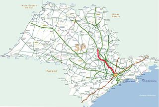
The Rodovia Bandeirantes is a highway in the state of São Paulo, Brazil.

Balsas is a city in the state of Maranhão, northeast Brazil. It is located in southern Maranhão, 800 km from the capital of the state, São Luís.

Couto Magalhães is a municipality located in the Brazilian state of Tocantins. Its population was 5,639 (2020) and its area is 1,586 km² (612.4 mi²), a density of 3.07 people/km². It is located 150 m (492.1 ft) above sea level. The demonym is Coutense.

Alto Parnaíba is a Brazilian municipality in the southernmost tip of the state of Maranhão. In 2020, the city's population was 11,212.

Alpestre is the northernmost municipality in the state of Rio Grande do Sul, Brazil. The city lies near the Uruguay River, at its northernmost point. A landmark called Ponto Extremo Norte marks the northernmost point of the state.

Apiacás is the northernmost municipality in the Brazilian state of Mato Grosso. It is the only city in a territorial "edge" of Mato Grosso that "pierce" the boundary between Amazonas and Pará.

Formosa do Rio Preto is the westernmost and largest city in the Brazilian state of Bahia. It is also the largest in all Northeastern Brazil.
Almeirim is a city on the Amazon and the northernmost municipality in the Brazilian state of Pará. It is also the fourth largest municipality in that state and the eighth largest in Brazil. The municipality is crossed by the Equator.
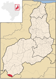
Cristalândia do Piauí is the southernmost city of the Brazilian state of Piauí.
Rebouças is a municipality in the state of Paraná in the Southern Region of Brazil. being filled with some hills on the surroundings and some parts of the city, the high structures are a tower in the hill of Mourão and the church [being a part of the Catholic church ], a big part of the ethnicity in the city are Polish and Ukrainians.
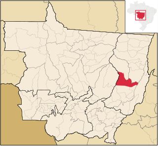
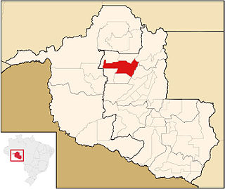
Canarana is a municipality in the Brazilian state of Mato Grosso.