
Vermilion Parish is a parish located in the U.S. state of Louisiana, created in 1844. The parish seat is Abbeville. Vermilion Parish is part of the Lafayette metropolitan statistical area, and located in southern Acadiana. At the 2020 U.S. census, the population was 57,359.

Lockport is a city in Will County, Illinois, United States, located 30 miles southwest of Chicago. Per the 2020 census, the population was 26,094. The city was incorporated in 1853. It is situated along the Illinois and Michigan (I&M) Canal, and was the headquarters of the canal when the canal was operating. A section of the canal runs through Lockport, including the remains of the canal's Lock No. 1 from which the town received its name. The canal right-of-way is now the Illinois and Michigan National Heritage Corridor.

Creston is a town in Lincoln County, Washington, United States. The population was 213 at the 2020 census.

The Kootenays or Kootenay is a region of southeastern British Columbia. It takes its name from the Kootenay River, which in turn was named for the Kutenai First Nations people.
Highway 21 is a cross-border spur in the Regional District of Central Kootenay in British Columbia. First opened in 1964, the highway travels 14 km (8.70 mi) northwest along the Kootenay River from its connection with Idaho State Highway 1 at the Rykerts Canada-U.S. border crossing to a point on the Crowsnest Highway just 1 km (0.62 mi) west of Creston.
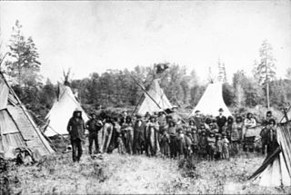
The Kutenai, also known as the Ktunaxa, Ksanka, Kootenay and Kootenai, are an indigenous people of Canada and the United States. Kutenai bands live in southeastern British Columbia, northern Idaho, and western Montana. The Kutenai language is a language isolate, thus unrelated to the languages of neighboring peoples or any other known language.

Creston is a town in the Kootenay region of southeastern British Columbia, Canada.

Crystal City is an unincorporated community recognized as a local urban district in the Municipality of Louise within the Canadian province of Manitoba. It held village status prior to January 1, 2015. It is located on Highway 3, 16 kilometres north of the Canada–United States border and 200 kilometres southwest of Winnipeg.

Louisiana Highway 9 (LA 9) is a state highway located in northern Louisiana. It runs 100.01 miles (160.95 km) in a north–south direction from the concurrent U.S. Highways 71 and 84 (US 71-84) in Campti to a junction with the concurrent US 63 and US 167 in Junction City.
Rural school districts in Washington are administrative districts that provide educational services in rural areas of Washington state.

Iowa Highway 25 (Iowa 25) is a north–south highway in the southwest and west-central portion of the state. It begins at Iowa 2 seven miles (11 km) south of Clearfield. It heads north along a two-lane road through Creston, Greenfield, and Guthrie Center on its way to its northern end at U.S. Route 30 (US 30) near Scranton.
British Columbia Highway 3, officially named the Crowsnest Highway, is an 841-kilometre (523 mi) highway that traverses southern British Columbia, Canada. It runs from the Trans-Canada Highway (Highway 1) at Hope to Crowsnest Pass at the Alberta border and forms the western portion of the interprovincial Crowsnest Highway that runs from Hope to Medicine Hat, Alberta. The highway is considered a Core Route of the National Highway System.
Southwestern Community College (SWCC) is an American public community college with its main campus in Creston, Iowa. It also has centers in Red Oak, Iowa, and Osceola, Iowa. In addition to an arts and sciences program, SWCC offers career and technical education (CTE) degrees and certificates.
Route 210, also known as the Burin Peninsula Highway and Heritage Run, is a highway that extends through the Burin Peninsula from Goobies to Grand Bank, Newfoundland and Labrador. The maximum speed limit is 90 km/h except through communities and settlements where the speed limit is reduced to 50 km/h. Just after exiting Swift Current, until a few kilometres north of Marystown, much of the landscape is barren, with very few trees prevalent. After entering Marystown, motorists approach a junction where they could turn right to continue their journey on Route 210 until arriving at Grand Bank, or going straight onto Route 220 towards Burin and St. Lawrence. Marystown is the most populous community along the route.

Creston is a city in and the county seat of Union County, Iowa. The population was 7,536 at the time of the 2020 Census.
Wynndel is an unincorporated community adjacent to Duck Creek, east of the Kootenay River, in the West Kootenay region of southeastern British Columbia. The locality, on BC Highway 3A, is by road about 11 kilometres (7 mi) north of Creston and 128 kilometres (80 mi) southeast of Nelson.
Crawford Bay is a community of approximately 350 people, situated in the Purcell mountain range on the eastern shore of Kootenay Lake in the West Kootenay region of southeastern British Columbia. This location on Highyway 3A is 76 kilometres (47 mi) by road north of Creston and 48 kilometres (29.8 mi) by road and ferry northeast across Kootenay Lake from Nelson.

The Porthill-Rykerts Border Crossing connects the town of Bonners Ferry, Idaho with Creston, British Columbia on the Canada–US border. Idaho State Highway 1 on the American side joins British Columbia Highway 21 on the Canadian side, which continues north towards Creston. The Porthill-Rykerts Border Crossing is used as the American Port only; Rykerts acts as the Canadian Crossing.

Creston Community School District is a public school district headquartered in Creston, Iowa.
Prescott Community School District was a school district headquartered in Prescott, Iowa, United States. It had a single school, Prescott Community School.
